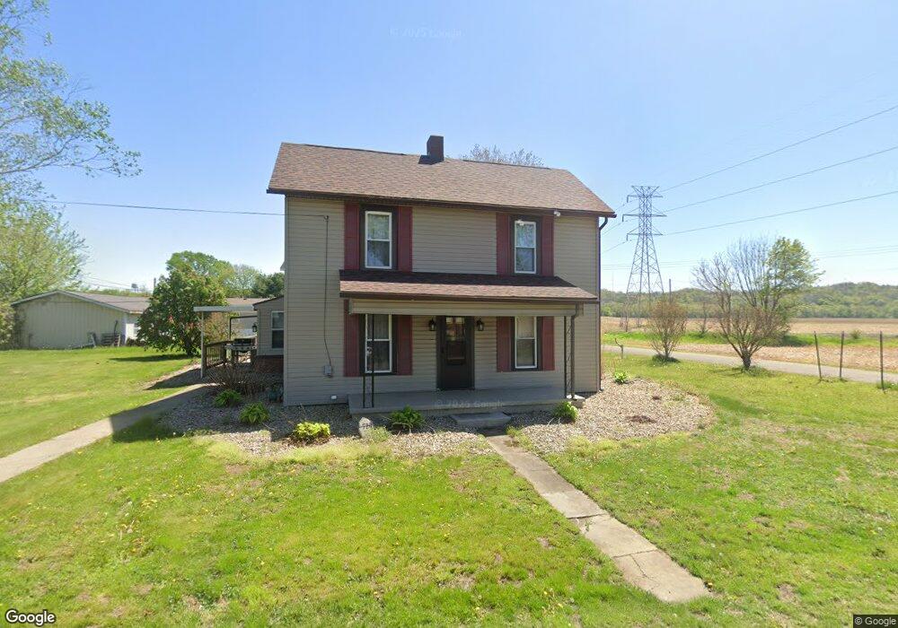
720 Duncan St Conesville, OH 43811
Estimated Value: $124,968 - $176,000
3
Beds
1
Bath
1,286
Sq Ft
$121/Sq Ft
Est. Value
About This Home
This home is located at 720 Duncan St, Conesville, OH 43811 and is currently estimated at $154,992, approximately $120 per square foot. 720 Duncan St is a home with nearby schools including River View High School.
Ownership History
Date
Name
Owned For
Owner Type
Purchase Details
Closed on
Jun 30, 2022
Sold by
Frye and Larry
Bought by
Frye Debra
Current Estimated Value
Home Financials for this Owner
Home Financials are based on the most recent Mortgage that was taken out on this home.
Original Mortgage
$70,000
Outstanding Balance
$66,597
Interest Rate
5.09%
Mortgage Type
Balloon
Estimated Equity
$88,395
Purchase Details
Closed on
Sep 19, 2012
Sold by
Moyer Ronald and Moyer Ronald
Bought by
Phillabaum Debra S and Moyer Jeffrey A
Purchase Details
Closed on
Dec 19, 1994
Sold by
Moyer Ronald
Bought by
Moyer Ronald
Create a Home Valuation Report for This Property
The Home Valuation Report is an in-depth analysis detailing your home's value as well as a comparison with similar homes in the area
Purchase History
| Date | Buyer | Sale Price | Title Company |
|---|---|---|---|
| Frye Debra | $53,000 | None Listed On Document | |
| Phillabaum Debra S | -- | None Available | |
| Moyer Ronald | -- | -- |
Source: Public Records
Mortgage History
| Date | Status | Borrower | Loan Amount |
|---|---|---|---|
| Open | Frye Debra | $70,000 |
Source: Public Records
Tax History
| Year | Tax Paid | Tax Assessment Tax Assessment Total Assessment is a certain percentage of the fair market value that is determined by local assessors to be the total taxable value of land and additions on the property. | Land | Improvement |
|---|---|---|---|---|
| 2024 | $1,190 | $30,220 | $2,800 | $27,420 |
| 2023 | $1,190 | $24,812 | $1,960 | $22,852 |
| 2022 | $1,010 | $24,812 | $1,960 | $22,852 |
| 2021 | $1,010 | $24,812 | $1,960 | $22,852 |
| 2020 | $1,021 | $24,784 | $1,964 | $22,820 |
| 2019 | $1,043 | $24,784 | $1,964 | $22,820 |
| 2018 | $899 | $24,784 | $1,964 | $22,820 |
| 2017 | $830 | $20,759 | $1,750 | $19,009 |
| 2016 | $789 | $20,759 | $1,750 | $19,009 |
| 2015 | $394 | $20,759 | $1,750 | $19,009 |
| 2014 | $441 | $20,762 | $1,750 | $19,012 |
Source: Public Records
Map
Nearby Homes
- 210 Biggs Ave
- 18224 County Road 6
- 17116 County Road 298
- 17981 Township Road 347
- 969 Linn St
- 1425 Cassingham Hollow Dr
- 0 Pleasant Valley Dr
- 1415 Tomahawk Ln
- 14240 Lot# 58 Cr 410
- 1213 Sleepy Hollow Dr
- 10550 Symmes Creek Rd
- 0 Raiders Rd Unit 5195515
- 51629 Township Road 146b
- 1681 Knob Hill Dr
- 917 Herbig Ave
- 1691 Knob Hill Dr
- 1215 Denman Ave
- 21569 State Route 16
- 2079 Buena Vista Dr
- 722 John St
- 618 Adams St
- 721 Duncan St
- 612 Adams St
- 613 Franklin Ave
- 611 Franklin Ave
- 504 Franklin Ave
- 608 Adams St
- 614 Franklin Ave
- 612 Franklin Ave
- 623 Franklin Ave
- 618 Franklin Ave
- 608 Franklin Ave
- 620 Franklin Ave
- 606 Adams St
- 622 Franklin Ave
- 702 Adams St
- 624 Franklin Ave
- 710 1st St
- 617 Marquand Ave
- 602 Adams St
Your Personal Tour Guide
Ask me questions while you tour the home.