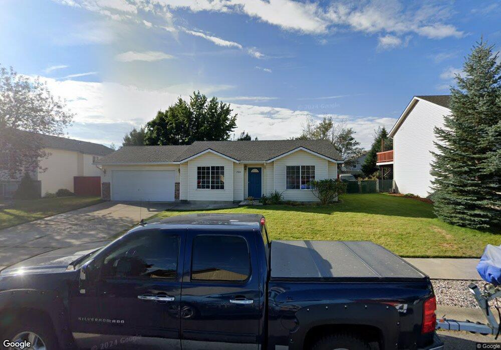
720 E Tiger Ave Post Falls, ID 83854
North Prairie NeighborhoodEstimated Value: $354,537 - $414,000
2
Beds
1
Bath
875
Sq Ft
$440/Sq Ft
Est. Value
About This Home
This home is located at 720 E Tiger Ave, Post Falls, ID 83854 and is currently estimated at $385,134, approximately $440 per square foot. 720 E Tiger Ave is a home located in Kootenai County with nearby schools including Mullan Trail Elementary School, Post Falls Middle School, and Post Falls High School.
Ownership History
Date
Name
Owned For
Owner Type
Purchase Details
Closed on
Oct 5, 2011
Sold by
Frazier Pamela F
Bought by
Genet Michelle M
Current Estimated Value
Home Financials for this Owner
Home Financials are based on the most recent Mortgage that was taken out on this home.
Original Mortgage
$75,000
Outstanding Balance
$50,523
Interest Rate
4.15%
Mortgage Type
New Conventional
Estimated Equity
$334,611
Create a Home Valuation Report for This Property
The Home Valuation Report is an in-depth analysis detailing your home's value as well as a comparison with similar homes in the area
Home Values in the Area
Average Home Value in this Area
Purchase History
| Date | Buyer | Sale Price | Title Company |
|---|---|---|---|
| Genet Michelle M | -- | -- |
Source: Public Records
Mortgage History
| Date | Status | Borrower | Loan Amount |
|---|---|---|---|
| Open | Genet Michelle M | $75,000 |
Source: Public Records
Tax History
| Year | Tax Paid | Tax Assessment Tax Assessment Total Assessment is a certain percentage of the fair market value that is determined by local assessors to be the total taxable value of land and additions on the property. | Land | Improvement |
|---|---|---|---|---|
| 2025 | $55 | $346,190 | $175,000 | $171,190 |
| 2024 | $50 | $324,660 | $152,000 | $172,660 |
| 2023 | $50 | $346,473 | $160,000 | $186,473 |
| 2022 | $505 | $364,692 | $157,500 | $207,192 |
| 2021 | $1,231 | $233,100 | $105,000 | $128,100 |
| 2020 | $1,232 | $203,310 | $90,000 | $113,310 |
| 2019 | $1,166 | $175,800 | $90,000 | $85,800 |
| 2018 | $1,093 | $148,240 | $70,000 | $78,240 |
| 2017 | $1,023 | $126,440 | $50,000 | $76,440 |
| 2016 | $974 | $113,350 | $40,000 | $73,350 |
| 2015 | $971 | $111,180 | $37,000 | $74,180 |
| 2013 | $870 | $91,130 | $32,000 | $59,130 |
Source: Public Records
Map
Nearby Homes
- 333 E Penrose Ave
- 585 N Divot Ave
- 3788 N Shelburne Loop
- 3670 N Heaton St
- 3752 N Shelburne Loop
- 1106 E Walton Ct
- 3596 N Leighton St
- 1147 E Walton Ct
- 880 E Allenby Ct
- 4224 N Brookie Dr
- 3576 N Blaze Loop
- 908 E Allenby Ct
- 3566 N Blaze Loop
- 3556 N Blaze Loop
- 3542 N Blaze Loop
- 3510 N Blaze Loop
- 984 E Allenby Ave
- 1039 E Blair Ave
- 3606 N Blaze Loop
- 3624 N Blaze Loop
- 720 Tiger Ave
- 740 E Tiger Ave
- 4237 Shelburne
- 680 E Tiger Ave
- 3665 Graphite Ct
- 760 Tiger Ave
- 3665 N Graphite Ct
- 760 E Tiger Ave
- 4237 N Shelburne Loop
- 4217 N Shelburne Loop
- 4217 Shelburne
- 4249 N Shelburne Loop
- 675 E Tiger Ave
- 695 Tiger Ave
- 4249 Shelburne
- 4201 N Shelburne Loop
- 660 E Tiger Ave
- 3675 N Graphite Ct
- 4185 N Shelburne Loop
- 4185 N Shelburne Loop
Your Personal Tour Guide
Ask me questions while you tour the home.