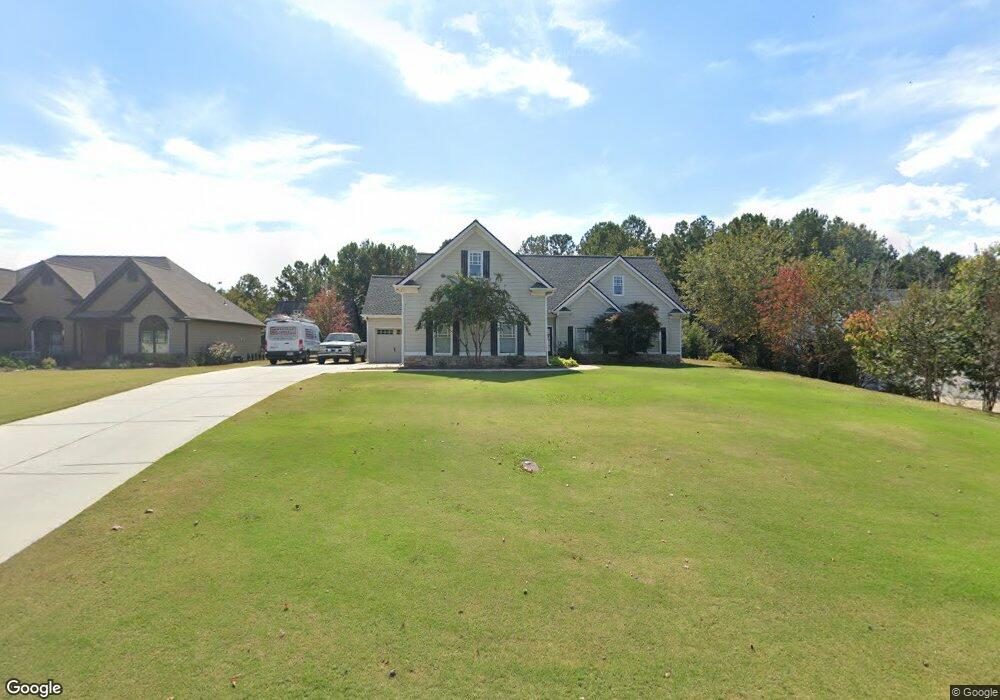
720 Lincoln Dr Winder, GA 30680
Estimated Value: $371,349 - $450,000
4
Beds
3
Baths
2,311
Sq Ft
$183/Sq Ft
Est. Value
About This Home
This home is located at 720 Lincoln Dr, Winder, GA 30680 and is currently estimated at $423,837, approximately $183 per square foot. 720 Lincoln Dr is a home located in Barrow County with nearby schools including County Line Elementary School, Russell Middle School, and Winder-Barrow High School.
Ownership History
Date
Name
Owned For
Owner Type
Purchase Details
Closed on
May 1, 2007
Sold by
Lemons Aimee B
Bought by
Lemons Ronnie L and Lemons Aimee B
Current Estimated Value
Home Financials for this Owner
Home Financials are based on the most recent Mortgage that was taken out on this home.
Original Mortgage
$231,420
Outstanding Balance
$137,525
Interest Rate
6.11%
Mortgage Type
FHA
Estimated Equity
$286,312
Purchase Details
Closed on
Feb 9, 2006
Sold by
Wd Thomas Hms Inc
Bought by
Lemons Aimee B
Home Financials for this Owner
Home Financials are based on the most recent Mortgage that was taken out on this home.
Original Mortgage
$171,520
Interest Rate
6.14%
Mortgage Type
New Conventional
Purchase Details
Closed on
Jan 14, 2005
Sold by
Ripp Star Development Llc
Bought by
W D Thomas Homes Inc
Home Financials for this Owner
Home Financials are based on the most recent Mortgage that was taken out on this home.
Original Mortgage
$116,925
Interest Rate
5.62%
Purchase Details
Closed on
Aug 15, 2003
Bought by
Ripp Star Development Llc
Create a Home Valuation Report for This Property
The Home Valuation Report is an in-depth analysis detailing your home's value as well as a comparison with similar homes in the area
Home Values in the Area
Average Home Value in this Area
Purchase History
| Date | Buyer | Sale Price | Title Company |
|---|---|---|---|
| Lemons Ronnie L | -- | -- | |
| Lemons Aimee B | $214,400 | -- | |
| W D Thomas Homes Inc | $38,800 | -- | |
| Ripp Star Development Llc | -- | -- |
Source: Public Records
Mortgage History
| Date | Status | Borrower | Loan Amount |
|---|---|---|---|
| Open | Lemons Ronnie L | $231,420 | |
| Previous Owner | Lemons Aimee B | $171,520 | |
| Previous Owner | W D Thomas Homes Inc | $116,925 |
Source: Public Records
Tax History
| Year | Tax Paid | Tax Assessment Tax Assessment Total Assessment is a certain percentage of the fair market value that is determined by local assessors to be the total taxable value of land and additions on the property. | Land | Improvement |
|---|---|---|---|---|
| 2025 | $3,199 | $136,972 | $29,600 | $107,372 |
| 2024 | $3,311 | $133,844 | $29,600 | $104,244 |
| 2023 | $2,907 | $134,444 | $29,600 | $104,844 |
| 2022 | $3,386 | $118,992 | $29,600 | $89,392 |
| 2021 | $2,830 | $93,838 | $17,600 | $76,238 |
| 2020 | $2,636 | $87,261 | $17,600 | $69,661 |
| 2019 | $2,680 | $87,261 | $17,600 | $69,661 |
| 2018 | $2,588 | $85,164 | $17,600 | $67,564 |
| 2017 | $2,186 | $75,066 | $17,600 | $57,466 |
| 2016 | $1,844 | $61,909 | $17,600 | $44,309 |
| 2015 | $1,867 | $62,390 | $17,600 | $44,790 |
| 2014 | $1,633 | $53,894 | $8,624 | $45,270 |
| 2013 | -- | $51,012 | $8,624 | $42,388 |
Source: Public Records
Map
Nearby Homes
- 311 Rockwell Church Rd NW
- 432 Mulberry Rd
- 932 Century Oak Dr
- 1929 Windstone Place
- 1303 Windstone Ct
- 406 Mulberry Rd
- 128 Northridge Dr
- 857 Laurel Ln
- 538 Valleyview Dr
- 817 Brookside Dr
- 300 Hyde Park
- 628 Knightsbridge Ln
- 845 Idlewood Rd
- 2050 Whispering Way
- 165 Peak Ct
- 101 Carnaby St
- 760 Highway 211 NW
- 71 Carnaby St
- 678 Knightsbridge Ln
- 318 Ryan Rd
- 722 Lincoln Dr
- 718 Lincoln Dr
- 724 Lincoln Dr
- 719 Lincoln Dr
- 721 Lincoln Dr
- 726 Lincoln Dr
- 717 Lincoln Dr
- 723 Lincoln Dr
- 716 Lincoln Dr
- 715 Lincoln Dr
- 715 Lincoln Dr Unit 3
- 725 Lincoln Dr
- 728 Lincoln Dr
- 716 Chicken Lyle Rd
- 692 Chicken Lyle Rd
- 727 Lincoln Dr
- 730 Lincoln Dr
- 696 Chicken Lyle Rd
- 729 Lincoln Dr
- 709 Lincoln Dr
Your Personal Tour Guide
Ask me questions while you tour the home.