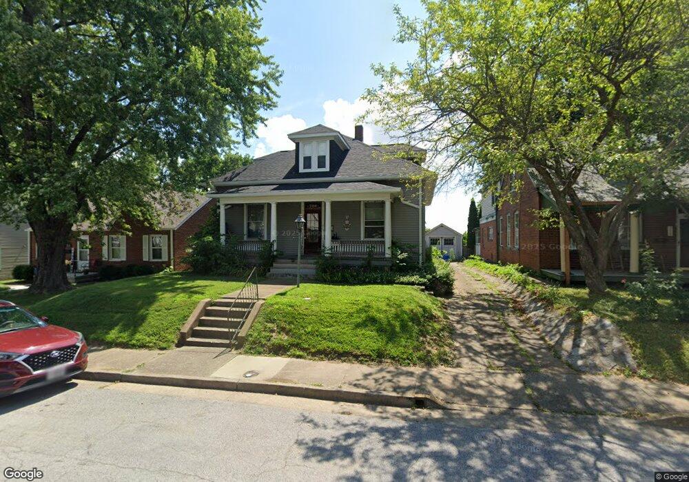
720 N 4th St Saint Charles, MO 63301
Old Town Saint Charles NeighborhoodEstimated Value: $289,000 - $310,000
3
Beds
1
Bath
1,607
Sq Ft
$187/Sq Ft
Est. Value
About This Home
This home is located at 720 N 4th St, Saint Charles, MO 63301 and is currently estimated at $300,777, approximately $187 per square foot. 720 N 4th St is a home located in St. Charles County with nearby schools including Blackhurst Elementary School, Hardin Middle School, and Jefferson Intermediate School.
Ownership History
Date
Name
Owned For
Owner Type
Purchase Details
Closed on
Jan 27, 2006
Sold by
Hussey Patrick K and Hussey Mary A
Bought by
Hussey Mary A
Current Estimated Value
Purchase Details
Closed on
May 14, 2003
Sold by
Hussey Mary A and Hussey Patrick K
Bought by
Hussey Patrick K and Hussey Mary A
Home Financials for this Owner
Home Financials are based on the most recent Mortgage that was taken out on this home.
Original Mortgage
$86,000
Interest Rate
5.79%
Mortgage Type
Purchase Money Mortgage
Create a Home Valuation Report for This Property
The Home Valuation Report is an in-depth analysis detailing your home's value as well as a comparison with similar homes in the area
Home Values in the Area
Average Home Value in this Area
Purchase History
| Date | Buyer | Sale Price | Title Company |
|---|---|---|---|
| Hussey Mary A | -- | None Available | |
| Hussey Patrick K | -- | -- |
Source: Public Records
Mortgage History
| Date | Status | Borrower | Loan Amount |
|---|---|---|---|
| Closed | Hussey Patrick K | $86,000 |
Source: Public Records
Tax History Compared to Growth
Tax History
| Year | Tax Paid | Tax Assessment Tax Assessment Total Assessment is a certain percentage of the fair market value that is determined by local assessors to be the total taxable value of land and additions on the property. | Land | Improvement |
|---|---|---|---|---|
| 2025 | $2,639 | $43,319 | -- | -- |
| 2023 | $2,635 | $41,023 | $0 | $0 |
| 2022 | $2,439 | $35,387 | $0 | $0 |
| 2021 | $2,441 | $35,387 | $0 | $0 |
| 2020 | $2,469 | $34,411 | $0 | $0 |
| 2019 | $2,448 | $34,411 | $0 | $0 |
| 2018 | $2,252 | $30,079 | $0 | $0 |
| 2017 | $2,222 | $30,079 | $0 | $0 |
| 2016 | $2,124 | $27,692 | $0 | $0 |
| 2015 | $2,120 | $27,692 | $0 | $0 |
| 2014 | $2,163 | $27,892 | $0 | $0 |
Source: Public Records
Map
Nearby Homes
- 1212 N 3rd St
- 728 N Kingshighway St
- 1913 Park Ave
- 909 Madison St
- 1020 Hawthorn Ave
- 917 Hawthorn Ave
- 2128 N 5th St
- 0 Unknown Unit MIS25074436
- 0 Unknown Unit MIS25074388
- 0 Unknown Unit MIS25074441
- 0 Unknown Unit MIS25074390
- 0 Unknown Unit MIS25074383
- 0 Unknown Unit MIS25074394
- 0 Unknown Unit MIS25074396
- 0 Unknown Unit MIS25074439
- 0 Unknown Unit MIS25074369
- 0 Unknown Unit MIS25074373
- 0 Unknown Unit MIS25074386
- 0 Unknown Unit MIS25074377
- 0 Unknown Unit MIS25074381