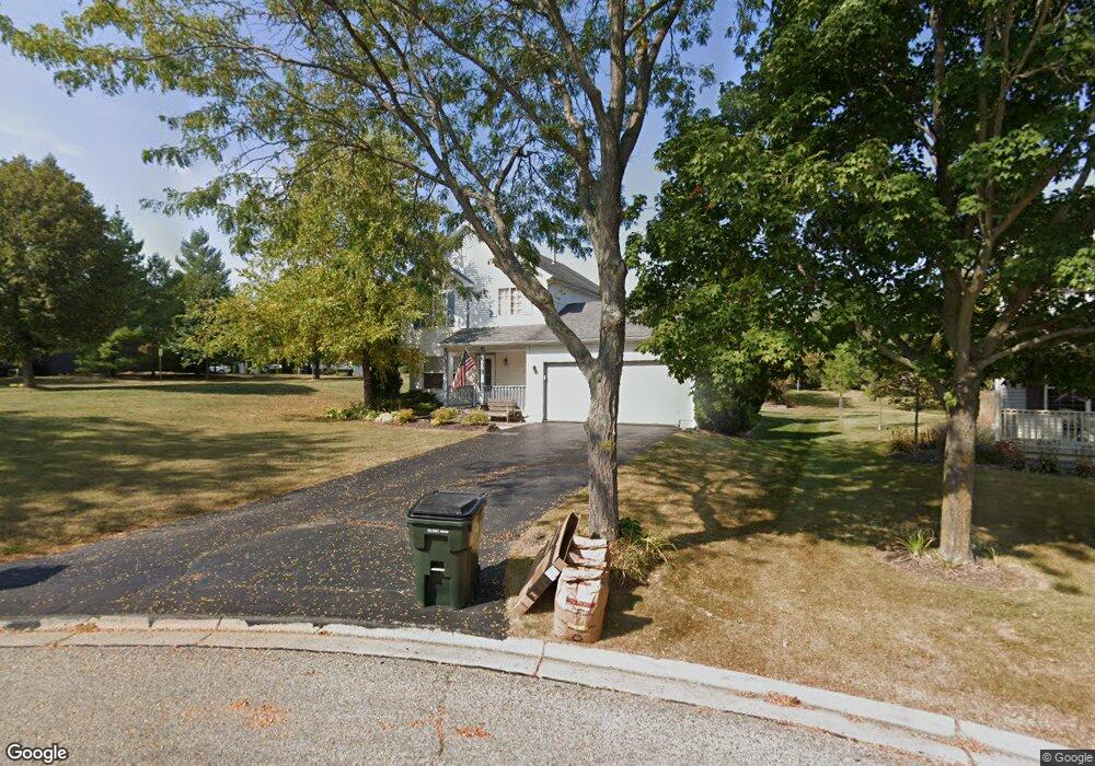
720 N Summit Ct Lindenhurst, IL 60046
Estimated Value: $347,000 - $398,000
2
Beds
3
Baths
1,630
Sq Ft
$227/Sq Ft
Est. Value
About This Home
This home is located at 720 N Summit Ct, Lindenhurst, IL 60046 and is currently estimated at $370,383, approximately $227 per square foot. 720 N Summit Ct is a home located in Lake County with nearby schools including Lakes Community High School.
Ownership History
Date
Name
Owned For
Owner Type
Purchase Details
Closed on
Oct 31, 1996
Sold by
J Maki Construction Co
Bought by
Sage Paul L and Sage Denine M
Current Estimated Value
Home Financials for this Owner
Home Financials are based on the most recent Mortgage that was taken out on this home.
Original Mortgage
$148,000
Outstanding Balance
$14,805
Interest Rate
8.26%
Mortgage Type
FHA
Estimated Equity
$355,578
Purchase Details
Closed on
Jul 15, 1996
Sold by
Oxford Bank & Trust
Bought by
J Maki Construction Company
Create a Home Valuation Report for This Property
The Home Valuation Report is an in-depth analysis detailing your home's value as well as a comparison with similar homes in the area
Home Values in the Area
Average Home Value in this Area
Purchase History
| Date | Buyer | Sale Price | Title Company |
|---|---|---|---|
| Sage Paul L | $157,500 | -- | |
| J Maki Construction Company | $41,000 | Chicago Title Insurance Co |
Source: Public Records
Mortgage History
| Date | Status | Borrower | Loan Amount |
|---|---|---|---|
| Open | Sage Paul L | $148,000 |
Source: Public Records
Tax History
| Year | Tax Paid | Tax Assessment Tax Assessment Total Assessment is a certain percentage of the fair market value that is determined by local assessors to be the total taxable value of land and additions on the property. | Land | Improvement |
|---|---|---|---|---|
| 2024 | $9,058 | $101,023 | $21,495 | $79,528 |
| 2023 | $8,280 | $89,259 | $18,992 | $70,267 |
| 2022 | $8,280 | $78,336 | $13,089 | $65,247 |
| 2021 | $7,871 | $72,769 | $12,159 | $60,610 |
| 2020 | $7,693 | $70,437 | $11,769 | $58,668 |
| 2019 | $8,426 | $71,991 | $12,029 | $59,962 |
| 2018 | $8,634 | $76,191 | $17,482 | $58,709 |
| 2017 | $8,405 | $74,159 | $17,016 | $57,143 |
| 2016 | $8,580 | $71,156 | $16,327 | $54,829 |
| 2015 | $8,183 | $66,458 | $15,249 | $51,209 |
| 2014 | $7,873 | $60,784 | $15,319 | $45,465 |
| 2012 | $7,322 | $69,578 | $18,480 | $51,098 |
Source: Public Records
Map
Nearby Homes
- 1896 E Vista Terrace
- 1650 Natures Way
- 527 Northgate Rd Unit 28
- 533 N Beck Rd Unit 28
- 39252 N Gelden Ln
- 20215 W Miller Rd
- 433 Woodland Trail
- 420 Woodland Trail
- 2312 High Point Dr
- 428 Woodland Trail
- 434 Woodland Trail
- 405 Woodland Trail
- 1809 Maplewood Ct
- 1903 S Shore Cove
- 1772 S Port Dr
- 1768 S Port Dr
- 1764 S Port Dr
- 210 Hazelwood Dr
- 697 Providence Ln
- 1245 Prairie Ridge Trail
- 722 N Summit Ct
- 735 N Auburn Ln
- 730 N Horizon Ct
- 724 N Summit Ct
- 739 N Auburn Ln
- 732 N Horizon Ct
- 1879 E Vista Terrace
- 1865 E Ivy Cir
- 719 N Summit Ct
- 725 N Summit Ct
- 1871 E Ivy Cir
- 1863 E Vista Terrace
- 721 N Summit Ct
- 723 N Summit Ct
- 1861 E Ivy Cir
- 749 N Auburn Ln
- 1847 E Vista Terrace
- 734 N Horizon Ct
- 1879 E Ivy Cir
- 742 N Auburn Ln
Your Personal Tour Guide
Ask me questions while you tour the home.