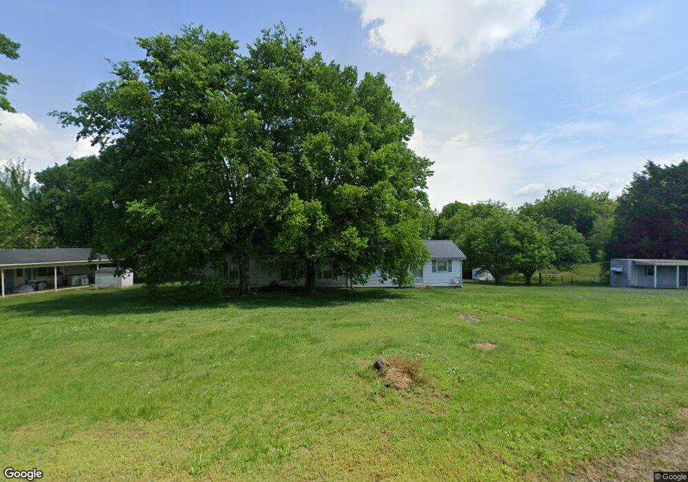
720 Rabbit Branch Rd Shelbyville, TN 37160
Estimated Value: $92,000 - $306,000
--
Bed
2
Baths
1,734
Sq Ft
$111/Sq Ft
Est. Value
About This Home
This home is located at 720 Rabbit Branch Rd, Shelbyville, TN 37160 and is currently estimated at $193,229, approximately $111 per square foot. 720 Rabbit Branch Rd is a home located in Bedford County with nearby schools including Liberty Elementary School, Shelbyville Central High School, and Christian Chapel Academy.
Ownership History
Date
Name
Owned For
Owner Type
Purchase Details
Closed on
Dec 19, 2024
Sold by
Brown Tony G and Brown Ted W
Bought by
Owen Michael H
Current Estimated Value
Purchase Details
Closed on
Apr 5, 1999
Sold by
Brown Betty Jo and Brown Ted W
Bought by
Brown Tony G
Purchase Details
Closed on
Apr 1, 1999
Sold by
Brown Betty Jo and Brown Ted W
Bought by
Brown Betty Jo and Brown Ted W
Purchase Details
Closed on
Oct 13, 1972
Bought by
Brown Wendell and Brown Geneva S
Purchase Details
Closed on
Jun 7, 1957
Bought by
Brown Wendell and Brown Geneva S
Create a Home Valuation Report for This Property
The Home Valuation Report is an in-depth analysis detailing your home's value as well as a comparison with similar homes in the area
Home Values in the Area
Average Home Value in this Area
Purchase History
| Date | Buyer | Sale Price | Title Company |
|---|---|---|---|
| Owen Michael H | $90,000 | None Listed On Document | |
| Brown Tony G | $38,125 | -- | |
| Brown Betty Jo | -- | -- | |
| Brown Wendell | -- | -- | |
| Brown Wendell | -- | -- |
Source: Public Records
Tax History Compared to Growth
Tax History
| Year | Tax Paid | Tax Assessment Tax Assessment Total Assessment is a certain percentage of the fair market value that is determined by local assessors to be the total taxable value of land and additions on the property. | Land | Improvement |
|---|---|---|---|---|
| 2025 | $629 | $26,925 | $0 | $0 |
| 2024 | $629 | $27,050 | $10,150 | $16,900 |
| 2023 | $629 | $27,050 | $10,150 | $16,900 |
| 2022 | $629 | $27,050 | $10,150 | $16,900 |
| 2021 | $532 | $27,050 | $10,150 | $16,900 |
| 2020 | $473 | $27,050 | $10,150 | $16,900 |
| 2019 | $473 | $17,775 | $6,000 | $11,775 |
| 2018 | $455 | $17,775 | $6,000 | $11,775 |
| 2017 | $455 | $17,775 | $6,000 | $11,775 |
| 2016 | $448 | $17,775 | $6,000 | $11,775 |
| 2015 | $448 | $17,775 | $6,000 | $11,775 |
| 2014 | $384 | $16,901 | $0 | $0 |
Source: Public Records
Map
Nearby Homes
- 0 Warner Bridge Rd
- 0 Rabbit Branch Rd
- 114 Annas Way
- The Benson II Plan at Ridgewood
- The Buford II Plan at Ridgewood
- The Caldwell Plan at Ridgewood
- The Braselton II Plan at Ridgewood
- The Langford Plan at Ridgewood
- The Greenbrier II Plan at Ridgewood
- The Piedmont Plan at Ridgewood
- 211 Hillview Ave
- 209 Hillview Ave
- 203 Hillview Ave
- 603 Tines Dr
- 226 Republic St
- 228 Republic St
- 119 Millet St
- 118 Millet St
- 100 Waycross Dr
- 105 Atlantic Ave
- 695 Rabbit Branch Rd
- 698 Rabbit Branch Rd
- 800 Rabbit Branch Rd
- 721 Rabbit Branch Rd
- 810 Rabbit Branch Rd
- 802 Rabbit Branch Rd
- 818 Rabbit Branch Rd
- 880 Rabbit Branch Rd
- 890 Rabbit Branch Rd
- 898 Rabbit Branch Rd
- 800 Grand Station Blvd
- 350 Warner Bridge Rd
- 810 Grand Station Blvd Unit 8
- 805 Grand Station Blvd
- 681 Rabbit Branch Rd
- 1 Warner Bridge Rd
- 104 Dawson St
- 522 Tines Dr
- 120 Annas Way
- 524 Tines Dr