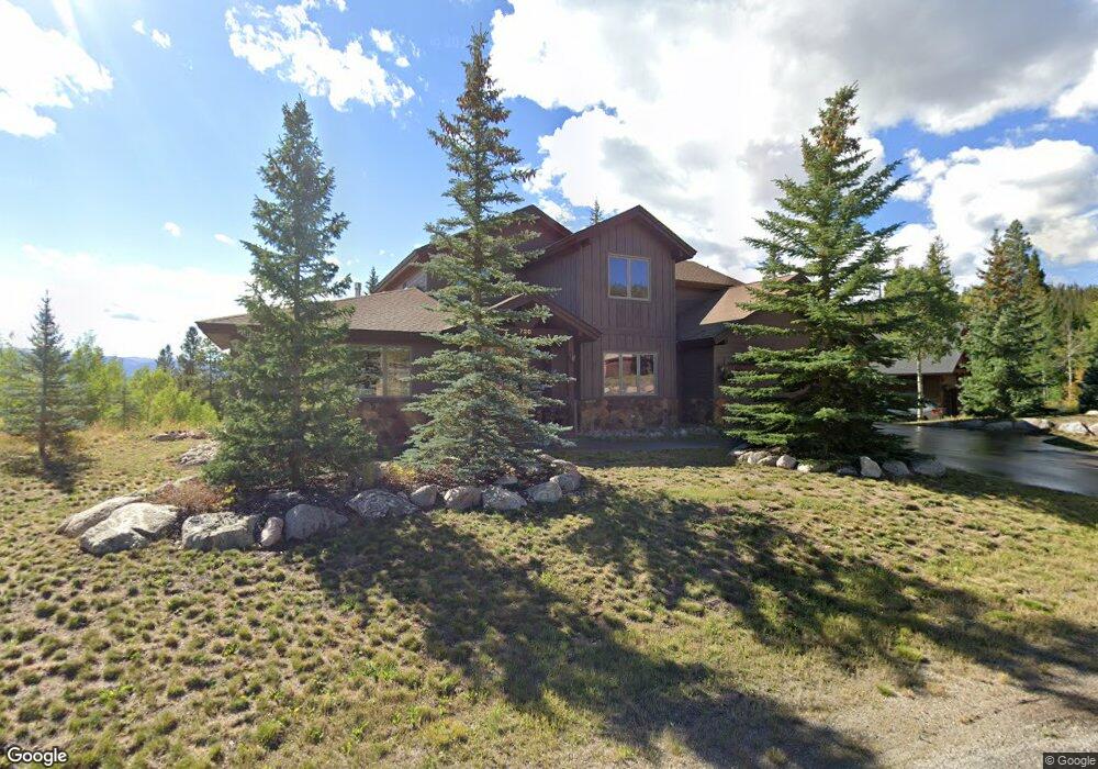
720 Willowbrook Rd Silverthorne, CO 80498
Estimated Value: $1,882,318 - $2,269,000
4
Beds
2
Baths
3,396
Sq Ft
$606/Sq Ft
Est. Value
About This Home
This home is located at 720 Willowbrook Rd, Silverthorne, CO 80498 and is currently estimated at $2,059,080, approximately $606 per square foot. 720 Willowbrook Rd is a home with nearby schools including Silverthorne Elementary School, Summit Middle School, and Summit High School.
Ownership History
Date
Name
Owned For
Owner Type
Purchase Details
Closed on
Jun 3, 2022
Sold by
Stickell Carolyn
Bought by
Stickell Carolyn and Peters Jill Stickell
Current Estimated Value
Purchase Details
Closed on
Oct 13, 2006
Sold by
Petersen William and Petersen Barbara A
Bought by
Stickell Carolyn
Home Financials for this Owner
Home Financials are based on the most recent Mortgage that was taken out on this home.
Original Mortgage
$555,000
Interest Rate
6.44%
Mortgage Type
New Conventional
Create a Home Valuation Report for This Property
The Home Valuation Report is an in-depth analysis detailing your home's value as well as a comparison with similar homes in the area
Home Values in the Area
Average Home Value in this Area
Purchase History
| Date | Buyer | Sale Price | Title Company |
|---|---|---|---|
| Stickell Carolyn | -- | None Listed On Document | |
| Stickell Carolyn | $985,000 | Landamerica |
Source: Public Records
Mortgage History
| Date | Status | Borrower | Loan Amount |
|---|---|---|---|
| Previous Owner | Stickell Carolyn | $555,000 |
Source: Public Records
Tax History
| Year | Tax Paid | Tax Assessment Tax Assessment Total Assessment is a certain percentage of the fair market value that is determined by local assessors to be the total taxable value of land and additions on the property. | Land | Improvement |
|---|---|---|---|---|
| 2024 | $6,482 | $123,669 | -- | -- |
| 2023 | $6,482 | $119,984 | $0 | $0 |
| 2022 | $4,480 | $78,403 | $0 | $0 |
| 2021 | $4,519 | $80,659 | $0 | $0 |
| 2020 | $4,235 | $80,761 | $0 | $0 |
| 2019 | $4,177 | $80,761 | $0 | $0 |
| 2018 | $3,819 | $71,555 | $0 | $0 |
| 2017 | $3,493 | $71,555 | $0 | $0 |
| 2016 | $3,278 | $66,143 | $0 | $0 |
| 2015 | $3,176 | $66,143 | $0 | $0 |
| 2014 | $2,974 | $61,165 | $0 | $0 |
| 2013 | -- | $61,165 | $0 | $0 |
Source: Public Records
Map
Nearby Homes
- 273 Two Cabins Dr
- 1803 Falcon Dr
- 125 Two Cabins Dr
- 481 Marmot Cir
- 490 W Coyote Dr
- 308 Red Hawk Cir
- 1709 Red Hawk Rd
- 440 Two Cabins Dr
- 170 Middle Park Ct
- 432 Bighorn Cir
- 1730 Red Hawk Rd
- 345 N Chipmunk Cir
- 383 W Coyote Dr
- 490 Two Cabins Dr
- 1325 Golden Eagle Rd
- 190 Easy Bend Trail
- 89 Emerald Rd
- 1813 Stellar Dr
- 104 Talon Cir
- 435 Kestrel Ln
- 718 Willowbrook Rd
- 104 Willow Creek Ridge Cir
- 721 Willowbrook Rd
- 722 Willowbrook Rd
- 716 Willowbrook Rd
- 723 Willowbrook Rd
- 717 Willowbrook Rd
- 106 Willow Creek Ridge Cir
- 724 Willowbrook Rd
- 712 Willowbrook Rd
- 112 Willow Creek Ridge Cir
- 710 Willowbrook Rd
- 725 Willowbrook Rd
- 727 Willowbrook Rd
- 110 Willow Creek Ridge Cir
- 726 Willowbrook Rd
- 108 Willow Creek Ridge Cir
- 706 Willowbrook Rd
- 715 Willowbrook Rd
- 737 Wild Rose Rd
Your Personal Tour Guide
Ask me questions while you tour the home.