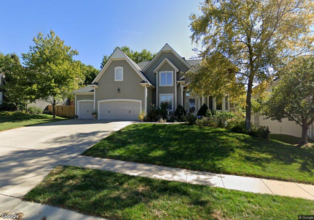
7203 Hauser Dr Shawnee, KS 66216
Estimated Value: $564,812 - $717,000
4
Beds
4
Baths
3,344
Sq Ft
$187/Sq Ft
Est. Value
About This Home
This home is located at 7203 Hauser Dr, Shawnee, KS 66216 and is currently estimated at $625,453, approximately $187 per square foot. 7203 Hauser Dr is a home located in Johnson County with nearby schools including Mill Creek Elementary School, Trailridge Middle School, and Shawnee Mission Northwest High School.
Ownership History
Date
Name
Owned For
Owner Type
Purchase Details
Closed on
Jun 14, 2024
Sold by
Tao Tony Y and Tao Margaret A
Bought by
Tony And Margaret Tao Revocable Trust and Tao
Current Estimated Value
Purchase Details
Closed on
Aug 27, 2003
Sold by
Cendant Mobility Financial Corp
Bought by
Tao Tony Y and Tao Margaret A
Home Financials for this Owner
Home Financials are based on the most recent Mortgage that was taken out on this home.
Original Mortgage
$92,000
Interest Rate
6.31%
Mortgage Type
Purchase Money Mortgage
Purchase Details
Closed on
Jun 11, 2003
Sold by
Talbert Lonnie C and Talbert Kathleen M
Bought by
Cendant Mobility Financial Corp
Purchase Details
Closed on
Jan 2, 2002
Sold by
J S Robinson Construction Inc
Bought by
Talbert Lonnie C and Talbert Kathleen M
Home Financials for this Owner
Home Financials are based on the most recent Mortgage that was taken out on this home.
Original Mortgage
$285,400
Interest Rate
4.87%
Purchase Details
Closed on
Apr 18, 2001
Sold by
7500 Partners
Bought by
J S Robinson Construction Inc
Home Financials for this Owner
Home Financials are based on the most recent Mortgage that was taken out on this home.
Original Mortgage
$295,000
Interest Rate
6.81%
Mortgage Type
Construction
Create a Home Valuation Report for This Property
The Home Valuation Report is an in-depth analysis detailing your home's value as well as a comparison with similar homes in the area
Home Values in the Area
Average Home Value in this Area
Purchase History
| Date | Buyer | Sale Price | Title Company |
|---|---|---|---|
| Tony And Margaret Tao Revocable Trust | -- | None Listed On Document | |
| Tao Tony Y | -- | -- | |
| Cendant Mobility Financial Corp | -- | -- | |
| Talbert Lonnie C | -- | Security Land Title Company | |
| J S Robinson Construction Inc | -- | Security Land Title Company |
Source: Public Records
Mortgage History
| Date | Status | Borrower | Loan Amount |
|---|---|---|---|
| Previous Owner | Tao Tony Y | $92,000 | |
| Previous Owner | Talbert Lonnie C | $285,400 | |
| Previous Owner | J S Robinson Construction Inc | $295,000 |
Source: Public Records
Tax History
| Year | Tax Paid | Tax Assessment Tax Assessment Total Assessment is a certain percentage of the fair market value that is determined by local assessors to be the total taxable value of land and additions on the property. | Land | Improvement |
|---|---|---|---|---|
| 2025 | $5,507 | $52,877 | $10,529 | $42,348 |
| 2023 | $4,975 | $46,356 | $10,029 | $36,327 |
| 2022 | $4,733 | $43,941 | $10,029 | $33,912 |
| 2021 | $4,822 | $42,125 | $9,122 | $33,003 |
| 2020 | $4,796 | $41,354 | $9,122 | $32,232 |
| 2019 | $4,704 | $40,538 | $8,686 | $31,852 |
| 2018 | $4,559 | $42,849 | $8,686 | $34,163 |
| 2017 | $4,409 | $37,260 | $7,930 | $29,330 |
| 2016 | $4,439 | $37,041 | $7,930 | $29,111 |
| 2015 | $4,227 | $36,478 | $7,930 | $28,548 |
| 2013 | -- | $35,017 | $7,930 | $27,087 |
Source: Public Records
Map
Nearby Homes
- 7238 Richards Dr
- 7119 Gillette St
- 13416 W 70th Terrace
- 13105 W 69th St
- 7101 Parkhill St
- 7220 Park St
- 12914 W 69th St
- 7216 Rene St
- 6939 Widmer Rd
- 13924 W 71st Place
- 13900 W 69th Terrace
- 12205 W 72nd St
- 7331 Monrovia St
- 5648 Long St
- 13212 W 67th St
- 12122 W 73rd Terrace
- 7221 Mullen Rd
- 7330 Charles St
- 6616 Bradshaw St
- 13929 W 76th Cir
- 7207 Hauser Dr
- 7121 Hauser Dr
- 7202 Noland Rd
- 7124 Noland Rd
- 7211 Hauser Dr
- 7206 Noland Rd
- 7117 Hauser Dr
- 13200 W 72nd St
- 7200 Hauser Dr
- 7215 Hauser Dr
- 7204 Hauser Dr
- 7116 Noland Rd
- 7210 Noland Rd
- 13204 W 72nd St
- 7212 Hauser Dr
- 13205 W 72nd St
- 7201 Noland Rd
- 7303 Hauser Dr
- 7129 Noland Rd
- 7113 Hauser Dr
Your Personal Tour Guide
Ask me questions while you tour the home.