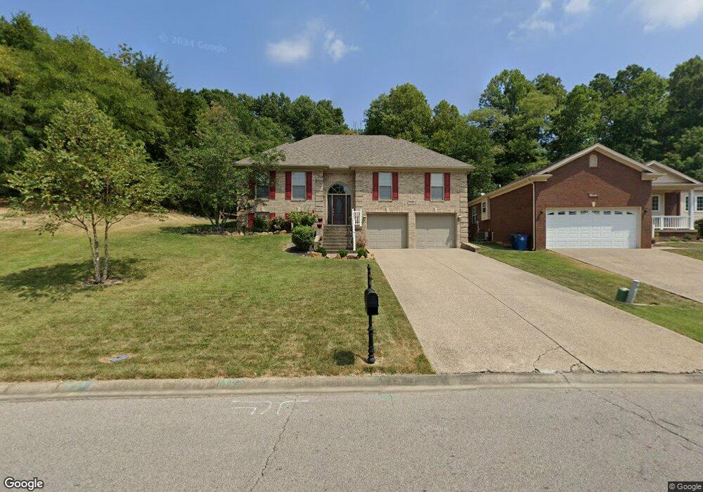
7205 Oakburn Dr Louisville, KY 40258
Valley Station NeighborhoodEstimated Value: $336,410 - $392,000
3
Beds
3
Baths
1,659
Sq Ft
$219/Sq Ft
Est. Value
About This Home
This home is located at 7205 Oakburn Dr, Louisville, KY 40258 and is currently estimated at $364,103, approximately $219 per square foot. 7205 Oakburn Dr is a home located in Jefferson County with nearby schools including Trunnell Elementary School, Stonestreet Elementary School, and Kenwood Elementary School.
Ownership History
Date
Name
Owned For
Owner Type
Purchase Details
Closed on
Jan 9, 2023
Sold by
Three Ds Development
Bought by
Edmondson Dennis and Edmondson Sharon
Current Estimated Value
Purchase Details
Closed on
Dec 16, 2005
Sold by
United Home Builders Llc
Bought by
Edmondson Dennis R and Edmondson Sharon D
Home Financials for this Owner
Home Financials are based on the most recent Mortgage that was taken out on this home.
Original Mortgage
$193,486
Interest Rate
6.28%
Mortgage Type
Fannie Mae Freddie Mac
Create a Home Valuation Report for This Property
The Home Valuation Report is an in-depth analysis detailing your home's value as well as a comparison with similar homes in the area
Home Values in the Area
Average Home Value in this Area
Purchase History
| Date | Buyer | Sale Price | Title Company |
|---|---|---|---|
| Edmondson Dennis | $5,000 | The Land Group | |
| Edmondson Dennis | $5,000 | The Land Group | |
| Edmondson Dennis R | $241,858 | Mattingly & Ford |
Source: Public Records
Mortgage History
| Date | Status | Borrower | Loan Amount |
|---|---|---|---|
| Previous Owner | Edmondson Dennis R | $193,486 |
Source: Public Records
Tax History Compared to Growth
Tax History
| Year | Tax Paid | Tax Assessment Tax Assessment Total Assessment is a certain percentage of the fair market value that is determined by local assessors to be the total taxable value of land and additions on the property. | Land | Improvement |
|---|---|---|---|---|
| 2024 | $2,341 | $247,290 | $36,040 | $211,250 |
| 2023 | $2,963 | $247,290 | $36,040 | $211,250 |
| 2022 | $2,972 | $247,290 | $36,040 | $211,250 |
| 2021 | $3,184 | $247,290 | $36,040 | $211,250 |
| 2020 | $2,457 | $212,400 | $47,000 | $165,400 |
| 2019 | $2,408 | $212,400 | $47,000 | $165,400 |
| 2018 | $2,380 | $212,400 | $47,000 | $165,400 |
| 2017 | $2,229 | $212,400 | $47,000 | $165,400 |
| 2013 | -- | $241,860 | $42,000 | $199,860 |
Source: Public Records
Map
Nearby Homes
- 3503 Dorset Rd
- 7107 Birnamwood Dr
- 164 Mills Dr
- 9701 Secretariat Dr
- 7904 Princess Wood Ct
- 7911 Princess Wood Ct
- 9716 Secretariat Dr
- 9809 Secretariat Dr
- 0 Hardwood Forest Dr
- 00 Hardwood Forest Dr
- 4000 Alydar Ct
- 4101 Smarty Jones Dr
- 4016 Blanton Ln
- 3031 Fordhaven Rd
- 4103 Smarty Jones Dr
- 4002 Alydar Ct
- 3015 Groveview Ct
- 4107 Smarty Jones Dr
- 3003 Treeview Ct
- 4109 Smarty Jones Dr
- 7207 Oakburn Dr
- 7209 Oakburn Dr
- 7209 Oakburn Dr Unit LOT 4
- 7211 Oakburn Dr
- 7206 Oakburn Dr
- 7204 Oakburn Dr
- 7208 Oakburn Dr
- 7213 Oakburn Dr
- 7201 Oakburn Dr
- 7200 Oakburn Dr
- 7210 Oakburn Dr
- 1 Oakburn Dr Tract #1
- 7215 Oakburn Dr
- 7212 Oakburn Dr
- 1512 Sand Dr
- 7217 Oakburn Dr
- 7217 Oakburn Dr Unit LOT 8
- 1478 Sand Dr
- 7412 Gaymont Dr
- 8103 Saint Andrews Church Rd