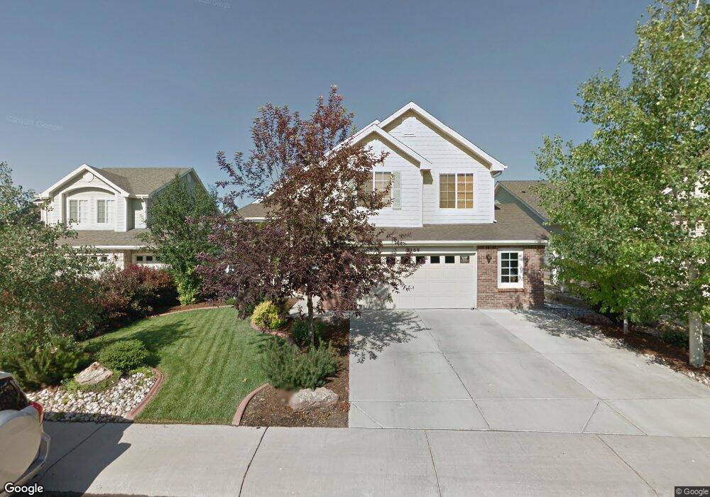
7209 Scamp Ct Fort Collins, CO 80526
Registry Ridge NeighborhoodEstimated Value: $510,000 - $576,000
3
Beds
3
Baths
1,628
Sq Ft
$337/Sq Ft
Est. Value
About This Home
This home is located at 7209 Scamp Ct, Fort Collins, CO 80526 and is currently estimated at $548,033, approximately $336 per square foot. 7209 Scamp Ct is a home located in Larimer County with nearby schools including Coyote Ridge Elementary School, Lucile Erwin Middle School, and Loveland High School.
Ownership History
Date
Name
Owned For
Owner Type
Purchase Details
Closed on
Jan 27, 2005
Sold by
Engle Homes Colorado
Bought by
Ernst Frederick C
Current Estimated Value
Home Financials for this Owner
Home Financials are based on the most recent Mortgage that was taken out on this home.
Original Mortgage
$184,860
Outstanding Balance
$95,502
Interest Rate
6%
Mortgage Type
New Conventional
Estimated Equity
$452,531
Create a Home Valuation Report for This Property
The Home Valuation Report is an in-depth analysis detailing your home's value as well as a comparison with similar homes in the area
Home Values in the Area
Average Home Value in this Area
Purchase History
| Date | Buyer | Sale Price | Title Company |
|---|---|---|---|
| Ernst Frederick C | $231,100 | -- |
Source: Public Records
Mortgage History
| Date | Status | Borrower | Loan Amount |
|---|---|---|---|
| Open | Ernst Frederick C | $184,860 | |
| Closed | Ernst Frederick C | $46,215 |
Source: Public Records
Tax History
| Year | Tax Paid | Tax Assessment Tax Assessment Total Assessment is a certain percentage of the fair market value that is determined by local assessors to be the total taxable value of land and additions on the property. | Land | Improvement |
|---|---|---|---|---|
| 2025 | $2,845 | $33,275 | $9,375 | $23,900 |
| 2024 | $2,752 | $37,071 | $3,685 | $33,386 |
| 2022 | $2,313 | $27,175 | $3,823 | $23,352 |
| 2021 | $2,380 | $27,957 | $3,933 | $24,024 |
| 2020 | $2,238 | $26,284 | $3,933 | $22,351 |
| 2019 | $2,202 | $26,284 | $3,933 | $22,351 |
| 2018 | $2,054 | $23,357 | $3,960 | $19,397 |
| 2017 | $1,787 | $23,357 | $3,960 | $19,397 |
| 2016 | $1,725 | $21,834 | $4,378 | $17,456 |
| 2015 | $1,711 | $21,840 | $4,380 | $17,460 |
| 2014 | $1,575 | $19,480 | $4,380 | $15,100 |
Source: Public Records
Map
Nearby Homes
- 7208 Trout Ct
- 1432 Curtiss Ct
- 7321 S Shields St
- 6915 Hancock Dr
- 6902 Nimitz Dr Unit 102
- 1408 Leahy Dr
- 6857 Enterprise Dr
- 6838 Enterprise Dr
- 1345 Forrestal Dr
- 6715 Enterprise Dr Unit D-102
- 6715 Enterprise Dr Unit A-104
- 415 Peyton Dr
- 7039 Woodrow Dr
- 7009 Egyptian Dr
- 214 Egyptian Ct
- 208 Egyptian Ct
- 120 Triangle Dr
- 6815 S College Ave
- 301 Uranus St
- 413 Skyway Dr
- 7215 Scamp Ct
- 7203 Scamp Ct
- 7221 Scamp Ct
- 7208 Scamp Ct
- 7202 Trout Ct
- 7214 Trout Ct
- 7202 Scamp Ct
- 7214 Scamp Ct
- 7227 Scamp Ct
- 1426 Bon Homme Richard Dr
- 7220 Trout Ct
- 7226 Scamp Ct
- 1432 Bon Homme Richard Dr
- 7220 Scamp Ct
- 1502 Bon Homme Richard Dr
- 1420 Bon Homme Richard Dr
- 1508 Bon Homme Richard Dr
- 7226 Trout Ct
- 1514 Bon Homme Richard Dr
- 1415 Bon Homme Richard Dr
Your Personal Tour Guide
Ask me questions while you tour the home.