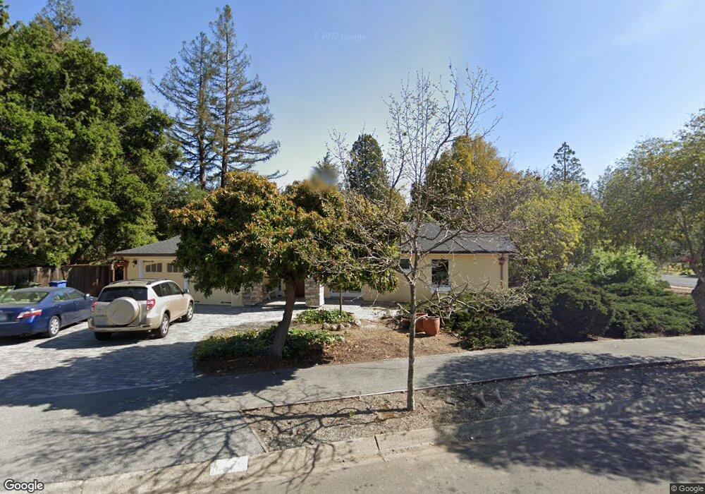
721 Alvarado Row Stanford, CA 94305
Estimated Value: $3,209,000 - $3,620,000
4
Beds
4
Baths
1,948
Sq Ft
$1,769/Sq Ft
Est. Value
About This Home
This home is located at 721 Alvarado Row, Stanford, CA 94305 and is currently estimated at $3,445,754, approximately $1,768 per square foot. 721 Alvarado Row is a home located in Santa Clara County with nearby schools including Escondido Elementary School, Frank S. Greene Jr. Middle, and Palo Alto High School.
Ownership History
Date
Name
Owned For
Owner Type
Purchase Details
Closed on
Jan 16, 1997
Sold by
Bark Dennis L and Bark Eleanor C
Bought by
Board Of Trustees Leland Stanford Jr Uni
Current Estimated Value
Create a Home Valuation Report for This Property
The Home Valuation Report is an in-depth analysis detailing your home's value as well as a comparison with similar homes in the area
Home Values in the Area
Average Home Value in this Area
Purchase History
| Date | Buyer | Sale Price | Title Company |
|---|---|---|---|
| Board Of Trustees Leland Stanford Jr Uni | $600,000 | First American Title Guarant |
Source: Public Records
Tax History Compared to Growth
Tax History
| Year | Tax Paid | Tax Assessment Tax Assessment Total Assessment is a certain percentage of the fair market value that is determined by local assessors to be the total taxable value of land and additions on the property. | Land | Improvement |
|---|---|---|---|---|
| 2025 | $15,019 | $1,302,992 | $651,475 | $651,517 |
| 2024 | $15,019 | $1,277,444 | $638,701 | $638,743 |
| 2023 | $15,664 | $1,252,397 | $626,178 | $626,219 |
| 2022 | $15,476 | $1,227,841 | $613,900 | $613,941 |
| 2021 | $13,338 | $1,050,146 | $601,863 | $448,283 |
| 2020 | $12,701 | $1,007,910 | $595,692 | $412,218 |
| 2019 | $12,569 | $990,011 | $584,012 | $405,999 |
| 2018 | $10,925 | $858,835 | $572,561 | $286,274 |
| 2017 | $10,726 | $841,996 | $561,335 | $280,661 |
| 2016 | $10,431 | $825,487 | $550,329 | $275,158 |
| 2015 | $10,309 | $813,088 | $542,063 | $271,025 |
| 2014 | $10,028 | $797,161 | $531,445 | $265,716 |
Source: Public Records
Map
Nearby Homes
- 843 Sonoma Terrace
- 78 Pearce Mitchell Place
- 103 Peter Coutts Cir
- 12 Peter Coutts Cir
- 72 Peter Coutts Cir
- 546 Oxford Ave
- 1630 Portola Ave
- 410 Sheridan Ave Unit 227
- 410 Sheridan Ave Unit 446
- 200 Sheridan Ave Unit 304
- 200 Sheridan Ave Unit 303
- 200 Sheridan Ave Unit 103
- 200 Sheridan Ave Unit 307
- 5 Plan at Acacia
- 4X Plan at Acacia
- 4 Plan at Acacia
- 3 Plan at Acacia
- 2A Plan at Acacia
- 2 Plan at Acacia
- 1 Plan at Acacia
- 817 Pine Hill Rd
- 719 Alvarado Row
- 720 Alvarado Row
- 816 San Francisco Ct
- 723 Alvarado Row
- 820 San Francisco Ct
- 823 Pine Hill Rd
- 718 Alvarado Row
- 824 San Francisco Ct
- 820 Pine Hill Rd
- 797 Esplanada Way
- 775 Esplanada Way
- 829 Pine Hill Rd
- 801 San Francisco Ct
- 826 San Francisco Ct
- 828 Pine Hill Rd
- 763 Esplanada Way
- 815 Esplanada Way
- 805 San Francisco Ct
- 716 Alvarado Row