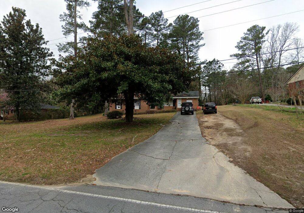
721 Central Rd SW Thomson, GA 30824
Estimated Value: $172,000 - $183,000
3
Beds
2
Baths
1,563
Sq Ft
$114/Sq Ft
Est. Value
About This Home
This home is located at 721 Central Rd SW, Thomson, GA 30824 and is currently estimated at $178,749, approximately $114 per square foot. 721 Central Rd SW is a home located in McDuffie County with nearby schools including Thomson High School.
Ownership History
Date
Name
Owned For
Owner Type
Purchase Details
Closed on
Oct 16, 2008
Sold by
Beggs Keith
Bought by
Wilhoit William Wirt
Current Estimated Value
Home Financials for this Owner
Home Financials are based on the most recent Mortgage that was taken out on this home.
Original Mortgage
$85,977
Interest Rate
5.78%
Mortgage Type
New Conventional
Purchase Details
Closed on
Sep 6, 2006
Sold by
Muns Mabel Knight
Bought by
Beggs Keith N
Purchase Details
Closed on
Nov 23, 1984
Bought by
Swofford Mabel K
Create a Home Valuation Report for This Property
The Home Valuation Report is an in-depth analysis detailing your home's value as well as a comparison with similar homes in the area
Home Values in the Area
Average Home Value in this Area
Purchase History
| Date | Buyer | Sale Price | Title Company |
|---|---|---|---|
| Wilhoit William Wirt | $107,000 | -- | |
| Beggs Keith N | $50,000 | -- | |
| Swofford Mabel K | -- | -- |
Source: Public Records
Mortgage History
| Date | Status | Borrower | Loan Amount |
|---|---|---|---|
| Closed | Wilhoit William Wirt | $85,977 |
Source: Public Records
Tax History Compared to Growth
Tax History
| Year | Tax Paid | Tax Assessment Tax Assessment Total Assessment is a certain percentage of the fair market value that is determined by local assessors to be the total taxable value of land and additions on the property. | Land | Improvement |
|---|---|---|---|---|
| 2025 | $2,058 | $66,199 | $7,354 | $58,845 |
| 2024 | $2,058 | $62,891 | $7,142 | $55,749 |
| 2023 | $1,980 | $60,252 | $6,780 | $53,472 |
| 2022 | $1,844 | $54,352 | $5,650 | $48,702 |
| 2021 | $1,498 | $43,359 | $5,650 | $37,709 |
| 2020 | $1,489 | $42,451 | $13,144 | $29,307 |
| 2019 | $1,721 | $48,654 | $13,144 | $35,510 |
| 2018 | $1,739 | $48,654 | $13,144 | $35,510 |
| 2017 | $1,692 | $48,654 | $13,144 | $35,510 |
| 2016 | $1,703 | $48,654 | $13,144 | $35,510 |
| 2015 | $1,511 | $48,653 | $13,144 | $35,510 |
| 2014 | $1,516 | $48,653 | $13,144 | $35,510 |
| 2013 | -- | $48,653 | $13,143 | $35,509 |
Source: Public Records
Map
Nearby Homes
- 609 Hillcrest Dr
- 67 Shadowmoor Cir
- 118 Langham St
- 354 King St
- 420 King Ln
- 709 Pine Lane Dr
- 1009 Berkley Ct
- 306 Michael St
- 1280 Acadia Dr
- 1037 Berkley Ct
- 1045 Berkley Ct
- 1077 Berkley Ct
- 1085 Berkley Ct
- 0 Wrens Hwy Unit 10652460
- 0 Wrens Hwy Unit 549833
- 416 Forrest Clary Dr
- 1008 Wrens Hwy
- 415 Stonewall Dr
- 717 Central Rd SW
- 713 Central Rd SW
- 321 Glenn Stovall Dr
- 716 Central Rd SW
- 709 Central Rd SW
- 316 Glenn Stovall Dr
- 712 Central Rd
- 620 Reese St
- 706 Central Rd
- 705 Central Rd SW
- 315 Glenn Stovall Dr
- 309 Glenn Stovall Dr
- 312 Glenn Stovall Dr
- 700 Central Rd
- 306 Glenn Stovall Dr
- 623 Central Rd
- 305 Glenn Stovall Dr
- 315 Glen Stovall Dr
- 313 Crawford Ln
- 620 Central Rd