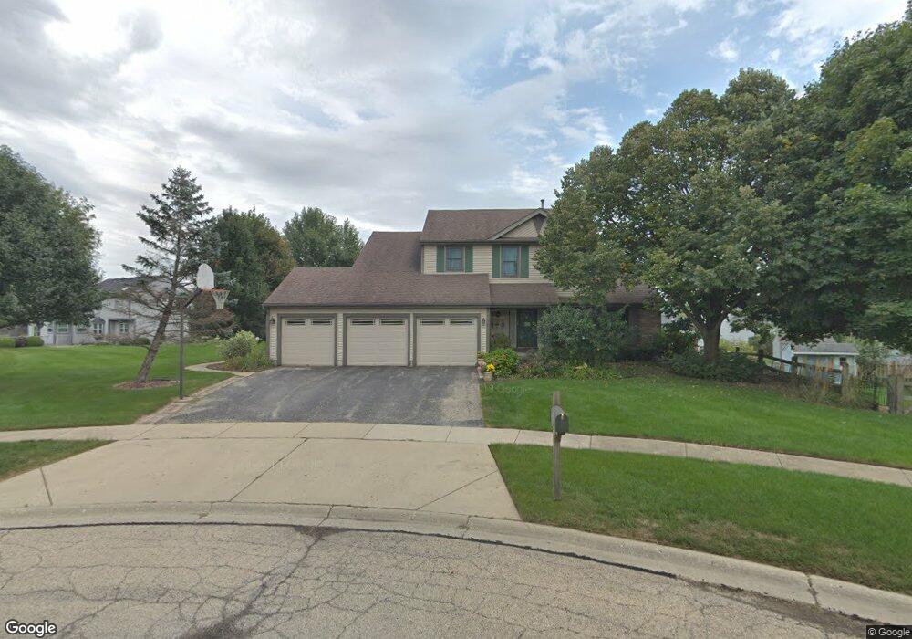
721 Macgregor Ct West Dundee, IL 60118
Estimated Value: $400,526 - $442,000
4
Beds
--
Bath
2,025
Sq Ft
$209/Sq Ft
Est. Value
About This Home
This home is located at 721 Macgregor Ct, West Dundee, IL 60118 and is currently estimated at $423,882, approximately $209 per square foot. 721 Macgregor Ct is a home located in Kane County with nearby schools including Dundee Highlands Elementary School, Dundee Middle School, and West Prairie Middle School.
Ownership History
Date
Name
Owned For
Owner Type
Purchase Details
Closed on
May 30, 2003
Sold by
Moretti Peter J and Moretti Patricia F
Bought by
Acevedo Ruperto and Acevedo Katarzyna W
Current Estimated Value
Home Financials for this Owner
Home Financials are based on the most recent Mortgage that was taken out on this home.
Original Mortgage
$260,775
Interest Rate
5.37%
Mortgage Type
Purchase Money Mortgage
Create a Home Valuation Report for This Property
The Home Valuation Report is an in-depth analysis detailing your home's value as well as a comparison with similar homes in the area
Home Values in the Area
Average Home Value in this Area
Purchase History
| Date | Buyer | Sale Price | Title Company |
|---|---|---|---|
| Acevedo Ruperto | $274,500 | -- |
Source: Public Records
Mortgage History
| Date | Status | Borrower | Loan Amount |
|---|---|---|---|
| Previous Owner | Acevedo Ruperto | $260,775 |
Source: Public Records
Tax History Compared to Growth
Tax History
| Year | Tax Paid | Tax Assessment Tax Assessment Total Assessment is a certain percentage of the fair market value that is determined by local assessors to be the total taxable value of land and additions on the property. | Land | Improvement |
|---|---|---|---|---|
| 2024 | $8,604 | $113,562 | $25,730 | $87,832 |
| 2023 | $8,059 | $102,179 | $23,151 | $79,028 |
| 2022 | $7,835 | $94,936 | $23,151 | $71,785 |
| 2021 | $7,558 | $89,638 | $21,859 | $67,779 |
| 2020 | $7,416 | $87,623 | $21,368 | $66,255 |
| 2019 | $7,175 | $83,181 | $20,285 | $62,896 |
| 2018 | $7,204 | $81,534 | $19,883 | $61,651 |
| 2017 | $6,855 | $76,272 | $18,600 | $57,672 |
| 2016 | $6,685 | $70,935 | $23,612 | $47,323 |
| 2015 | $5,922 | $66,468 | $22,125 | $44,343 |
| 2014 | $5,922 | $64,632 | $21,514 | $43,118 |
| 2013 | $5,922 | $66,611 | $22,173 | $44,438 |
Source: Public Records
Map
Nearby Homes
- 1715 W Main St
- 1601 Higgins Rd
- 812 Lindsay Ln
- 822 Lindsay Ln
- 814 Lindsay Ln
- 816 Lindsay Ln
- 813 Lindsay Ln
- 825 Lindsay Ln
- 818 Lindsay Ln
- 215 Sharon Dr
- Marianne Plan at Hickory Glen
- Charlotte Plan at Hickory Glen
- 1023 Shagbark Ln
- 1031 Shagbark Ln
- 325 Sharon Dr
- 104 Thorobred Ln
- 2742 Connolly Ln
- 2857 Bristol Ct
- 842 Winmoor Dr
- 1 S Lincoln Ave
- 712 Campbell Ct
- 2060 Glenmoor Dr
- 730 Macgregor Ct
- 2040 Glenmoor Dr
- 708 Campbell Ct
- 2030 Glenmoor Dr
- 716 Campbell Ct
- 734 Macgregor Ct
- 2010 Glenmoor Dr
- 722 Macgregor Ct
- 728 Campbell Ct
- 2113 Spaulding Ave
- 2109 Spaulding Ave Unit 2
- 706 Macgregor Ct
- 2061 Glenmoor Dr
- 2127 Spaulding Ave
- 2110 Stewart Ln
- 2065 Spaulding Ave
- 711 Campbell Ct
- 2139 Spaulding Ave