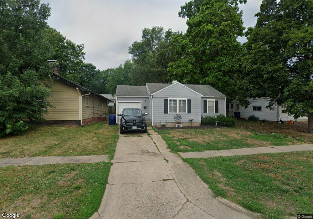
721 Meade St Brookfield, MO 64628
Estimated Value: $90,000 - $104,000
2
Beds
1
Bath
1,006
Sq Ft
$95/Sq Ft
Est. Value
About This Home
This home is located at 721 Meade St, Brookfield, MO 64628 and is currently estimated at $95,149, approximately $94 per square foot. 721 Meade St is a home with nearby schools including Brookfield Elementary School, Brookfield Middle School, and Brookfield High School.
Ownership History
Date
Name
Owned For
Owner Type
Purchase Details
Closed on
May 22, 2019
Sold by
Huffmon Julie A and Huffmon Mike L
Bought by
Quail Colton Jacob
Current Estimated Value
Home Financials for this Owner
Home Financials are based on the most recent Mortgage that was taken out on this home.
Original Mortgage
$43,430
Outstanding Balance
$37,947
Interest Rate
4.1%
Mortgage Type
Construction
Estimated Equity
$57,202
Purchase Details
Closed on
Sep 19, 2018
Sold by
Matthew Rulon
Bought by
Huffmon Juliee A
Purchase Details
Closed on
Apr 21, 2008
Bought by
Rulon Matt and Schmitt Amber
Create a Home Valuation Report for This Property
The Home Valuation Report is an in-depth analysis detailing your home's value as well as a comparison with similar homes in the area
Home Values in the Area
Average Home Value in this Area
Purchase History
| Date | Buyer | Sale Price | Title Company |
|---|---|---|---|
| Quail Colton Jacob | $54,287 | -- | |
| Huffmon Juliee A | -- | -- | |
| Rulon Matt | $19,000 | -- |
Source: Public Records
Mortgage History
| Date | Status | Borrower | Loan Amount |
|---|---|---|---|
| Open | Quail Colton Jacob | $43,430 |
Source: Public Records
Tax History
| Year | Tax Paid | Tax Assessment Tax Assessment Total Assessment is a certain percentage of the fair market value that is determined by local assessors to be the total taxable value of land and additions on the property. | Land | Improvement |
|---|---|---|---|---|
| 2025 | -- | $5,229 | $779 | $4,450 |
| 2024 | $3 | $5,016 | $779 | $4,237 |
| 2023 | $313 | $5,016 | $779 | $4,237 |
| 2022 | $316 | $5,035 | $779 | $4,256 |
| 2021 | $0 | $5,035 | $779 | $4,256 |
| 2020 | $316 | $5,035 | $779 | $4,256 |
| 2019 | $316 | $5,035 | $779 | $4,256 |
| 2018 | $312 | $4,997 | $779 | $4,218 |
| 2015 | -- | $4,902 | $646 | $4,256 |
| 2011 | -- | $28,700 | $2,000 | $26,700 |
Source: Public Records
Map
Nearby Homes
- 721 Lincoln St
- 1007 Country Side Dr
- 119 W Dake St
- 316 Macon St
- 317 Macon St
- 303 Shelby St
- 713 Brookfield Ave
- 1002 N State St
- 420 Smith St
- 1118 Courtland St
- 117 N Main St
- 420 Mcgowan St
- 417 Laclede Ave
- 627 Mcgowan St
- 0 W Wood St
- 304 E Canal St
- 131 Silver Ln
- 547 Harrison St
- 0 S State St
- 21145 Highway 5
- 719 Meade St
- 727 Meade St
- 713 Meade St
- 304 E Sedgwick St
- 716 Meade St
- 801 Meade St
- 714 Meade St
- 306 E Sedgwick St
- 716 Lincoln St
- 710 Meade St
- 315 E Prairie St
- 712 Lincoln St
- 730 Lincoln St
- 706 Lincoln St
- 312 E Sedgwick St
- 303 E Prairie St
- 311 E Sedgwick St
- 811 Meade St
- 702 Meade St
- 318 E Sedgwick St
Your Personal Tour Guide
Ask me questions while you tour the home.