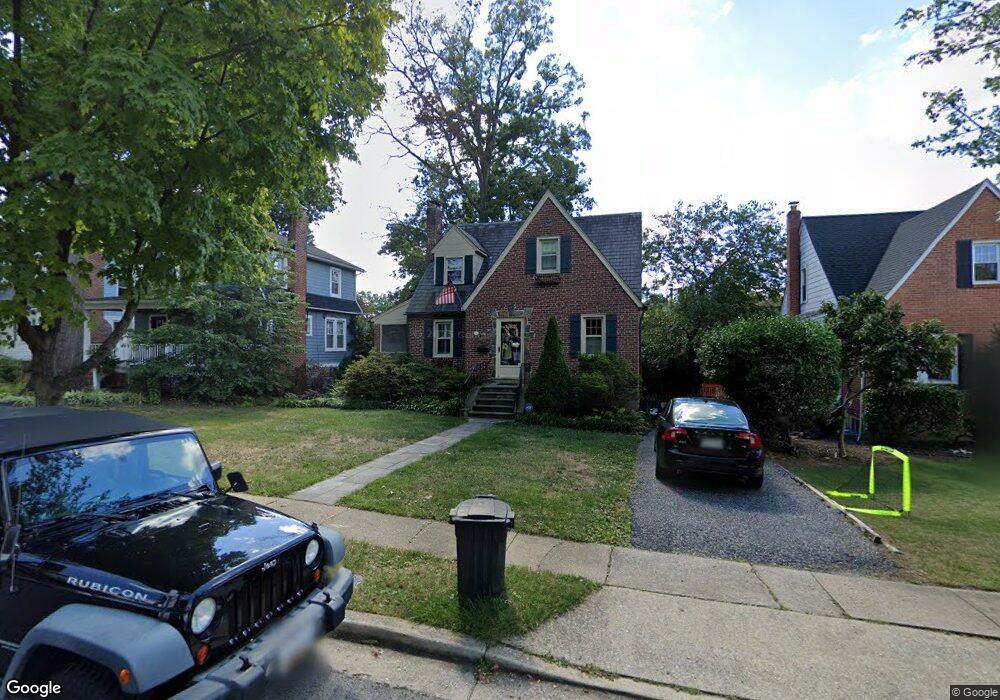
721 Murdock Rd Baltimore, MD 21212
Estimated Value: $452,009 - $620,000
Studio
2
Baths
1,470
Sq Ft
$365/Sq Ft
Est. Value
About This Home
This home is located at 721 Murdock Rd, Baltimore, MD 21212 and is currently estimated at $537,252, approximately $365 per square foot. 721 Murdock Rd is a home located in Baltimore County with nearby schools including Stoneleigh Elementary School, Dumbarton Middle School, and Towson High Law & Public Policy.
Ownership History
Date
Name
Owned For
Owner Type
Purchase Details
Closed on
May 30, 2019
Sold by
Wagner Thomas F and Wagner Sheila S
Bought by
Wagner Thomas F
Current Estimated Value
Home Financials for this Owner
Home Financials are based on the most recent Mortgage that was taken out on this home.
Original Mortgage
$328,000
Interest Rate
3.5%
Purchase Details
Closed on
Jul 31, 2001
Sold by
Currotto Eugene A
Bought by
Wagner Thomas F and Wagner Sheila S
Purchase Details
Closed on
Aug 19, 1986
Sold by
Mcguffin Gerald R
Bought by
Currotto Eugene A
Create a Home Valuation Report for This Property
The Home Valuation Report is an in-depth analysis detailing your home's value as well as a comparison with similar homes in the area
Home Values in the Area
Average Home Value in this Area
Purchase History
| Date | Buyer | Sale Price | Title Company |
|---|---|---|---|
| Wagner Thomas F | -- | Lafayette Setmnt Svcs Inc | |
| Wagner Thomas F | $224,000 | -- | |
| Currotto Eugene A | $123,000 | -- |
Source: Public Records
Mortgage History
| Date | Status | Borrower | Loan Amount |
|---|---|---|---|
| Previous Owner | Wagner Thomas F | $328,000 |
Source: Public Records
Tax History
| Year | Tax Paid | Tax Assessment Tax Assessment Total Assessment is a certain percentage of the fair market value that is determined by local assessors to be the total taxable value of land and additions on the property. | Land | Improvement |
|---|---|---|---|---|
| 2025 | $5,211 | $418,100 | $99,700 | $318,400 |
| 2024 | $5,211 | $394,500 | $0 | $0 |
| 2023 | $2,444 | $370,900 | $0 | $0 |
| 2022 | $4,764 | $347,300 | $94,700 | $252,600 |
| 2021 | $6,296 | $344,200 | $0 | $0 |
| 2020 | $4,327 | $341,100 | $0 | $0 |
| 2019 | $4,097 | $338,000 | $94,700 | $243,300 |
| 2018 | $4,229 | $327,967 | $0 | $0 |
| 2017 | $3,823 | $317,933 | $0 | $0 |
| 2016 | $3,171 | $307,900 | $0 | $0 |
| 2015 | $3,171 | $307,900 | $0 | $0 |
| 2014 | $3,171 | $307,900 | $0 | $0 |
Source: Public Records
Map
Nearby Homes
- 722 Anneslie Rd
- 664 Regester Ave
- 625 Dunkirk Rd
- 633 Anneslie Rd
- 613 Anneslie Rd
- 615 Overbrook Rd
- 6225 Chinquapin Pkwy
- 529 Overbrook Rd
- 12 Stone Ridge Ct
- 1117 Walker Ave
- 6504 Crestwood Rd
- 6923 Summit Cir
- 820 Cedarcroft Rd
- 501 Stoneleigh Rd
- 726 Highwood Dr
- 6750 Glenkirk Rd
- 1206 Cedarcroft Rd
- 1322 Limit Ave
- 1204 Saint Andrews Way
- 318 Hopkins Rd
Your Personal Tour Guide
Ask me questions while you tour the home.