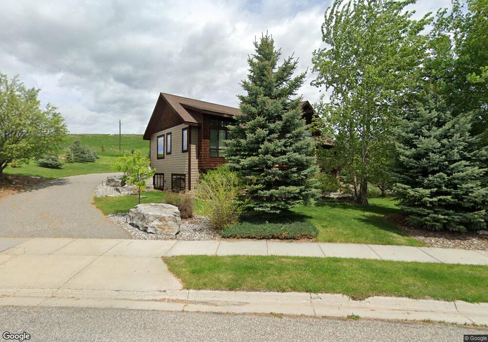
721 St Andrews Dr Bozeman, MT 59715
North Bozeman NeighborhoodEstimated Value: $1,103,165 - $1,779,000
5
Beds
3
Baths
4,768
Sq Ft
$275/Sq Ft
Est. Value
About This Home
This home is located at 721 St Andrews Dr, Bozeman, MT 59715 and is currently estimated at $1,310,041, approximately $274 per square foot. 721 St Andrews Dr is a home located in Gallatin County with nearby schools including Hawthorne Elementary School, Chief Joseph Middle School, and Gallatin High School.
Ownership History
Date
Name
Owned For
Owner Type
Purchase Details
Closed on
Oct 7, 2021
Sold by
Carl E Olsen And Sue E Olsen Living Trus
Bought by
Rostad Philip O and Rostad Joan
Current Estimated Value
Purchase Details
Closed on
Dec 16, 2011
Sold by
Koelzer Patrick E and Koelzer Avrielle
Bought by
Rostad Phil and Rostad Joan
Home Financials for this Owner
Home Financials are based on the most recent Mortgage that was taken out on this home.
Original Mortgage
$255,000
Interest Rate
3.12%
Mortgage Type
New Conventional
Purchase Details
Closed on
Aug 1, 2005
Sold by
Koelzer Pat
Bought by
Koelzer Patrick E and Koelzer Avrielle
Home Financials for this Owner
Home Financials are based on the most recent Mortgage that was taken out on this home.
Original Mortgage
$432,000
Interest Rate
6.37%
Mortgage Type
Purchase Money Mortgage
Create a Home Valuation Report for This Property
The Home Valuation Report is an in-depth analysis detailing your home's value as well as a comparison with similar homes in the area
Home Values in the Area
Average Home Value in this Area
Purchase History
| Date | Buyer | Sale Price | Title Company |
|---|---|---|---|
| Rostad Philip O | -- | None Listed On Document | |
| Rostad Phil | -- | Security Title Company | |
| Koelzer Patrick E | -- | Security Title Company |
Source: Public Records
Mortgage History
| Date | Status | Borrower | Loan Amount |
|---|---|---|---|
| Previous Owner | Rostad Phil | $255,000 | |
| Previous Owner | Koelzer Patrick E | $432,000 |
Source: Public Records
Tax History Compared to Growth
Tax History
| Year | Tax Paid | Tax Assessment Tax Assessment Total Assessment is a certain percentage of the fair market value that is determined by local assessors to be the total taxable value of land and additions on the property. | Land | Improvement |
|---|---|---|---|---|
| 2025 | $5,681 | $1,141,600 | $0 | $0 |
| 2024 | $7,820 | $1,174,800 | $0 | $0 |
| 2023 | $7,561 | $1,174,800 | $0 | $0 |
| 2022 | $5,455 | $711,400 | $0 | $0 |
| 2021 | $6,020 | $711,400 | $0 | $0 |
| 2020 | $6,513 | $762,873 | $0 | $0 |
| 2019 | $6,661 | $762,873 | $0 | $0 |
| 2018 | $4,279 | $453,880 | $0 | $0 |
| 2017 | $4,232 | $453,880 | $0 | $0 |
| 2016 | $3,523 | $373,409 | $0 | $0 |
| 2015 | $7,047 | $746,819 | $0 | $0 |
| 2014 | $6,418 | $400,362 | $0 | $0 |
Source: Public Records
Map
Nearby Homes
- 557 St Andrews Dr
- 523 St Andrews Dr
- 1055 Caddie Ct
- 3213 Augusta Dr
- 1031 Boylan Rd
- 2503 Valhalla Ct
- 1050 Boylan Rd Unit 4
- 2403 Birdie Dr Unit A
- TBD Lucy Ln
- TBD Canyon Gate Blvd
- TBD Blvd
- 2402 Blue Silos Way
- 323 Gallatin Park Dr Unit 102/202
- TBD Story Mill Rd
- 2434 Richau Ln
- 27737 Frontage Rd
- TBD Cultivar St
- 611 Nikles Dr Unit 102/202
- 18 Moon Shadow Dr
- 0 St Andrews Dr Unit 184535
- 753 St Andrews Dr
- 720 St Andrews Dr
- 696 Saint Andrews Dr
- 801 Turnberry Ct
- 668 St Andrews
- 790 St Andrews Dr
- 000 Turnberry Ct
- 611 St Andrews Dr
- 644 St Andrews Dr
- 833 Turnberry Ct
- 886 St Andrews Dr
- 802 Turnberry Ct
- 579 N St Andrews
- 610 St Andrews Dr
- 825 St Andrews Dr
- 902 St Andrews Dr
- TBD St Andrews Dr
- 849 St Andrews Dr
- 887 St Andrews Dr