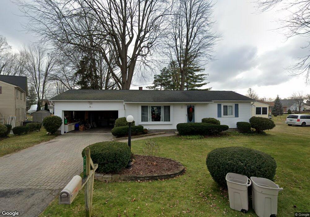
721 Townsend Dr Algonac, MI 48001
Estimated Value: $189,000 - $292,000
2
Beds
1
Bath
1,320
Sq Ft
$173/Sq Ft
Est. Value
About This Home
This home is located at 721 Townsend Dr, Algonac, MI 48001 and is currently estimated at $228,049, approximately $172 per square foot. 721 Townsend Dr is a home located in St. Clair County.
Ownership History
Date
Name
Owned For
Owner Type
Purchase Details
Closed on
Aug 12, 2021
Sold by
Ford Irene and Ford Irene
Bought by
Lane Daniel and Lane Brenda
Current Estimated Value
Home Financials for this Owner
Home Financials are based on the most recent Mortgage that was taken out on this home.
Original Mortgage
$123,000
Outstanding Balance
$110,511
Interest Rate
2.7%
Mortgage Type
New Conventional
Estimated Equity
$117,538
Purchase Details
Closed on
Aug 3, 2021
Sold by
Ford Irene and Ford Robin L
Bought by
Ford Irene
Home Financials for this Owner
Home Financials are based on the most recent Mortgage that was taken out on this home.
Original Mortgage
$123,000
Outstanding Balance
$110,511
Interest Rate
2.7%
Mortgage Type
New Conventional
Estimated Equity
$117,538
Create a Home Valuation Report for This Property
The Home Valuation Report is an in-depth analysis detailing your home's value as well as a comparison with similar homes in the area
Home Values in the Area
Average Home Value in this Area
Purchase History
| Date | Buyer | Sale Price | Title Company |
|---|---|---|---|
| Lane Daniel | $165,000 | Ata National Title Group | |
| Ford Irene | -- | Ata National Title Group |
Source: Public Records
Mortgage History
| Date | Status | Borrower | Loan Amount |
|---|---|---|---|
| Open | Lane Daniel | $123,000 |
Source: Public Records
Tax History
| Year | Tax Paid | Tax Assessment Tax Assessment Total Assessment is a certain percentage of the fair market value that is determined by local assessors to be the total taxable value of land and additions on the property. | Land | Improvement |
|---|---|---|---|---|
| 2025 | $2,114 | $99,600 | $0 | $0 |
| 2024 | $3,141 | $101,800 | $0 | $0 |
| 2023 | $2,924 | $89,900 | $0 | $0 |
| 2022 | $3,093 | $75,600 | $0 | $0 |
| 2020 | $2,069 | $65,300 | $15,600 | $49,700 |
| 2019 | $2,044 | $74,700 | $0 | $0 |
| 2018 | $2,004 | $65,500 | $0 | $0 |
| 2017 | $1,895 | $55,700 | $0 | $0 |
| 2016 | $1,752 | $55,700 | $0 | $0 |
| 2015 | -- | $52,500 | $15,600 | $36,900 |
| 2014 | -- | $44,800 | $15,600 | $29,200 |
| 2013 | -- | $45,500 | $0 | $0 |
Source: Public Records
Map
Nearby Homes
- 710 Ruskin Ave
- 102 Island Ct
- 800 Ruskin Ave
- 429 Edgewater Dr
- 408 Conley St
- 206 Edgewater Dr
- 623 Columbia St
- 0 N Channel Dr Unit 50172349
- 304 Kama Ct
- 468 Russell Rd
- 9642 Nook Rd Unit 7
- 1103 Beth Ct
- 2435 Fruit St
- 1523 Saint Clair River Dr
- 1516 Saint Clair River Dr
- 1609 Saint Clair River Dr
- 1713 Saint Clair River Dr
- 1719 Saint Clair River Dr
- 1670 S Channel Dr
- 130 Delta Dr
- 361 Willard Ave
- 720 Townsend Dr
- 453 Willard Ave
- 716 Townsend Dr
- 454 Willard Ave
- 706 Townsend Dr
- 320 Willard Ave
- 457 Willard Ave
- 728 Townsend Dr
- 719 Ruskin Dr
- 715 Ruskin Dr
- 456 Willard Ave
- 709 Ruskin Dr
- 633 Ruskin Dr
- 438 Willard Ave
- 727 Ruskin Dr
- 218 Willard Ave
- 442 Willard Ave
- 236 Willard Ave
- 729 Ruskin Dr
Your Personal Tour Guide
Ask me questions while you tour the home.