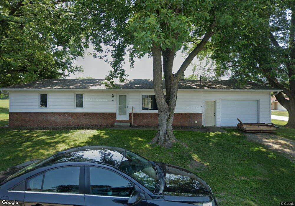
721 W High St Colfax, IA 50054
Estimated Value: $190,000 - $214,000
2
Beds
2
Baths
1,200
Sq Ft
$167/Sq Ft
Est. Value
About This Home
This home is located at 721 W High St, Colfax, IA 50054 and is currently estimated at $200,484, approximately $167 per square foot. 721 W High St is a home located in Jasper County with nearby schools including Colfax-Mingo Elementary School and Colfax-Mingo High School.
Ownership History
Date
Name
Owned For
Owner Type
Purchase Details
Closed on
May 24, 2022
Sold by
Knode and Kristin
Bought by
Russell Colton and Russell Michael
Current Estimated Value
Home Financials for this Owner
Home Financials are based on the most recent Mortgage that was taken out on this home.
Original Mortgage
$142,500
Outstanding Balance
$135,372
Interest Rate
5.25%
Mortgage Type
New Conventional
Estimated Equity
$65,112
Purchase Details
Closed on
Apr 1, 2022
Sold by
Lou Carlyle Connie
Bought by
Knode Randy and Knode Kristin
Home Financials for this Owner
Home Financials are based on the most recent Mortgage that was taken out on this home.
Original Mortgage
$142,500
Outstanding Balance
$135,372
Interest Rate
5.25%
Mortgage Type
New Conventional
Estimated Equity
$65,112
Purchase Details
Closed on
May 22, 2020
Sold by
Mcvay Michael E
Bought by
Mcvay Alan and Mcvay Brian
Create a Home Valuation Report for This Property
The Home Valuation Report is an in-depth analysis detailing your home's value as well as a comparison with similar homes in the area
Home Values in the Area
Average Home Value in this Area
Purchase History
| Date | Buyer | Sale Price | Title Company |
|---|---|---|---|
| Russell Colton | $150,000 | None Listed On Document | |
| Knode Randy | $125,000 | None Listed On Document | |
| Mcvay Alan | -- | None Available |
Source: Public Records
Mortgage History
| Date | Status | Borrower | Loan Amount |
|---|---|---|---|
| Open | Russell Colton | $142,500 | |
| Previous Owner | Knode Randy | $100,000 |
Source: Public Records
Tax History Compared to Growth
Tax History
| Year | Tax Paid | Tax Assessment Tax Assessment Total Assessment is a certain percentage of the fair market value that is determined by local assessors to be the total taxable value of land and additions on the property. | Land | Improvement |
|---|---|---|---|---|
| 2025 | $3,090 | $181,870 | $20,140 | $161,730 |
| 2024 | $3,090 | $162,300 | $20,140 | $142,160 |
| 2023 | $3,112 | $162,300 | $20,140 | $142,160 |
| 2022 | $2,436 | $131,000 | $20,140 | $110,860 |
| 2021 | $2,282 | $114,250 | $13,070 | $101,180 |
| 2020 | $2,282 | $104,270 | $11,850 | $92,420 |
| 2019 | $2,401 | $89,570 | $0 | $0 |
| 2018 | $2,044 | $89,570 | $0 | $0 |
| 2017 | $2,010 | $89,570 | $0 | $0 |
| 2016 | $2,016 | $89,570 | $0 | $0 |
| 2015 | $2,000 | $89,570 | $0 | $0 |
| 2014 | $1,904 | $89,570 | $0 | $0 |
Source: Public Records
Map
Nearby Homes
- 501 W Broadway St
- 215 W Spring St
- 223 W Broadway St
- 119 W Washington St
- 108 N West St
- 108 S Walnut St
- 34 E Broadway St
- 222 E Broadway St
- 226 S Iowa St
- 200 Jefferson St
- 520 S Oak Park Ave
- 0000 Lincoln St
- 400 S Goodrich St
- 20 S Oak Park Ave
- 300 E Front St
- 624 S Goodrich St
- 1161 S Goodrich St
- 655 E Division St
- 11213 Orchard Ave
- HWY 117 at Intersection of Fleet Ave
- 624 S Hastings Ave
- 626 S Hastings Ave
- 603 S Hastings Ave
- 715 W High St
- 524 S Hastings Ave
- 714 W High St
- 712 W High St
- 615 S Hastings Ave Unit A
- 615 S Hastings Ave
- 628 S Hastings Ave
- 505 S Hastings Ave
- 702 W High St
- 621 S Hastings Ave
- 627 S Hastings Ave
- 630 S Hastings Ave
- 719 W Pleasant St
- 529 S Hastings Ave
- 529 S Hastings Ave Unit A
- 711 W Pleasant St
- 503 S Hastings Ave