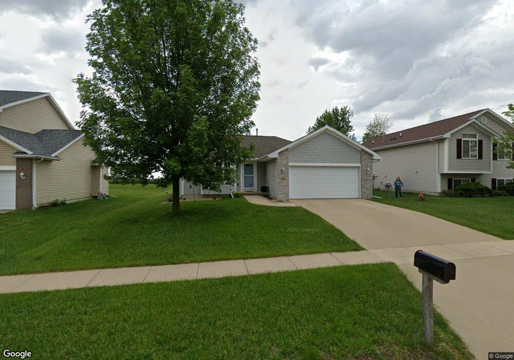
7210 Prairie Heights Dr SW Cedar Rapids, IA 52404
Lincolnway Village NeighborhoodEstimated Value: $292,595 - $316,000
4
Beds
2
Baths
1,364
Sq Ft
$225/Sq Ft
Est. Value
About This Home
This home is located at 7210 Prairie Heights Dr SW, Cedar Rapids, IA 52404 and is currently estimated at $306,399, approximately $224 per square foot. 7210 Prairie Heights Dr SW is a home located in Linn County with nearby schools including Prairie Heights Elementary School, Prairie Crest Elementary School, and Prairie View Elementary School.
Ownership History
Date
Name
Owned For
Owner Type
Purchase Details
Closed on
Mar 8, 2006
Sold by
Jerrys Homes Inc
Bought by
Hayward Jason A and Hayward Kristine S
Current Estimated Value
Home Financials for this Owner
Home Financials are based on the most recent Mortgage that was taken out on this home.
Original Mortgage
$143,960
Outstanding Balance
$82,127
Interest Rate
6.33%
Mortgage Type
Fannie Mae Freddie Mac
Estimated Equity
$224,272
Create a Home Valuation Report for This Property
The Home Valuation Report is an in-depth analysis detailing your home's value as well as a comparison with similar homes in the area
Home Values in the Area
Average Home Value in this Area
Purchase History
| Date | Buyer | Sale Price | Title Company |
|---|---|---|---|
| Hayward Jason A | $179,500 | None Available |
Source: Public Records
Mortgage History
| Date | Status | Borrower | Loan Amount |
|---|---|---|---|
| Open | Hayward Jason A | $143,960 |
Source: Public Records
Tax History Compared to Growth
Tax History
| Year | Tax Paid | Tax Assessment Tax Assessment Total Assessment is a certain percentage of the fair market value that is determined by local assessors to be the total taxable value of land and additions on the property. | Land | Improvement |
|---|---|---|---|---|
| 2025 | $4,514 | $263,200 | $55,300 | $207,900 |
| 2024 | $4,602 | $248,700 | $52,300 | $196,400 |
| 2023 | $4,602 | $248,700 | $52,300 | $196,400 |
| 2022 | $4,236 | $216,600 | $44,900 | $171,700 |
| 2021 | $4,386 | $203,900 | $41,900 | $162,000 |
| 2020 | $4,386 | $201,200 | $41,900 | $159,300 |
| 2019 | $4,120 | $192,200 | $32,900 | $159,300 |
| 2018 | $4,002 | $192,200 | $32,900 | $159,300 |
| 2017 | $4,040 | $188,100 | $32,900 | $155,200 |
| 2016 | $3,923 | $181,300 | $32,900 | $148,400 |
| 2015 | $3,827 | $177,815 | $32,890 | $144,925 |
| 2014 | $3,640 | $177,815 | $32,890 | $144,925 |
| 2013 | $3,454 | $177,815 | $32,890 | $144,925 |
Source: Public Records
Map
Nearby Homes
- 6620 Preston Terrace Ct SW
- 51 Oklahoma Ave SW
- 5750 J St SW
- 62 Oklahoma Ave SW
- 5655 Deerwood St SW
- 49 Devonwood Ave SW
- 0 6th St & 76th Ave SW Unit 202505956
- 142 Brighton Cir SW
- 5600 Klinger St SW
- 137 Woodstone Ln SW
- 107 Woodstone Ln SW
- 121 Woodstone Ln SW
- 160 Bethany Loop SW Unit A
- 160 Bethany Loop SW Unit C
- 160 Bethany Loop SW Unit B
- 163 Bethany Loop SW Unit A
- 163 Bethany Loop SW Unit B
- 8704 Eddie Dr SW Unit B
- 8705 Lewis Dr SW Unit C
- 8704 Eddie Dr SW Unit A
- 7216 Prairie Heights Dr SW
- 7204 Prairie Heights Dr SW
- 7222 Prairie Heights Dr SW
- 7126 Prairie Heights Dr SW
- 7205 Prairie Heights Dr SW
- 7125 Prairie Heights Dr SW
- 7211 Prairie Heights Dr SW
- 7300 Prairie Heights Dr SW
- 7120 Prairie Heights Dr SW
- 7119 Prairie Heights Dr SW
- 7306 Prairie Heights Dr SW
- 7114 Prairie Heights Dr SW
- 7303 Prairie Heights Dr SW
- 7215 Prairie Hawk Dr SW
- 7113 Prairie Heights Dr SW
- 7309 Prairie Heights Dr SW
- 7312 Prairie Heights Dr SW
- 7108 Prairie Heights Dr SW
- 7212 Prairie Hawk Dr SW
- 7107 Prairie Heights Dr SW