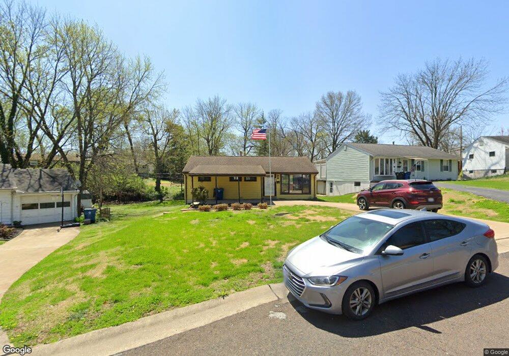
7210 Shellburne Dr Saint Louis, MO 63123
Estimated Value: $176,000 - $255,000
3
Beds
1
Bath
960
Sq Ft
$218/Sq Ft
Est. Value
About This Home
This home is located at 7210 Shellburne Dr, Saint Louis, MO 63123 and is currently estimated at $209,312, approximately $218 per square foot. 7210 Shellburne Dr is a home located in St. Louis County with nearby schools including Mesnier Primary School, Gotsch Intermediate School, and Rogers Middle School.
Ownership History
Date
Name
Owned For
Owner Type
Purchase Details
Closed on
May 20, 2022
Sold by
Stelz Properties Llc
Bought by
Gilliam Elyse and Schowalter Todd
Current Estimated Value
Home Financials for this Owner
Home Financials are based on the most recent Mortgage that was taken out on this home.
Original Mortgage
$147,250
Outstanding Balance
$139,566
Interest Rate
5%
Mortgage Type
New Conventional
Estimated Equity
$69,746
Purchase Details
Closed on
Apr 5, 2022
Sold by
Mcauley Fred C and Revoca Leah
Bought by
Stelz Properties Llc
Home Financials for this Owner
Home Financials are based on the most recent Mortgage that was taken out on this home.
Original Mortgage
$147,250
Outstanding Balance
$139,566
Interest Rate
5%
Mortgage Type
New Conventional
Estimated Equity
$69,746
Create a Home Valuation Report for This Property
The Home Valuation Report is an in-depth analysis detailing your home's value as well as a comparison with similar homes in the area
Home Values in the Area
Average Home Value in this Area
Purchase History
| Date | Buyer | Sale Price | Title Company |
|---|---|---|---|
| Gilliam Elyse | -- | Freedom Title | |
| Stelz Properties Llc | -- | Freedom Title |
Source: Public Records
Mortgage History
| Date | Status | Borrower | Loan Amount |
|---|---|---|---|
| Open | Gilliam Elyse | $147,250 | |
| Previous Owner | Stelz Properties Llc | $160,234 |
Source: Public Records
Tax History
| Year | Tax Paid | Tax Assessment Tax Assessment Total Assessment is a certain percentage of the fair market value that is determined by local assessors to be the total taxable value of land and additions on the property. | Land | Improvement |
|---|---|---|---|---|
| 2025 | $2,445 | $34,850 | $15,220 | $19,630 |
| 2024 | $2,445 | $30,060 | $10,150 | $19,910 |
| 2023 | $2,364 | $30,060 | $10,150 | $19,910 |
| 2022 | $2,381 | $27,590 | $11,150 | $16,440 |
| 2021 | $2,327 | $27,590 | $11,150 | $16,440 |
| 2020 | $1,997 | $22,060 | $9,820 | $12,240 |
| 2019 | $1,981 | $22,060 | $9,820 | $12,240 |
| 2018 | $2,096 | $20,650 | $6,840 | $13,810 |
| 2016 | $1,462 | $15,330 | $3,230 | $12,100 |
Source: Public Records
Map
Nearby Homes
- 8210 Marvale Ln
- 6901 General Sherman Ln
- 7609 General Meade Ln
- 1433 Ronald Dr
- 6723 Colony Acres Dr
- 435 Hampshire Ct
- 6722 Colony Acres Dr
- 8200 New Hampshire Ave
- 6714 Colony Acres Dr
- 6804 Snowy Owl Ln
- 8501 Palmetto Dr
- 804 Edgar Rd
- 6625 Hurstgreen Ln
- 1330 Drayton Ave
- 7917 Grantwood Cove Ln
- 8520 Ava Dr
- 8942 Eden Ave
- 6421 Judson Ave
- 60 Flamingo Dr
- 8016 Wynwood Dr
- 7214 Shellburne Dr
- 7206 Shellburne Dr
- 7218 Shellburne Dr
- 7134 Fernbrook Dr
- 02BBLT the Shelbourne at the Arbors
- 8130 S Laclede Station Rd
- 7217 General Sherman Ln
- 7130 Fernbrook Dr
- 7201 Shellburne Dr
- 7215 Shellburne Dr
- 7225 General Sherman Ln
- 8134 S Laclede Station Rd
- 7221 General Sherman Ln
- 7221 Shellburne Dr
- 7213 General Sherman Ln
- 8138 S Laclede Station Rd
- 7231 General Sherman Ln
- 7208 Fernbrook Dr
- 7126 Fernbrook Dr
- 8116 S Laclede Station Rd
Your Personal Tour Guide
Ask me questions while you tour the home.