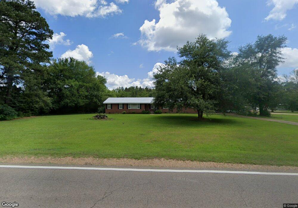
7212 Highway 50 E Columbus, MS 39702
Estimated Value: $117,000 - $180,000
--
Bed
1
Bath
2,051
Sq Ft
$79/Sq Ft
Est. Value
About This Home
This home is located at 7212 Highway 50 E, Columbus, MS 39702 and is currently estimated at $161,726, approximately $78 per square foot. 7212 Highway 50 E is a home.
Ownership History
Date
Name
Owned For
Owner Type
Purchase Details
Closed on
Jun 21, 2022
Sold by
Jordan Sumrall
Bought by
Brewer Dale
Current Estimated Value
Purchase Details
Closed on
Nov 1, 2021
Sold by
Jordan Sumrall
Bought by
Roberts Jack R
Purchase Details
Closed on
Dec 5, 2011
Sold by
Federal National Mortgage Association
Bought by
Summrall Jordan
Home Financials for this Owner
Home Financials are based on the most recent Mortgage that was taken out on this home.
Original Mortgage
$73,000
Interest Rate
4.4%
Mortgage Type
FHA
Purchase Details
Closed on
Oct 13, 2006
Sold by
Oxendine Patsy Robertson
Bought by
Richards Bryan K and Richards Robin D
Create a Home Valuation Report for This Property
The Home Valuation Report is an in-depth analysis detailing your home's value as well as a comparison with similar homes in the area
Home Values in the Area
Average Home Value in this Area
Purchase History
| Date | Buyer | Sale Price | Title Company |
|---|---|---|---|
| Brewer Dale | -- | None Listed On Document | |
| Roberts Jack R | -- | None Listed On Document | |
| Summrall Jordan | -- | -- | |
| Richards Bryan K | -- | -- |
Source: Public Records
Mortgage History
| Date | Status | Borrower | Loan Amount |
|---|---|---|---|
| Previous Owner | Richards Bryan K | $73,000 |
Source: Public Records
Tax History Compared to Growth
Tax History
| Year | Tax Paid | Tax Assessment Tax Assessment Total Assessment is a certain percentage of the fair market value that is determined by local assessors to be the total taxable value of land and additions on the property. | Land | Improvement |
|---|---|---|---|---|
| 2025 | $192 | $3,369 | $0 | $0 |
| 2024 | $189 | $3,369 | $0 | $0 |
| 2023 | $163 | $2,932 | $0 | $0 |
| 2022 | $164 | $2,932 | $0 | $0 |
| 2021 | $508 | $8,676 | $0 | $0 |
| 2020 | $464 | $8,676 | $0 | $0 |
| 2019 | $477 | $8,413 | $0 | $0 |
| 2018 | $477 | $8,562 | $0 | $0 |
| 2017 | $443 | $8,562 | $0 | $0 |
| 2016 | $443 | $8,562 | $0 | $0 |
| 2015 | $536 | $9,642 | $0 | $0 |
| 2014 | $536 | $9,642 | $0 | $0 |
Source: Public Records
Map
Nearby Homes
- 0 Gunshoot Rd
- 1495 Lee Stokes Rd
- 98 Alisha Ln
- 1256 Lee Stokes Rd
- 511 Belle Cir
- 1051 Tabernacle Rd
- 190 Tabernacle Rd
- 2746 Phillips Hill Rd
- 3533 Sand Rd
- 0 Sand Rd
- 411 Fernbank Rd
- 127 E Cherry St
- 83 Bowling Green Cir
- 432 Old Country Ln
- 0 Poole Rd
- 159 Lenox Ln
- 142 Lenox Ln
- 29 Lenox Ln
- 260 Nichols Bend
- 0 Hobbs Sheffield Rd
- 7210 Highway 50 E
- 7304 Highway 50 E
- 7316 Highway 50 E
- 109 Crestview Cir
- 7107 Highway 50 E
- 17 Terraceview Ln
- 53 Terraceview Ln
- 24 Terraceview Ln
- 7030 Highway 50 E
- 71 Terraceview Ln
- 7432 Highway 50 E
- 52 Terraceview Ln
- 152 Crestview Cir
- 190 Crestview Cir
- 89 Terraceview Ln
- 134 Crestview Cir
- 70 Terraceview Ln
- 260 Crestview Cir
- 107 Terraceview Ln
- 7014 Highway 50 E
