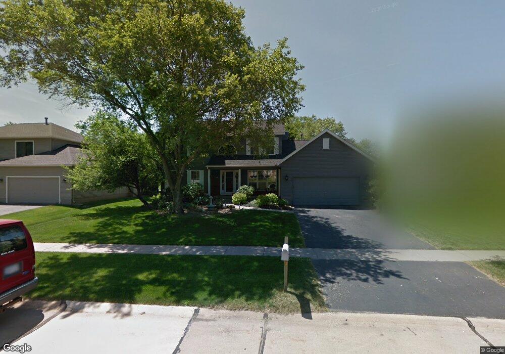
7213 Hampshire Dr NE Cedar Rapids, IA 52402
Estimated Value: $329,000 - $393,078
4
Beds
4
Baths
2,398
Sq Ft
$153/Sq Ft
Est. Value
About This Home
This home is located at 7213 Hampshire Dr NE, Cedar Rapids, IA 52402 and is currently estimated at $368,020, approximately $153 per square foot. 7213 Hampshire Dr NE is a home located in Linn County with nearby schools including Bowman Woods Elementary School, Oak Ridge School, and Linn-Mar High School.
Ownership History
Date
Name
Owned For
Owner Type
Purchase Details
Closed on
Aug 3, 2015
Sold by
Smoak Gilbert M and Smoak Kimberly K
Bought by
Bohr Thomas C and Bohr Amy L
Current Estimated Value
Home Financials for this Owner
Home Financials are based on the most recent Mortgage that was taken out on this home.
Original Mortgage
$212,000
Outstanding Balance
$166,623
Interest Rate
4.01%
Mortgage Type
New Conventional
Estimated Equity
$201,397
Create a Home Valuation Report for This Property
The Home Valuation Report is an in-depth analysis detailing your home's value as well as a comparison with similar homes in the area
Home Values in the Area
Average Home Value in this Area
Purchase History
| Date | Buyer | Sale Price | Title Company |
|---|---|---|---|
| Bohr Thomas C | $265,000 | None Available |
Source: Public Records
Mortgage History
| Date | Status | Borrower | Loan Amount |
|---|---|---|---|
| Open | Bohr Thomas C | $212,000 |
Source: Public Records
Tax History Compared to Growth
Tax History
| Year | Tax Paid | Tax Assessment Tax Assessment Total Assessment is a certain percentage of the fair market value that is determined by local assessors to be the total taxable value of land and additions on the property. | Land | Improvement |
|---|---|---|---|---|
| 2025 | $7,344 | $383,500 | $67,700 | $315,800 |
| 2024 | $7,134 | $374,800 | $67,700 | $307,100 |
| 2023 | $7,134 | $374,800 | $67,700 | $307,100 |
| 2022 | $6,564 | $312,100 | $61,600 | $250,500 |
| 2021 | $6,564 | $296,500 | $57,500 | $239,000 |
| 2020 | $6,564 | $279,600 | $47,200 | $232,400 |
| 2019 | $6,178 | $265,900 | $47,200 | $218,700 |
| 2018 | $5,914 | $265,900 | $47,200 | $218,700 |
| 2017 | $4,992 | $262,700 | $47,200 | $215,500 |
| 2016 | $4,992 | $223,200 | $47,200 | $176,000 |
| 2015 | $5,051 | $225,559 | $28,728 | $196,831 |
| 2014 | $4,856 | $225,559 | $28,728 | $196,831 |
| 2013 | $4,600 | $225,559 | $28,728 | $196,831 |
Source: Public Records
Map
Nearby Homes
- 342 Cambridge Dr NE
- 7320 Hampshire Dr NE
- 316 Sussex Dr NE
- 6726 Bowman Ln NE
- 3310 Timber Ridge Ct
- 1151 Plumwood Ct NE
- 1000 Hampshire Cir
- 980 Hampshire Cir
- 960 Hampshire Cir
- 948 Hampshire Cir
- 916 Hampshire Cir
- 7415 Pin Tail Dr NE
- 1150 Bedford Ct
- 884 Hampshire Cir
- 932 Prescott Ln
- 862 Hampshire Cir
- 2140 Newcastle Rd
- 820 Hampshire Cir
- 819 Hampshire Cir
- 786 Hampshire Cir
- 7209 Hampshire Dr NE
- 7217 Hampshire Dr NE
- 7205 Hampshire Dr NE
- 7221 Hampshire Dr NE
- 358 Willshire Ct NE
- 7301 Beckett Dr NE
- 7225 Hampshire Dr NE
- 7201 Hampshire Dr NE
- 7105 Kent Dr NE
- 7222 Hampshire Dr NE
- 362 Willshire Ct NE
- 7204 Hampshire Dr NE
- 357 Willshire Ct NE
- 7305 Beckett Dr NE
- 7229 Hampshire Dr NE
- 7200 Hampshire Dr NE
- 7304 Normandy Dr NE
- 7101 Kent Dr NE
- 7300 Beckett Dr NE
- 7311 Beckett Dr NE