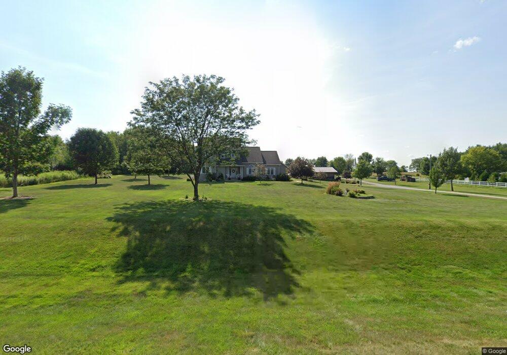
7213 N Union Rd Cedar Falls, IA 50613
Estimated Value: $562,000 - $638,000
4
Beds
6
Baths
3,059
Sq Ft
$197/Sq Ft
Est. Value
About This Home
This home is located at 7213 N Union Rd, Cedar Falls, IA 50613 and is currently estimated at $601,627, approximately $196 per square foot. 7213 N Union Rd is a home located in Black Hawk County with nearby schools including Helen A. Hansen Elementary School, Holmes Junior High School, and Cedar Falls High School.
Ownership History
Date
Name
Owned For
Owner Type
Purchase Details
Closed on
Oct 5, 2007
Sold by
Mckenna Daniel R and Mckenna Jenny L
Bought by
Goetz Daniel D and Goetz Tami R
Current Estimated Value
Home Financials for this Owner
Home Financials are based on the most recent Mortgage that was taken out on this home.
Original Mortgage
$230,000
Interest Rate
5.51%
Mortgage Type
New Conventional
Purchase Details
Closed on
Jan 18, 2005
Sold by
Simpson Travis R and Simpson Janet A
Bought by
Mckenna Daniel R and Mckenna Jenny L
Home Financials for this Owner
Home Financials are based on the most recent Mortgage that was taken out on this home.
Original Mortgage
$63,000
Interest Rate
5.83%
Mortgage Type
Credit Line Revolving
Create a Home Valuation Report for This Property
The Home Valuation Report is an in-depth analysis detailing your home's value as well as a comparison with similar homes in the area
Home Values in the Area
Average Home Value in this Area
Purchase History
| Date | Buyer | Sale Price | Title Company |
|---|---|---|---|
| Goetz Daniel D | $295,000 | None Available | |
| Mckenna Daniel R | $315,000 | Iowa Title & Escrow Services |
Source: Public Records
Mortgage History
| Date | Status | Borrower | Loan Amount |
|---|---|---|---|
| Previous Owner | Goetz Daniel D | $230,000 | |
| Previous Owner | Mckenna Daniel R | $63,000 |
Source: Public Records
Tax History Compared to Growth
Tax History
| Year | Tax Paid | Tax Assessment Tax Assessment Total Assessment is a certain percentage of the fair market value that is determined by local assessors to be the total taxable value of land and additions on the property. | Land | Improvement |
|---|---|---|---|---|
| 2024 | $5,362 | $456,890 | $110,000 | $346,890 |
| 2023 | $6,976 | $456,890 | $110,000 | $346,890 |
| 2022 | $7,036 | $487,520 | $99,000 | $388,520 |
| 2021 | $6,206 | $487,520 | $99,000 | $388,520 |
| 2020 | $6,114 | $436,020 | $47,500 | $388,520 |
| 2019 | $6,114 | $436,020 | $47,500 | $388,520 |
| 2018 | $5,242 | $369,230 | $47,500 | $321,730 |
| 2017 | $5,314 | $369,230 | $47,500 | $321,730 |
| 2016 | $4,880 | $369,230 | $47,500 | $321,730 |
| 2015 | $4,880 | $369,230 | $47,500 | $321,730 |
| 2014 | $4,840 | $369,230 | $47,500 | $321,730 |
Source: Public Records
Map
Nearby Homes
- 10241 Winslow Rd
- 7931 Clark St
- 9706 Sylvan Dr
- 10203 Mark Rd
- 6410 N Butler Rd
- 531 Hickory St
- 1281 270th St
- 903 S Main St
- 407 Maple St
- 8052 Buck Ridge Rd
- Lot 14 Pine St
- Lot 13 Pine St
- Lot 12 Pine St
- Lot 11 Pine St
- Lot 10 Pine St
- Lot 16 Pine St
- 411 Pine St
- Lot 8 Cbbt Commercial Subdivision
- Lot 7 Cbbt Commercial Subdivision
- Lot 6 Cbbt Commercial Subdivision
- 7112 Pioneer Dr
- 7219 N Union Rd
- 7125 N Union Rd
- 7130 Pioneer Dr
- 7227 N Union Rd
- 7227 N Union Rd
- 7305 N Union Rd
- 7140 Pioneer Dr
- 7106 Pioneer Dr
- 7111 Pioneer Dr
- 7046 Pioneer Dr
- 7131 Pioneer Dr
- 7148 Pioneer Dr
- 7047 Pioneer Dr
- 7315 N Union Rd
- 7147 Pioneer Dr
- 7033 N Union Rd
- 7032 Pioneer Dr
- 8808 Union Cir
- 8836 Union Cir