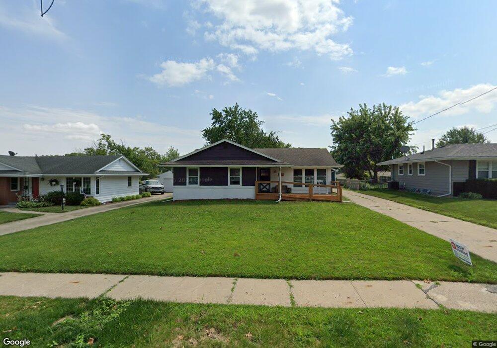
7214 Maple Dr Urbandale, IA 50322
Estimated Value: $257,000 - $279,010
3
Beds
2
Baths
1,194
Sq Ft
$226/Sq Ft
Est. Value
About This Home
This home is located at 7214 Maple Dr, Urbandale, IA 50322 and is currently estimated at $269,753, approximately $225 per square foot. 7214 Maple Dr is a home located in Polk County with nearby schools including Karen Acres Elementary School, Valerius Elementary School, and Urbandale Middle School.
Ownership History
Date
Name
Owned For
Owner Type
Purchase Details
Closed on
Feb 4, 2019
Sold by
Blu Ember Properties Llc
Bought by
Debner Matthew David
Current Estimated Value
Home Financials for this Owner
Home Financials are based on the most recent Mortgage that was taken out on this home.
Original Mortgage
$244,138
Outstanding Balance
$214,209
Interest Rate
4.5%
Mortgage Type
VA
Estimated Equity
$55,544
Purchase Details
Closed on
Dec 17, 2007
Sold by
Perry Darrell A
Bought by
Koehler Sandra A Heinricks
Home Financials for this Owner
Home Financials are based on the most recent Mortgage that was taken out on this home.
Original Mortgage
$125,400
Interest Rate
6.31%
Mortgage Type
Purchase Money Mortgage
Create a Home Valuation Report for This Property
The Home Valuation Report is an in-depth analysis detailing your home's value as well as a comparison with similar homes in the area
Home Values in the Area
Average Home Value in this Area
Purchase History
| Date | Buyer | Sale Price | Title Company |
|---|---|---|---|
| Debner Matthew David | $239,000 | None Available | |
| Koehler Sandra A Heinricks | $131,500 | Itc |
Source: Public Records
Mortgage History
| Date | Status | Borrower | Loan Amount |
|---|---|---|---|
| Open | Debner Matthew David | $244,138 | |
| Previous Owner | Koehler Sandra A Heinricks | $125,400 |
Source: Public Records
Tax History Compared to Growth
Tax History
| Year | Tax Paid | Tax Assessment Tax Assessment Total Assessment is a certain percentage of the fair market value that is determined by local assessors to be the total taxable value of land and additions on the property. | Land | Improvement |
|---|---|---|---|---|
| 2025 | $4,448 | $290,900 | $61,500 | $229,400 |
| 2024 | $4,448 | $264,700 | $55,100 | $209,600 |
| 2023 | $4,442 | $264,700 | $55,100 | $209,600 |
| 2022 | $4,388 | $219,300 | $47,500 | $171,800 |
| 2021 | $4,274 | $219,300 | $47,500 | $171,800 |
| 2020 | $3,388 | $203,200 | $44,000 | $159,200 |
| 2019 | $3,270 | $166,400 | $44,000 | $122,400 |
| 2018 | $3,146 | $150,700 | $38,900 | $111,800 |
| 2017 | $2,892 | $150,700 | $38,900 | $111,800 |
| 2016 | $2,816 | $136,800 | $34,900 | $101,900 |
| 2015 | $2,816 | $136,800 | $34,900 | $101,900 |
| 2014 | $2,642 | $132,800 | $33,200 | $99,600 |
Source: Public Records
Map
Nearby Homes
- 7201 Maple Dr
- 7051 Oak Brook Dr
- 7204 Douglas Ave
- 3206 68th St
- 3233 68th St
- 3808 72nd St
- 6717 Roseland Dr
- 2708 68th St
- 6620 Boston Ave
- 7100 Holcomb Ave
- 3611 68th St
- 3907 73rd St
- 6614 Oliver Smith Dr
- 6700 Sheridan Ave
- 3100 64th St
- 6316 Clearview Cir
- 3814 67th St
- 2250 70th St
- 3818 66th St
- 2610 Westover Blvd
- 7218 Maple Dr
- 7210 Maple Dr
- 7302 Maple Dr
- 7213 Oak Brook Dr
- 7209 Oak Brook Dr
- 7215 Oak Brook Dr
- 7205 Oak Brook Dr
- 7213 Maple Dr
- 7202 Maple Dr
- 7306 Maple Dr
- 7209 Maple Dr
- 7217 Maple Dr
- 7301 Oak Brook Dr
- 7205 Maple Dr
- 7201 Oak Brook Dr
- 7301 Maple Dr
- 7310 Maple Dr
- 7303 Oak Brook Dr
- 7309 Maple Dr
- 7313 Maple Dr