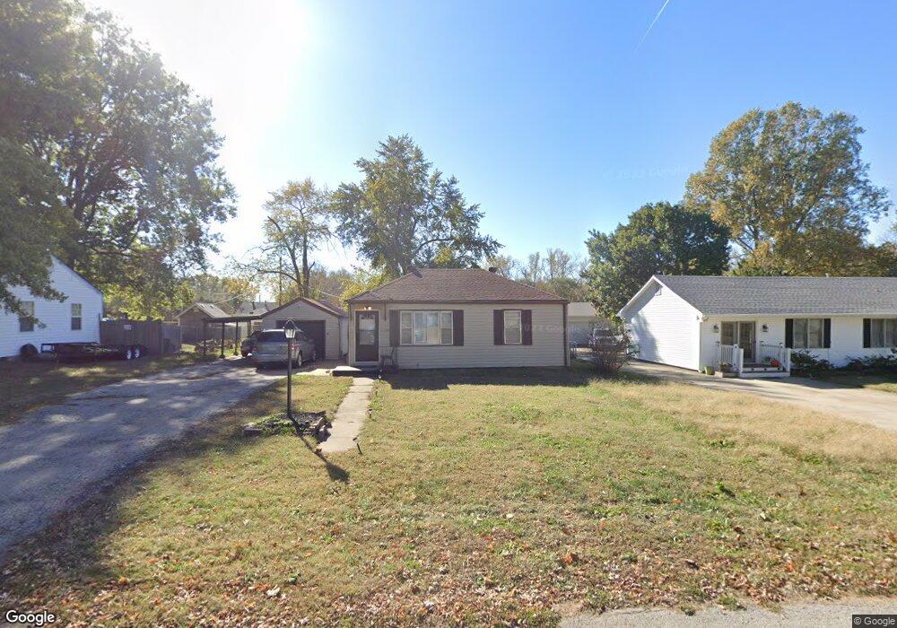
7215 Hasbrook Ave Kansas City, KS 66111
Muncie NeighborhoodEstimated Value: $158,000 - $214,000
2
Beds
1
Bath
907
Sq Ft
$202/Sq Ft
Est. Value
About This Home
This home is located at 7215 Hasbrook Ave, Kansas City, KS 66111 and is currently estimated at $183,074, approximately $201 per square foot. 7215 Hasbrook Ave is a home located in Wyandotte County with nearby schools including Stony Point South Elementary, Arrowhead Middle School, and Washington High School.
Ownership History
Date
Name
Owned For
Owner Type
Purchase Details
Closed on
Aug 25, 2017
Sold by
Brownawell Gerald Duane and Brownawell Judy
Bought by
Meals Maria Jhaneth
Current Estimated Value
Home Financials for this Owner
Home Financials are based on the most recent Mortgage that was taken out on this home.
Original Mortgage
$35,000
Outstanding Balance
$18,889
Interest Rate
3.92%
Mortgage Type
New Conventional
Estimated Equity
$164,185
Purchase Details
Closed on
Jan 23, 2002
Sold by
Sanderson Evelyn K and Sanderson Robert G
Bought by
Brownawell Gerald Dean
Create a Home Valuation Report for This Property
The Home Valuation Report is an in-depth analysis detailing your home's value as well as a comparison with similar homes in the area
Home Values in the Area
Average Home Value in this Area
Purchase History
| Date | Buyer | Sale Price | Title Company |
|---|---|---|---|
| Meals Maria Jhaneth | -- | First American Title Ins Co | |
| Brownawell Gerald Dean | $29,000 | -- |
Source: Public Records
Mortgage History
| Date | Status | Borrower | Loan Amount |
|---|---|---|---|
| Open | Meals Maria Jhaneth | $35,000 |
Source: Public Records
Tax History Compared to Growth
Tax History
| Year | Tax Paid | Tax Assessment Tax Assessment Total Assessment is a certain percentage of the fair market value that is determined by local assessors to be the total taxable value of land and additions on the property. | Land | Improvement |
|---|---|---|---|---|
| 2024 | $2,182 | $15,157 | $4,181 | $10,976 |
| 2023 | $2,165 | $13,754 | $3,463 | $10,291 |
| 2022 | $1,865 | $11,822 | $3,003 | $8,819 |
| 2021 | $1,636 | $10,040 | $2,898 | $7,142 |
| 2020 | $1,459 | $8,980 | $2,328 | $6,652 |
| 2019 | $1,317 | $8,140 | $2,183 | $5,957 |
| 2018 | $1,166 | $7,268 | $1,661 | $5,607 |
| 2017 | $1,199 | $7,402 | $1,661 | $5,741 |
| 2016 | $1,129 | $6,918 | $1,661 | $5,257 |
| 2015 | $1,108 | $6,716 | $1,556 | $5,160 |
| 2014 | $1,120 | $6,743 | $1,556 | $5,187 |
Source: Public Records
Map
Nearby Homes
- 7201 Hasbrook Ave
- 7219 Hasbrook Ave
- 7210 Osage Ave
- 7200 Hasbrook Ave
- 7223 Hasbrook Ave
- 7200 Osage Ave
- 7216 Osage Ave
- 7218 Osage Ave
- 7218 Hasbrook Ave
- 724 S 72nd St
- 741 S 72nd St
- 747 S 72nd St
- 7230 Osage Ave
- 751 S 72nd St
- 7226 Hasbrook Ave
- 720 S 72nd St
- 727 S 72nd St
- 7235 Hasbrook Ave
- 757 S 72nd St
- 763 S 72nd St