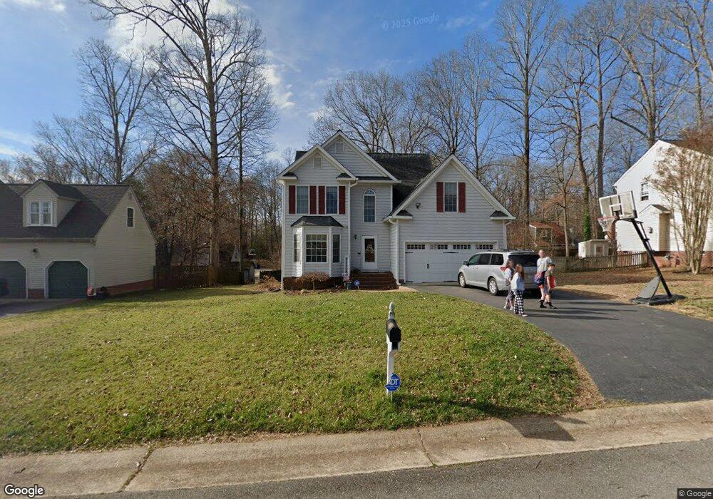
7219 Port Side Dr Midlothian, VA 23112
Estimated Value: $350,000 - $406,178
4
Beds
3
Baths
2,101
Sq Ft
$185/Sq Ft
Est. Value
About This Home
This home is located at 7219 Port Side Dr, Midlothian, VA 23112 and is currently estimated at $389,545, approximately $185 per square foot. 7219 Port Side Dr is a home located in Chesterfield County with nearby schools including Clover Hill Elementary School, Swift Creek Middle, and Clover Hill High.
Ownership History
Date
Name
Owned For
Owner Type
Purchase Details
Closed on
Jul 19, 2010
Sold by
Dogtown Inc
Bought by
Koehne C Ryan
Current Estimated Value
Home Financials for this Owner
Home Financials are based on the most recent Mortgage that was taken out on this home.
Original Mortgage
$154,000
Outstanding Balance
$102,642
Interest Rate
4.78%
Mortgage Type
New Conventional
Estimated Equity
$286,903
Purchase Details
Closed on
Apr 16, 2010
Sold by
Ets Of Virginia
Bought by
Dogtown Inc
Purchase Details
Closed on
Feb 3, 2009
Sold by
Paul J Rubis Trustee
Bought by
Homecomings Financial Llc
Purchase Details
Closed on
Dec 29, 2000
Bought by
Smith Ricky L and Smith Teresa B
Home Financials for this Owner
Home Financials are based on the most recent Mortgage that was taken out on this home.
Original Mortgage
$12,815
Interest Rate
7.7%
Mortgage Type
New Conventional
Create a Home Valuation Report for This Property
The Home Valuation Report is an in-depth analysis detailing your home's value as well as a comparison with similar homes in the area
Home Values in the Area
Average Home Value in this Area
Purchase History
| Date | Buyer | Sale Price | Title Company |
|---|---|---|---|
| Koehne C Ryan | $192,500 | -- | |
| Dogtown Inc | $132,500 | -- | |
| Homecomings Financial Llc | $182,751 | -- | |
| Smith Ricky L | -- | -- |
Source: Public Records
Mortgage History
| Date | Status | Borrower | Loan Amount |
|---|---|---|---|
| Open | Koehne C Ryan | $154,000 | |
| Previous Owner | Smith Ricky L | $12,815 |
Source: Public Records
Tax History
| Year | Tax Paid | Tax Assessment Tax Assessment Total Assessment is a certain percentage of the fair market value that is determined by local assessors to be the total taxable value of land and additions on the property. | Land | Improvement |
|---|---|---|---|---|
| 2025 | $3,340 | $372,500 | $59,000 | $313,500 |
| 2024 | $3,340 | $362,300 | $56,000 | $306,300 |
| 2023 | $2,934 | $322,400 | $54,000 | $268,400 |
| 2022 | $2,835 | $308,200 | $52,000 | $256,200 |
| 2021 | $2,613 | $268,100 | $50,000 | $218,100 |
| 2020 | $2,547 | $268,100 | $50,000 | $218,100 |
| 2019 | $2,417 | $254,400 | $48,000 | $206,400 |
| 2018 | $2,315 | $243,700 | $47,000 | $196,700 |
| 2017 | $2,156 | $224,600 | $44,000 | $180,600 |
| 2016 | $2,030 | $211,500 | $43,000 | $168,500 |
| 2015 | $2,017 | $207,500 | $42,000 | $165,500 |
| 2014 | $1,948 | $200,300 | $41,000 | $159,300 |
Source: Public Records
Map
Nearby Homes
- 6812 Sika Ln
- 6924 Velvet Antler Dr
- 7104 Deer Run Ln
- 24 Spinnaker Cove Dr
- 13805 Buck Rub Dr
- 34 Spinnaker Cove Dr
- 7303 Native Dancer Dr
- 6024 Watch Harbour Rd
- 5910 Harbourwood Place
- 4823 Sapphire Dr Unit 4823
- 5900 Harbourwood Place
- 5713 Promontory Place
- 5601 Promontory Pointe Rd
- 4816 Long Shadow Dr
- 14202 Branched Antler Place
- 13207 Court Ridge Rd
- 4714 Five Springs Ct
- 13313 Farm Crest Ct
- 5201 Creek Heights Dr
- 4607 Morning Hill Ct
- 7301 Port Side Dr
- 7213 Port Side Dr
- 7218 Full Rack Dr
- 7212 Full Rack Dr
- 7224 Full Rack Dr
- 7307 Port Side Dr
- 7207 Port Side Dr
- 7300 Port Side Dr
- 6513 Ships Watch Ln
- 7206 Full Rack Dr
- 7230 Full Rack Dr
- 7306 Port Side Dr
- 7206 Port Side Dr
- 7313 Port Side Dr
- 6600 Harbourside Dr
- 7236 Full Rack Dr
- 7200 Full Rack Dr
- 7200 Full Rack Dr Unit 2
- 6507 Ships Watch Ln
- 6506 Ships Watch Ln
Your Personal Tour Guide
Ask me questions while you tour the home.