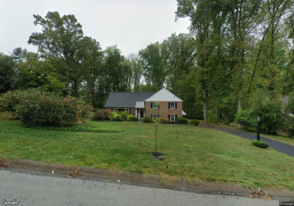
722 Clyde Cir Bryn Mawr, PA 19010
Estimated Value: $937,606 - $1,265,000
4
Beds
3
Baths
2,725
Sq Ft
$396/Sq Ft
Est. Value
About This Home
This home is located at 722 Clyde Cir, Bryn Mawr, PA 19010 and is currently estimated at $1,079,402, approximately $396 per square foot. 722 Clyde Cir is a home located in Delaware County with nearby schools including Ithan Elementary School, Radnor Middle School, and Radnor Senior High School.
Ownership History
Date
Name
Owned For
Owner Type
Purchase Details
Closed on
Jul 15, 1997
Sold by
Noonan Leona E
Bought by
Cohen Michael and Cohen Katherine
Current Estimated Value
Home Financials for this Owner
Home Financials are based on the most recent Mortgage that was taken out on this home.
Original Mortgage
$224,000
Outstanding Balance
$32,927
Interest Rate
7.79%
Estimated Equity
$1,046,475
Create a Home Valuation Report for This Property
The Home Valuation Report is an in-depth analysis detailing your home's value as well as a comparison with similar homes in the area
Home Values in the Area
Average Home Value in this Area
Purchase History
| Date | Buyer | Sale Price | Title Company |
|---|---|---|---|
| Cohen Michael | $280,000 | -- |
Source: Public Records
Mortgage History
| Date | Status | Borrower | Loan Amount |
|---|---|---|---|
| Open | Cohen Michael | $224,000 |
Source: Public Records
Tax History Compared to Growth
Tax History
| Year | Tax Paid | Tax Assessment Tax Assessment Total Assessment is a certain percentage of the fair market value that is determined by local assessors to be the total taxable value of land and additions on the property. | Land | Improvement |
|---|---|---|---|---|
| 2025 | $10,948 | $541,480 | $232,640 | $308,840 |
| 2024 | $10,948 | $541,480 | $232,640 | $308,840 |
| 2023 | $10,514 | $541,480 | $232,640 | $308,840 |
| 2022 | $10,399 | $541,480 | $232,640 | $308,840 |
| 2021 | $16,704 | $541,480 | $232,640 | $308,840 |
| 2020 | $9,755 | $280,430 | $137,090 | $143,340 |
| 2019 | $9,480 | $280,430 | $137,090 | $143,340 |
| 2018 | $9,294 | $280,430 | $0 | $0 |
| 2017 | $9,100 | $280,430 | $0 | $0 |
| 2016 | $1,539 | $280,430 | $0 | $0 |
| 2015 | $1,570 | $280,430 | $0 | $0 |
| 2014 | $1,570 | $280,430 | $0 | $0 |
Source: Public Records
Map
Nearby Homes
- 820 Darby Paoli Rd
- 726 Darby Paoli Rd
- 560 S Bryn Mawr Ave
- 3920 Darby Rd
- 119 Bella Dr Unit 2MD
- 117 Bella Dr Unit 3AD
- 204 Wedgewood Cir
- 238 E Chelsea Cir Unit 238
- 124 Carli Dr
- 211 E Chelsea Cir
- 12 Lincoln Ln
- 212 Aronimink Dr
- 217 Jeffrey Ln
- 3111 Sawmill Rd
- 406 Barclay Rd
- 202 Summit Dr Unit B
- 103 Summit Dr Unit B
- 215 Cornell Dr
- 633 Foxfields Rd
- 307 B B000 Summit Dr Unit B