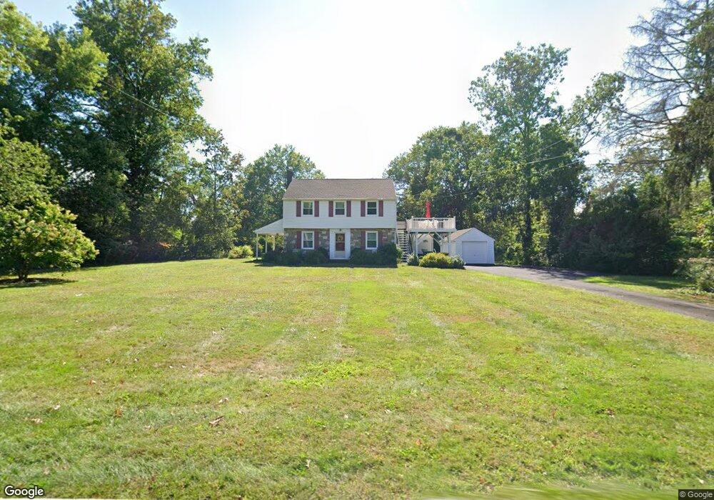
722 Cowpath Rd Hatfield, PA 19440
Estimated Value: $372,000 - $479,081
2
Beds
2
Baths
1,758
Sq Ft
$247/Sq Ft
Est. Value
About This Home
This home is located at 722 Cowpath Rd, Hatfield, PA 19440 and is currently estimated at $434,520, approximately $247 per square foot. 722 Cowpath Rd is a home located in Montgomery County with nearby schools including Oak Park El School, Pennfield Middle School, and North Penn Senior High School.
Ownership History
Date
Name
Owned For
Owner Type
Purchase Details
Closed on
Dec 28, 2016
Sold by
Weiss Betty W
Bought by
Heim Judith A
Current Estimated Value
Purchase Details
Closed on
May 25, 1979
Bought by
Weiss Betty W
Create a Home Valuation Report for This Property
The Home Valuation Report is an in-depth analysis detailing your home's value as well as a comparison with similar homes in the area
Home Values in the Area
Average Home Value in this Area
Purchase History
| Date | Buyer | Sale Price | Title Company |
|---|---|---|---|
| Heim Judith A | -- | None Available | |
| Weiss Betty W | -- | -- |
Source: Public Records
Tax History
| Year | Tax Paid | Tax Assessment Tax Assessment Total Assessment is a certain percentage of the fair market value that is determined by local assessors to be the total taxable value of land and additions on the property. | Land | Improvement |
|---|---|---|---|---|
| 2025 | $6,043 | $150,940 | $68,850 | $82,090 |
| 2024 | $6,043 | $150,940 | $68,850 | $82,090 |
| 2023 | $5,784 | $150,940 | $68,850 | $82,090 |
| 2022 | $5,595 | $150,940 | $68,850 | $82,090 |
| 2021 | $5,436 | $150,940 | $68,850 | $82,090 |
| 2020 | $5,308 | $150,940 | $68,850 | $82,090 |
| 2019 | $5,219 | $150,940 | $68,850 | $82,090 |
Source: Public Records
Map
Nearby Homes
- 7 Fortuna Dr
- 2 Fortuna Dr
- 6 Fortuna Dr
- Lot 0 Fortuna Dr
- 1315 Deer Run Rd
- 2288 Rebecca Dr
- 1514 Maple Ave
- 1943 Linden Ln
- 2732 Valley Woods Rd
- 1714 Lydia Dr
- 816 Kenilworth Ave
- 2296 Bramble Gate Dr
- 1118 Emerald Ave
- 29 W Vine St
- 737 Shaw Ave
- 416 Oak Park Rd
- 1035 Poplar St
- 000 Lenape Dr
- 83 Bethlehem Pike Unit 1306- HAMILTON PLAN
- 83 Bethlehem Pike Unit 1405
- 708 Cowpath Rd
- 715 Cowpath Rd Unit 9
- 660 Cowpath Rd
- 709 Cowpath Rd
- 808 Cowpath Rd
- 1721 Forest Hills Dr
- 1713 Forest Hills Dr
- 1705 Forest Hills Dr
- 1729 Forest Hills Dr
- 632 Cowpath Rd
- 1922 Line Lexington Rd
- 703 Cowpath Rd
- 1697 Forest Hills Dr
- 824 Cowpath Rd
- 1737 Forest Hills Dr
- 620 Cowpath Rd
- 1689 Forest Hills Dr
- 1664 Forest Hills Dr
- 1930 Line Lexington Rd
- 1680 Forest Hills Dr
Your Personal Tour Guide
Ask me questions while you tour the home.