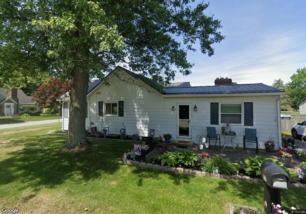
722 E Crocker St Bradner, OH 43406
Estimated Value: $156,000 - $208,000
4
Beds
1
Bath
1,537
Sq Ft
$112/Sq Ft
Est. Value
About This Home
This home is located at 722 E Crocker St, Bradner, OH 43406 and is currently estimated at $171,934, approximately $111 per square foot. 722 E Crocker St is a home located in Wood County with nearby schools including Lakota Elementary School, Lakota Middle School, and Lakota High School.
Ownership History
Date
Name
Owned For
Owner Type
Purchase Details
Closed on
May 21, 2008
Sold by
Root Tyson T and Root Corinna D
Bought by
Newman Robin L
Current Estimated Value
Home Financials for this Owner
Home Financials are based on the most recent Mortgage that was taken out on this home.
Original Mortgage
$112,244
Outstanding Balance
$69,773
Interest Rate
5.87%
Mortgage Type
Purchase Money Mortgage
Estimated Equity
$102,161
Purchase Details
Closed on
Sep 7, 1994
Sold by
Brossia Robert W
Bought by
Mccluer Kyle L and Mccluer Sherrie L
Home Financials for this Owner
Home Financials are based on the most recent Mortgage that was taken out on this home.
Original Mortgage
$47,950
Interest Rate
8.65%
Mortgage Type
New Conventional
Purchase Details
Closed on
Jun 18, 1987
Bought by
Brossia Robert W
Create a Home Valuation Report for This Property
The Home Valuation Report is an in-depth analysis detailing your home's value as well as a comparison with similar homes in the area
Purchase History
| Date | Buyer | Sale Price | Title Company |
|---|---|---|---|
| Newman Robin L | $110,000 | Attorney | |
| Mccluer Kyle L | $50,500 | -- | |
| Brossia Robert W | $37,500 | -- |
Source: Public Records
Mortgage History
| Date | Status | Borrower | Loan Amount |
|---|---|---|---|
| Open | Newman Robin L | $112,244 | |
| Previous Owner | Mccluer Kyle L | $47,950 |
Source: Public Records
Tax History
| Year | Tax Paid | Tax Assessment Tax Assessment Total Assessment is a certain percentage of the fair market value that is determined by local assessors to be the total taxable value of land and additions on the property. | Land | Improvement |
|---|---|---|---|---|
| 2025 | $2,118 | $47,600 | $5,250 | $42,350 |
| 2024 | $2,167 | $47,600 | $5,250 | $42,350 |
| 2023 | $2,167 | $47,600 | $5,250 | $42,350 |
| 2021 | $1,856 | $34,800 | $5,010 | $29,790 |
| 2020 | $1,864 | $34,800 | $5,010 | $29,790 |
| 2019 | $1,700 | $31,300 | $5,010 | $26,290 |
| 2018 | $1,706 | $31,300 | $5,010 | $26,290 |
| 2017 | $1,507 | $31,300 | $5,010 | $26,290 |
| 2016 | $1,433 | $31,720 | $5,010 | $26,710 |
| 2015 | $1,433 | $31,720 | $5,010 | $26,710 |
| 2014 | $1,569 | $31,720 | $5,010 | $26,710 |
| 2013 | $1,636 | $31,720 | $5,010 | $26,710 |
Source: Public Records
Map
Nearby Homes
- 115 N Evans St
- 217 N East St
- 7563 County Road 21
- 145 W Strong St
- 145 W Bryant St
- 119 E Main St
- 1897 Bays Rd
- 7430 County Road 67
- 13527 McCutcheonville Rd
- 6480 County Road 1
- 6540 County Road 1
- 433 Water St
- 177 Bierley Ave
- 455 Linden (Lot 42) Dr
- 127 Bierley Ave
- 123 Catalpa (Lot 21) Ct
- 214 Main St
- 428 Linden Drive (Lot 9)
- 432 Linden St
- 818 S Ludwig Ave
Your Personal Tour Guide
Ask me questions while you tour the home.