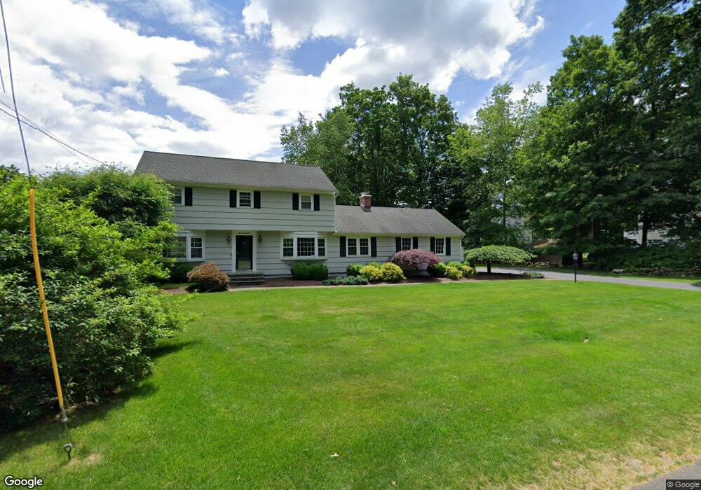
722 Mountain Laurel Rd Fairfield, CT 06824
Lake Mohegan Hills NeighborhoodEstimated Value: $1,188,789 - $1,370,000
4
Beds
3
Baths
1,940
Sq Ft
$668/Sq Ft
Est. Value
About This Home
This home is located at 722 Mountain Laurel Rd, Fairfield, CT 06824 and is currently estimated at $1,295,447, approximately $667 per square foot. 722 Mountain Laurel Rd is a home located in Fairfield County with nearby schools including Burr Elementary School, Tomlinson Middle School, and Fairfield Warde High School.
Ownership History
Date
Name
Owned For
Owner Type
Purchase Details
Closed on
Jul 28, 2022
Sold by
Digiulio Aristodemo C and Digiulio Linda R
Bought by
Pittsburg Adam D and Feinberg Stephanie A
Current Estimated Value
Purchase Details
Closed on
Apr 28, 2006
Sold by
Stevens Jean
Bought by
Dogiulio Aristodemo C and Digiulio Linda R
Home Financials for this Owner
Home Financials are based on the most recent Mortgage that was taken out on this home.
Original Mortgage
$410,000
Interest Rate
6.4%
Create a Home Valuation Report for This Property
The Home Valuation Report is an in-depth analysis detailing your home's value as well as a comparison with similar homes in the area
Home Values in the Area
Average Home Value in this Area
Purchase History
| Date | Buyer | Sale Price | Title Company |
|---|---|---|---|
| Pittsburg Adam D | $1,125,000 | None Available | |
| Pittsburg Adam D | $1,125,000 | None Available | |
| Dogiulio Aristodemo C | $740,000 | -- | |
| Dogiulio Aristodemo C | $740,000 | -- |
Source: Public Records
Mortgage History
| Date | Status | Borrower | Loan Amount |
|---|---|---|---|
| Previous Owner | Dogiulio Aristodemo C | $411,000 | |
| Previous Owner | Dogiulio Aristodemo C | $290,000 | |
| Previous Owner | Dogiulio Aristodemo C | $219,000 | |
| Previous Owner | Dogiulio Aristodemo C | $410,000 |
Source: Public Records
Tax History
| Year | Tax Paid | Tax Assessment Tax Assessment Total Assessment is a certain percentage of the fair market value that is determined by local assessors to be the total taxable value of land and additions on the property. | Land | Improvement |
|---|---|---|---|---|
| 2025 | $11,302 | $398,090 | $221,690 | $176,400 |
| 2024 | $11,107 | $398,090 | $221,690 | $176,400 |
| 2023 | $10,951 | $398,090 | $221,690 | $176,400 |
| 2022 | $10,844 | $398,090 | $221,690 | $176,400 |
| 2021 | $10,740 | $398,090 | $221,690 | $176,400 |
| 2020 | $10,757 | $401,520 | $192,360 | $209,160 |
| 2019 | $10,757 | $401,520 | $192,360 | $209,160 |
| 2018 | $10,584 | $401,520 | $192,360 | $209,160 |
| 2017 | $10,367 | $401,520 | $192,360 | $209,160 |
| 2016 | $10,219 | $401,520 | $192,360 | $209,160 |
| 2015 | $10,040 | $405,020 | $213,360 | $191,660 |
| 2014 | $9,882 | $405,020 | $213,360 | $191,660 |
Source: Public Records
Map
Nearby Homes
- 385 Samp Mortar Dr
- 145 Galloping Hill Rd
- 210 Pansy Rd
- 54 Ridgedale Rd
- 1115 Galloping Hill Rd
- 10 Pansy Rd
- 706 Judd St
- 31 High Ridge Rd
- 205 Winnepoge Dr
- 158 Mayfair Rd
- 164 Farist Rd
- 204 Glen Ridge Rd
- 6 Buckboard Ln
- 115 Mayfair Rd
- 185 Windsor Rd
- 218 Lower Farm Rd
- 217 Fairland Dr
- 109 Katona Dr Unit 18
- 148 Millspaugh Dr
- 11 Tuckahoe Ln
- 766 Mountain Laurel Rd Unit Furn
- 766 Mountain Laurel Rd Unit Unfurn
- 766 Mountain Laurel Rd
- 652 Mountain Laurel Rd
- 715 Mountain Laurel Rd
- 739 Mountain Laurel Rd
- 798 Mountain Laurel Rd
- 719 Mountain Laurel Rd
- 38 Oriole Ln
- 789 Mountain Laurel Rd
- 820 Mountain Laurel Rd
- 12 Stroll Rock Common
- 723 Mountain Laurel Rd
- 120 Stroll Rock Common
- 140 Stroll Rock Common
- 817 Mountain Laurel Rd
- 60 Oriole Ln
- 55 Oriole Ln
- 125 Stroll Rock Common
- 850 Mountain Laurel Rd
Your Personal Tour Guide
Ask me questions while you tour the home.