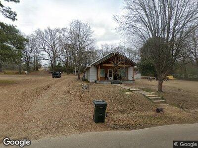
722 Old Highway 70 W Dierks, AR 71833
Estimated Value: $77,652 - $116,000
--
Bed
1
Bath
1,288
Sq Ft
$72/Sq Ft
Est. Value
About This Home
This home is located at 722 Old Highway 70 W, Dierks, AR 71833 and is currently estimated at $92,663, approximately $71 per square foot. 722 Old Highway 70 W is a home located in Howard County with nearby schools including Joann Walters Elementary School and Dierks High School.
Ownership History
Date
Name
Owned For
Owner Type
Purchase Details
Closed on
Feb 21, 2002
Sold by
Not Provided
Bought by
Janes Chris and Janes Kristi
Current Estimated Value
Purchase Details
Closed on
Feb 15, 2002
Sold by
Not Provided
Bought by
Divorc Robert Paul Piearcy
Purchase Details
Closed on
May 23, 2000
Sold by
Not Provided
Bought by
Piearcy Robert P and Piearcy Lisa
Purchase Details
Closed on
Jul 9, 1990
Sold by
Not Provided
Bought by
Tollett
Create a Home Valuation Report for This Property
The Home Valuation Report is an in-depth analysis detailing your home's value as well as a comparison with similar homes in the area
Home Values in the Area
Average Home Value in this Area
Purchase History
| Date | Buyer | Sale Price | Title Company |
|---|---|---|---|
| Janes Chris | $45,000 | -- | |
| Divorc Robert Paul Piearcy | -- | -- | |
| Piearcy Robert P | $40,000 | -- | |
| Tollett | $16,000 | -- |
Source: Public Records
Mortgage History
| Date | Status | Borrower | Loan Amount |
|---|---|---|---|
| Open | Janes Christopher M | $60,300 | |
| Closed | Janes Christopher Michael | $8,467 | |
| Closed | Janes Chris | $50,000 |
Source: Public Records
Tax History Compared to Growth
Tax History
| Year | Tax Paid | Tax Assessment Tax Assessment Total Assessment is a certain percentage of the fair market value that is determined by local assessors to be the total taxable value of land and additions on the property. | Land | Improvement |
|---|---|---|---|---|
| 2024 | $585 | $11,190 | $720 | $10,470 |
| 2023 | $585 | $11,190 | $720 | $10,470 |
| 2022 | $187 | $11,190 | $720 | $10,470 |
| 2021 | $150 | $11,190 | $720 | $10,470 |
| 2020 | $128 | $11,190 | $720 | $10,470 |
| 2019 | $105 | $11,190 | $720 | $10,470 |
| 2018 | $449 | $8,750 | $720 | $8,030 |
| 2017 | $449 | $8,750 | $720 | $8,030 |
| 2016 | $99 | $8,750 | $720 | $8,030 |
| 2015 | $440 | $8,750 | $720 | $8,030 |
| 2014 | $440 | $8,750 | $720 | $8,030 |
| 2013 | $481 | $9,560 | $800 | $8,760 |
Source: Public Records
Map
Nearby Homes
- 507 W 1st St
- 602 W 2nd St
- 601 W 3rd St
- 607 W 3rd St
- 1205 N Walters Ave
- 1133 Main Ave
- 127 Nottingham Dr
- 208 Kesterson Ave
- Barite Road
- 255 Mount Carmel Rd
- 1479 Highway 369 N
- 315 N Center Point St
- TBD Bluegrass Rd
- 0 Hwy 278 W Unit 24028464
- 161 Manasco Loop
- 12 Lake View Ln
- 895 Faulkner Rd
- 1734 Crosstrails Rd
- 2247 Mount Pleasant Dr
- 638 Blue Bayou Rd
- 722 Old Highway 70 W
- 712 Old Highway 70 W
- 729 Highway 70 W
- 706 Old Highway 70 W
- 202 Alsabrook Ave
- 104 S Walters Ave
- S Walters Ave
- 608 Front St
- 100 S Walters Ave
- 604 W First St
- 601 W First St
- TBD Corner of W 2nd and Walters St
- 607 W Second St
- 602 W First St
- 511 W 1st St
- 511 W First St
- W 1st St
- 603 W Second St
- 823 Old Highway 70 W
- 510 W First St