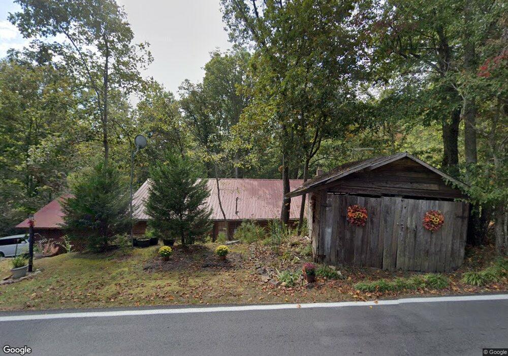
722 Pardue Mill Rd Demorest, GA 30535
Estimated Value: $352,080 - $533,000
3
Beds
2
Baths
2,161
Sq Ft
$200/Sq Ft
Est. Value
About This Home
This home is located at 722 Pardue Mill Rd, Demorest, GA 30535 and is currently estimated at $431,520, approximately $199 per square foot. 722 Pardue Mill Rd is a home located in Habersham County with nearby schools including Fairview Elementary School, North Habersham Middle School, and Habersham Success Academy.
Ownership History
Date
Name
Owned For
Owner Type
Purchase Details
Closed on
May 13, 2014
Sold by
Lewallen Derryl C
Bought by
Lewallen Derryl C and Lewallen Teresa B
Current Estimated Value
Purchase Details
Closed on
Aug 10, 2012
Sold by
Smith Mara G
Bought by
Lewallen Darryl C
Home Financials for this Owner
Home Financials are based on the most recent Mortgage that was taken out on this home.
Original Mortgage
$206,122
Interest Rate
3.55%
Mortgage Type
New Conventional
Create a Home Valuation Report for This Property
The Home Valuation Report is an in-depth analysis detailing your home's value as well as a comparison with similar homes in the area
Home Values in the Area
Average Home Value in this Area
Purchase History
| Date | Buyer | Sale Price | Title Company |
|---|---|---|---|
| Lewallen Derryl C | -- | -- | |
| Lewallen Darryl C | $215,000 | -- |
Source: Public Records
Mortgage History
| Date | Status | Borrower | Loan Amount |
|---|---|---|---|
| Previous Owner | Lewallen Darryl C | $206,122 |
Source: Public Records
Tax History
| Year | Tax Paid | Tax Assessment Tax Assessment Total Assessment is a certain percentage of the fair market value that is determined by local assessors to be the total taxable value of land and additions on the property. | Land | Improvement |
|---|---|---|---|---|
| 2025 | $1,650 | $108,869 | $15,227 | $93,642 |
| 2024 | -- | $104,320 | $14,744 | $89,576 |
| 2023 | $1,248 | $89,044 | $14,744 | $74,300 |
| 2022 | $1,636 | $78,668 | $14,744 | $63,924 |
| 2021 | $1,875 | $72,248 | $14,744 | $57,504 |
| 2020 | $1,729 | $64,296 | $14,744 | $49,552 |
| 2019 | $1,731 | $64,296 | $14,744 | $49,552 |
| 2018 | $1,718 | $64,296 | $14,744 | $49,552 |
| 2017 | $1,618 | $60,240 | $14,744 | $45,496 |
| 2016 | $1,571 | $150,600 | $14,744 | $45,496 |
| 2015 | $1,552 | $150,600 | $14,744 | $45,496 |
| 2014 | $1,418 | $148,340 | $14,744 | $44,592 |
| 2013 | -- | $59,336 | $14,744 | $44,592 |
Source: Public Records
Map
Nearby Homes
- 415 Pardue Mill Rd
- 1361 Soque Ridge Cir
- 201 Fred Pitts Rd
- 549 Garrett Rd
- 234 Dh Green Rd
- 426 Rockhouse Crossing
- 0 St Augustine Ct Unit 7658117
- 0 Peaceful Waters Ln Unit 10683927
- 1616 St Augustine Ct
- 0 Olde Rockhouse Ln Unit 10711979
- 0 Olde Rockhouse Ln Unit 7736493
- 0 Wheeler Rd Unit 22579726
- 186 Sweetbriar Dr Unit LOT 10
- 186 Sweetbriar Dr
- LOT 4 Olde Rockhouse Ln
- 257 Iris Dr
- LOT 36 Habersham Mills Complex
- 1772 Highway 115
- 316 Bar Rod Rd
- 699 Cobblestone Ln
- 717 Pardue Mill Rd Unit 1
- 717 Pardue Mill Rd
- 826 Pardue Mill Rd
- 117 Gator Hill Dr
- 593 Pardue Mill Rd
- 155 Gator Hill Dr
- 458 Pardue Mill Rd
- 220 Caney Fork
- 2552 Highway 115
- 179 Gator Hill Dr
- 150 Gator Hill Dr
- 228 Caney Fork
- 747 Pardue Mill Rd
- 1077 Wheeler Rd Unit B
- 200 Gator Hill Dr
- 425 Pardue Mill Rd
- 801 Pardue Mill Rd
- 1085 Wheeler Rd
- 865 Pardue Mill Rd
- 118 Caney Fork
Your Personal Tour Guide
Ask me questions while you tour the home.