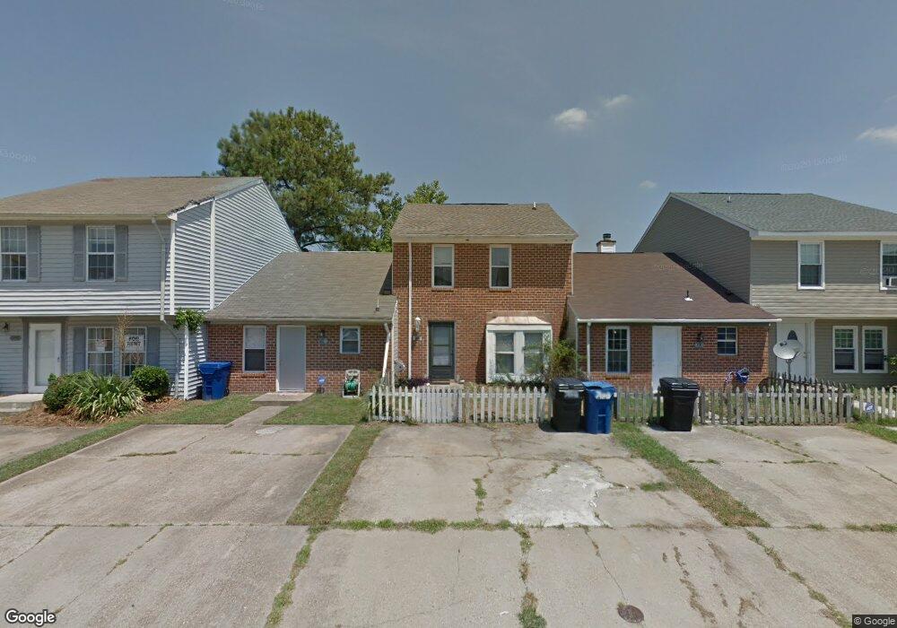
722 Wolftrap Ln Virginia Beach, VA 23462
Bayside NeighborhoodEstimated Value: $202,000 - $230,000
3
Beds
2
Baths
1,200
Sq Ft
$181/Sq Ft
Est. Value
About This Home
This home is located at 722 Wolftrap Ln, Virginia Beach, VA 23462 and is currently estimated at $217,449, approximately $181 per square foot. 722 Wolftrap Ln is a home located in Virginia Beach City with nearby schools including Bettie F. Williams Elementary, Newtown Elementary School, and Diamond Springs Elementary School.
Ownership History
Date
Name
Owned For
Owner Type
Purchase Details
Closed on
Nov 20, 2008
Sold by
Sec Of Veterans Affairs
Bought by
Ghameshlouy Kevin D
Current Estimated Value
Purchase Details
Closed on
Apr 30, 2008
Sold by
Jackson Shankrysta L
Bought by
Sec Of Veterans Affairs
Purchase Details
Closed on
Sep 28, 2005
Sold by
Riley Jacqualine J
Bought by
Millennium Properties
Create a Home Valuation Report for This Property
The Home Valuation Report is an in-depth analysis detailing your home's value as well as a comparison with similar homes in the area
Home Values in the Area
Average Home Value in this Area
Purchase History
| Date | Buyer | Sale Price | Title Company |
|---|---|---|---|
| Ghameshlouy Kevin D | $120,000 | -- | |
| Sec Of Veterans Affairs | $126,908 | -- | |
| Millennium Properties | $80,000 | -- |
Source: Public Records
Tax History Compared to Growth
Tax History
| Year | Tax Paid | Tax Assessment Tax Assessment Total Assessment is a certain percentage of the fair market value that is determined by local assessors to be the total taxable value of land and additions on the property. | Land | Improvement |
|---|---|---|---|---|
| 2025 | $1,788 | $198,200 | $90,000 | $108,200 |
| 2024 | $1,788 | $184,300 | $85,000 | $99,300 |
| 2023 | $1,596 | $161,200 | $60,000 | $101,200 |
| 2022 | $1,558 | $157,400 | $58,600 | $98,800 |
| 2021 | $1,364 | $137,800 | $48,000 | $89,800 |
| 2020 | $1,301 | $127,900 | $48,000 | $79,900 |
| 2019 | $1,247 | $112,900 | $43,000 | $69,900 |
| 2018 | $1,132 | $112,900 | $43,000 | $69,900 |
| 2017 | $1,013 | $101,000 | $35,000 | $66,000 |
| 2016 | $973 | $98,300 | $33,900 | $64,400 |
| 2015 | $1,494 | $96,000 | $33,200 | $62,800 |
| 2014 | $1,427 | $97,600 | $36,900 | $60,700 |
Source: Public Records
Map
Nearby Homes
- 5549 Lynbrook Landing
- 5555 Lynbrook Landing
- 5500 Taylors Walke Ln
- 813 Gas Light Ln
- 864 Gas Light Ln
- 1037 Gas Light Ln
- 708 Brock Ct
- 644 Lawrence Dr
- 703 Oak Hurst Ct
- 668 Revival Ln
- 661 Revival Ln
- 5606 Dodington Ct
- 5317 Brookstone Ln
- 716 Aylesbury Dr Unit X1705
- 900 Southmoor Dr Unit 103
- 900 Southmoor Dr Unit 105
- 900 Southmoor Dr Unit 205
- 1027 Backwoods Rd
- 661 Aubrey Dr
- 912 Southmoor Dr Unit 303
- 724 Wolftrap Ln
- 720 Wolftrap Ln
- 718 Wolftrap Ln
- 726 Wolftrap Ln
- 716 Wolftrap Ln
- 5552 Lynbrook Landing
- 714 Wolftrap Ln
- 5554 Lynbrook Landing
- 868 Newtown Rd
- 712 Wolftrap Ln
- 5556 Lynbrook Landing
- 5558 Lynbrook Landing
- 725 Wolftrap Ln
- 710 Wolftrap Ln
- 723 Wolftrap Ln
- 721 Wolftrap Ln
- 5560 Lynbrook Landing
- 719 Wolftrap Ln
- 717 Wolftrap Ln
- 5543 Lynbrook Landing