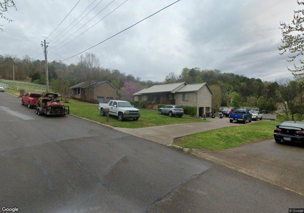
7220 Foxtrace Dr Unit s/d Fox Trace Rockford, TN 37853
Estimated Value: $342,000 - $403,000
3
Beds
3
Baths
1,456
Sq Ft
$250/Sq Ft
Est. Value
About This Home
This home is located at 7220 Foxtrace Dr Unit s/d Fox Trace, Rockford, TN 37853 and is currently estimated at $363,354, approximately $249 per square foot. 7220 Foxtrace Dr Unit s/d Fox Trace is a home located in Blount County with nearby schools including Rockford Elementary School, Eagleton College and Career Academy, and Clayton-Bradley Academy.
Ownership History
Date
Name
Owned For
Owner Type
Purchase Details
Closed on
Oct 16, 2020
Sold by
Moneypenny Kimberly I
Bought by
Moneypenny Curtis C
Current Estimated Value
Purchase Details
Closed on
Mar 30, 2007
Sold by
Kirby Carl J and Kirby Janet H
Bought by
Moneypenny Curtis C
Home Financials for this Owner
Home Financials are based on the most recent Mortgage that was taken out on this home.
Original Mortgage
$157,753
Interest Rate
6.15%
Purchase Details
Closed on
Jul 21, 2005
Bought by
Kirby Carl J and Kirby Janet H
Purchase Details
Closed on
Sep 25, 1991
Bought by
York Beryl
Purchase Details
Closed on
May 1, 1991
Bought by
Stooksbury Teddy K
Purchase Details
Closed on
Oct 18, 1985
Bought by
Fox Trace Dev
Create a Home Valuation Report for This Property
The Home Valuation Report is an in-depth analysis detailing your home's value as well as a comparison with similar homes in the area
Home Values in the Area
Average Home Value in this Area
Purchase History
| Date | Buyer | Sale Price | Title Company |
|---|---|---|---|
| Moneypenny Curtis C | -- | -- | |
| Moneypenny Curtis C | $159,000 | -- | |
| Kirby Carl J | $145,800 | -- | |
| York Beryl | $72,000 | -- | |
| Stooksbury Teddy K | $10,000 | -- | |
| Fox Trace Dev | -- | -- |
Source: Public Records
Mortgage History
| Date | Status | Borrower | Loan Amount |
|---|---|---|---|
| Previous Owner | Fox Trace Dev | $157,753 |
Source: Public Records
Tax History Compared to Growth
Tax History
| Year | Tax Paid | Tax Assessment Tax Assessment Total Assessment is a certain percentage of the fair market value that is determined by local assessors to be the total taxable value of land and additions on the property. | Land | Improvement |
|---|---|---|---|---|
| 2024 | $1,121 | $70,525 | $15,000 | $55,525 |
| 2023 | $1,121 | $70,525 | $15,000 | $55,525 |
| 2022 | $945 | $38,275 | $8,750 | $29,525 |
| 2021 | $945 | $38,275 | $8,750 | $29,525 |
| 2020 | $945 | $38,275 | $8,750 | $29,525 |
| 2019 | $945 | $38,275 | $8,750 | $29,525 |
| 2018 | $863 | $34,925 | $6,700 | $28,225 |
| 2017 | $863 | $34,925 | $6,700 | $28,225 |
| 2016 | $863 | $34,925 | $6,700 | $28,225 |
| 2015 | $751 | $34,925 | $6,700 | $28,225 |
| 2014 | $820 | $34,925 | $6,700 | $28,225 |
| 2013 | $820 | $38,150 | $0 | $0 |
Source: Public Records
Map
Nearby Homes
- 103 Rockford Heights Rd
- 4078 Glenmore Dr
- 322 Abrams St
- 316 Rockford Walker Ct
- 4089 Glenmore Dr
- 505 Cusick Rd
- Tract 2 Martin Mill (6 537 Acres) Pike
- 673 Self Hollow Rd
- 334 Roddy Branch Rd
- Tract 3 Martin Mill (12 Acres) Pike
- 654 Martin Mill Pike
- 807 Killion St
- 134 A T Crumley Rd
- 4719 Old Knoxville Hwy
- 4717 Old Knoxville Hwy
- 4220 Reed Rd
- 4505 Sing Ln
- 107 Farmer Rd
- 727 Sam Houston School Rd
- 1115 Law Rd
- 7220 Foxtrace Dr
- 7220 Foxtrace Dr Unit s/d Fox Trace in Roc
- 7224 Foxtrace Dr
- 7216 Foxtrace Dr
- 7226 Foxtrace Dr
- 7212 Foxtrace Dr
- 7221 Foxtrace Dr
- 7225 Foxtrace Dr
- 7208 Foxtrace Dr
- 6284 Sierra Cir
- 332 Gibson Rd Unit 335
- 7209 Foxtrace Dr
- 261 Self Hollow Rd
- 7204 Foxtrace Dr
- 253 Self Hollow Rd
- 5216 Aspen Ln
- 5220 Aspen Ln
- 5212 Aspen Ln
- 6280 Sierra Cir
- 6289 Sierra Cir
