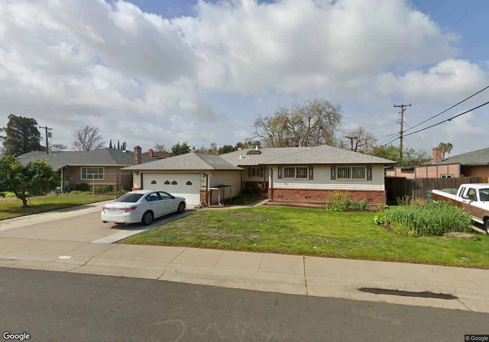
7220 Nomad Way Sacramento, CA 95828
Estimated Value: $291,000 - $429,000
4
Beds
2
Baths
1,442
Sq Ft
$265/Sq Ft
Est. Value
About This Home
This home is located at 7220 Nomad Way, Sacramento, CA 95828 and is currently estimated at $382,682, approximately $265 per square foot. 7220 Nomad Way is a home located in Sacramento County with nearby schools including David Reese Elementary School, James Rutter Middle School, and Florin High School.
Ownership History
Date
Name
Owned For
Owner Type
Purchase Details
Closed on
Jun 12, 2009
Sold by
Loewe Erwin G and Loewe Lydia
Bought by
Lee Fong and Su Lan
Current Estimated Value
Home Financials for this Owner
Home Financials are based on the most recent Mortgage that was taken out on this home.
Original Mortgage
$112,000
Outstanding Balance
$70,839
Interest Rate
4.79%
Mortgage Type
Purchase Money Mortgage
Estimated Equity
$311,843
Create a Home Valuation Report for This Property
The Home Valuation Report is an in-depth analysis detailing your home's value as well as a comparison with similar homes in the area
Home Values in the Area
Average Home Value in this Area
Purchase History
| Date | Buyer | Sale Price | Title Company |
|---|---|---|---|
| Lee Fong | $150,000 | Fidelity National Title Co |
Source: Public Records
Mortgage History
| Date | Status | Borrower | Loan Amount |
|---|---|---|---|
| Open | Lee Fong | $112,000 |
Source: Public Records
Tax History Compared to Growth
Tax History
| Year | Tax Paid | Tax Assessment Tax Assessment Total Assessment is a certain percentage of the fair market value that is determined by local assessors to be the total taxable value of land and additions on the property. | Land | Improvement |
|---|---|---|---|---|
| 2025 | $2,117 | $193,606 | $25,809 | $167,797 |
| 2024 | $2,117 | $189,810 | $25,303 | $164,507 |
| 2023 | $2,064 | $186,089 | $24,807 | $161,282 |
| 2022 | $2,029 | $182,441 | $24,321 | $158,120 |
| 2021 | $2,007 | $178,865 | $23,845 | $155,020 |
| 2020 | $1,981 | $177,032 | $23,601 | $153,431 |
| 2019 | $1,945 | $173,562 | $23,139 | $150,423 |
| 2018 | $1,878 | $170,160 | $22,686 | $147,474 |
| 2017 | $1,845 | $166,825 | $22,242 | $144,583 |
| 2016 | $1,783 | $163,555 | $21,806 | $141,749 |
| 2015 | $1,750 | $161,099 | $21,479 | $139,620 |
| 2014 | $1,722 | $157,945 | $21,059 | $136,886 |
Source: Public Records
Map
Nearby Homes
- 7548 Lindale Dr
- 6944 Mirador Way
- 7020 Sunnyslope Dr
- 6837 Southwood Way
- 7312 Del Prado Way
- 7631 Verna Mae Ave
- 6990 Chris Ave
- 7442 Della Cir
- 7825 Rockhurst Way
- 7413 Skander Way
- 6920 Farmington Way
- 6941 Wagon Wheel Way
- 6916 Farmington Way
- 6912 Richeve Way
- 7928 Rockhurst Way
- 7309 Power Inn Rd
- 7606 Tierra Arbor Way
- 6400 66th Ave Unit 21
- 6532 Harley Way
- 7551 Red Bud Ln
- 7230 Nomad Way
- 7210 Nomad Way
- 7231 Rimrock Dr
- 7235 Rimrock Dr
- 7200 Conrad Dr
- 7239 Rimrock Dr
- 7301 Nomad Way
- 7300 Conrad Dr
- 7240 Nomad Way
- 7243 Rimrock Dr
- 7250 Nomad Way
- 7310 Conrad Dr
- 7221 Conrad Dr
- 7211 Conrad Dr
- 7311 Nomad Way
- 7300 Nomad Way
- 7231 Conrad Dr
- 7247 Rimrock Dr
- 7201 Conrad Dr
- 6963 Mirador Way