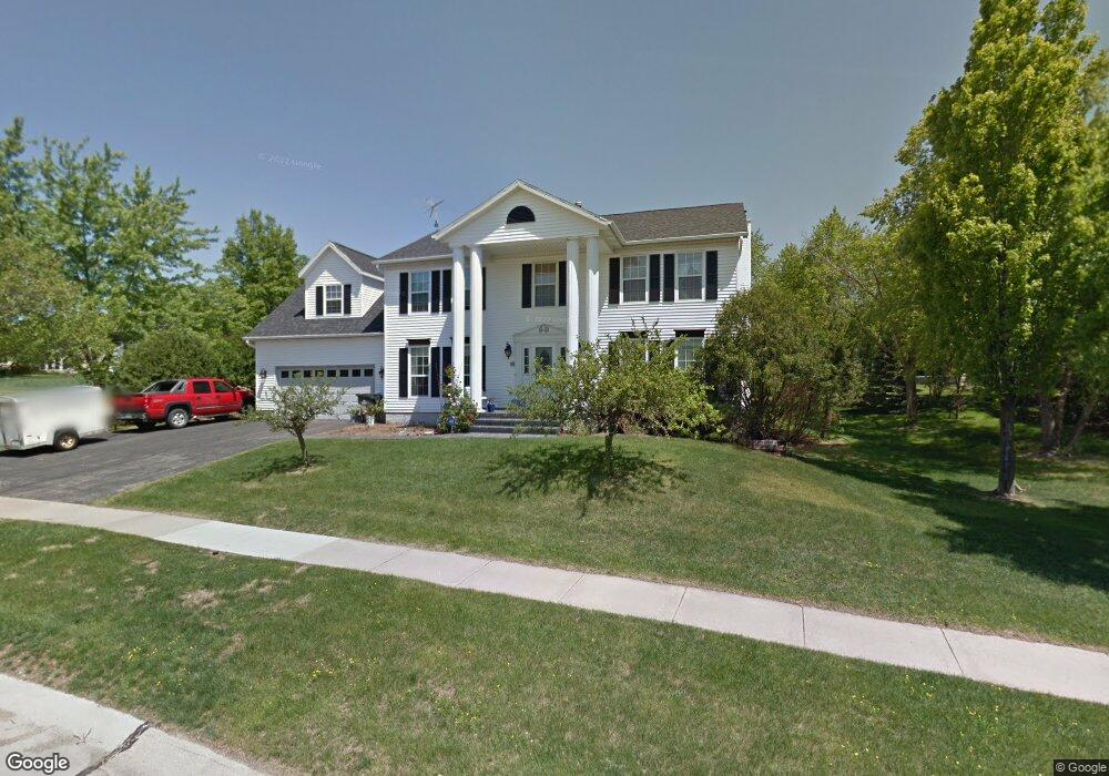
7222 Hampshire Dr NE Cedar Rapids, IA 52402
Estimated Value: $367,000 - $406,000
4
Beds
3
Baths
3,243
Sq Ft
$121/Sq Ft
Est. Value
About This Home
This home is located at 7222 Hampshire Dr NE, Cedar Rapids, IA 52402 and is currently estimated at $391,414, approximately $120 per square foot. 7222 Hampshire Dr NE is a home located in Linn County with nearby schools including Bowman Woods Elementary School, Oak Ridge School, and Linn-Mar High School.
Ownership History
Date
Name
Owned For
Owner Type
Purchase Details
Closed on
Oct 19, 2009
Sold by
Ottenbreit Jan J and Ottenbreit Esther J
Bought by
Kilburg William John and Kilburg Rebecca Ann
Current Estimated Value
Home Financials for this Owner
Home Financials are based on the most recent Mortgage that was taken out on this home.
Original Mortgage
$204,000
Outstanding Balance
$128,662
Interest Rate
4.5%
Mortgage Type
New Conventional
Estimated Equity
$262,752
Create a Home Valuation Report for This Property
The Home Valuation Report is an in-depth analysis detailing your home's value as well as a comparison with similar homes in the area
Home Values in the Area
Average Home Value in this Area
Purchase History
| Date | Buyer | Sale Price | Title Company |
|---|---|---|---|
| Kilburg William John | $254,500 | None Available |
Source: Public Records
Mortgage History
| Date | Status | Borrower | Loan Amount |
|---|---|---|---|
| Open | Kilburg William John | $204,000 |
Source: Public Records
Tax History Compared to Growth
Tax History
| Year | Tax Paid | Tax Assessment Tax Assessment Total Assessment is a certain percentage of the fair market value that is determined by local assessors to be the total taxable value of land and additions on the property. | Land | Improvement |
|---|---|---|---|---|
| 2025 | $6,858 | $368,400 | $71,300 | $297,100 |
| 2024 | $6,954 | $360,500 | $71,300 | $289,200 |
| 2023 | $6,954 | $360,500 | $71,300 | $289,200 |
| 2022 | $6,386 | $313,100 | $64,800 | $248,300 |
| 2021 | $6,398 | $297,400 | $60,500 | $236,900 |
| 2020 | $6,398 | $281,100 | $49,700 | $231,400 |
| 2019 | $6,016 | $267,500 | $49,700 | $217,800 |
| 2018 | $5,756 | $267,500 | $49,700 | $217,800 |
| 2017 | $5,753 | $264,400 | $49,700 | $214,700 |
| 2016 | $5,753 | $257,200 | $49,700 | $207,500 |
| 2015 | $5,821 | $259,977 | $30,256 | $229,721 |
| 2014 | $5,626 | $259,977 | $30,256 | $229,721 |
| 2013 | $5,436 | $259,977 | $30,256 | $229,721 |
Source: Public Records
Map
Nearby Homes
- 7320 Hampshire Dr NE
- 342 Cambridge Dr NE
- 3310 Timber Ridge Ct
- 316 Sussex Dr NE
- 6726 Bowman Ln NE
- 1000 Hampshire Cir
- 980 Hampshire Cir
- 960 Hampshire Cir
- 1151 Plumwood Ct NE
- 7415 Pin Tail Dr NE
- 948 Hampshire Cir
- 1150 Bedford Ct
- 916 Hampshire Cir
- 884 Hampshire Cir
- 932 Prescott Ln
- 862 Hampshire Cir
- 820 Hampshire Cir
- 819 Hampshire Cir
- 2140 Newcastle Rd
- 786 Hampshire Cir
- 7304 Normandy Dr NE
- 7305 Beckett Dr NE
- 7301 Beckett Dr NE
- 7312 Normandy Dr NE
- 7311 Beckett Dr NE
- 7226 Hampshire Dr NE
- 7221 Hampshire Dr NE
- 7217 Hampshire Dr NE
- 7225 Hampshire Dr NE
- 7321 Beckett Dr NE
- 7320 Normandy Dr NE
- 7213 Hampshire Dr NE
- 7235 Berkshire Dr NE
- 7230 Hampshire Dr NE
- 7229 Hampshire Dr NE
- 7329 Beckett Dr NE
- 7209 Hampshire Dr NE
- 7328 Normandy Dr NE
- 7405 Berkshire Dr NE
- 7204 Hampshire Dr NE