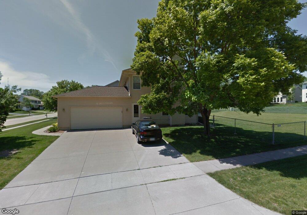
7226 Hampshire Dr NE Cedar Rapids, IA 52402
Estimated Value: $335,000 - $389,000
4
Beds
4
Baths
2,543
Sq Ft
$142/Sq Ft
Est. Value
About This Home
This home is located at 7226 Hampshire Dr NE, Cedar Rapids, IA 52402 and is currently estimated at $362,322, approximately $142 per square foot. 7226 Hampshire Dr NE is a home located in Linn County with nearby schools including Bowman Woods Elementary School, Oak Ridge School, and Linn-Mar High School.
Ownership History
Date
Name
Owned For
Owner Type
Purchase Details
Closed on
Mar 19, 1998
Sold by
Nash Finch Company
Bought by
Maurer William R and Maurer Carol M
Current Estimated Value
Home Financials for this Owner
Home Financials are based on the most recent Mortgage that was taken out on this home.
Original Mortgage
$157,410
Interest Rate
7.14%
Mortgage Type
Balloon
Create a Home Valuation Report for This Property
The Home Valuation Report is an in-depth analysis detailing your home's value as well as a comparison with similar homes in the area
Home Values in the Area
Average Home Value in this Area
Purchase History
| Date | Buyer | Sale Price | Title Company |
|---|---|---|---|
| Maurer William R | $174,500 | -- |
Source: Public Records
Mortgage History
| Date | Status | Borrower | Loan Amount |
|---|---|---|---|
| Closed | Maurer William R | $157,410 |
Source: Public Records
Tax History Compared to Growth
Tax History
| Year | Tax Paid | Tax Assessment Tax Assessment Total Assessment is a certain percentage of the fair market value that is determined by local assessors to be the total taxable value of land and additions on the property. | Land | Improvement |
|---|---|---|---|---|
| 2025 | $7,006 | $375,900 | $71,700 | $304,200 |
| 2024 | $6,622 | $368,000 | $71,700 | $296,300 |
| 2023 | $6,622 | $368,000 | $71,700 | $296,300 |
| 2022 | $6,080 | $298,600 | $65,200 | $233,400 |
| 2021 | $6,072 | $283,600 | $60,900 | $222,700 |
| 2020 | $6,072 | $267,200 | $50,000 | $217,200 |
| 2019 | $5,712 | $254,400 | $50,000 | $204,400 |
| 2018 | $5,464 | $254,400 | $50,000 | $204,400 |
| 2017 | $5,485 | $252,000 | $50,000 | $202,000 |
| 2016 | $5,485 | $245,200 | $50,000 | $195,200 |
| 2015 | $5,349 | $238,873 | $30,430 | $208,443 |
| 2014 | $5,154 | $238,873 | $30,430 | $208,443 |
| 2013 | $4,978 | $238,873 | $30,430 | $208,443 |
Source: Public Records
Map
Nearby Homes
- 7320 Hampshire Dr NE
- 342 Cambridge Dr NE
- 3310 Timber Ridge Ct
- 316 Sussex Dr NE
- 6726 Bowman Ln NE
- 7415 Pin Tail Dr NE
- 1000 Hampshire Cir
- 980 Hampshire Cir
- 1151 Plumwood Ct NE
- 960 Hampshire Cir
- 948 Hampshire Cir
- 1150 Bedford Ct
- 916 Hampshire Cir
- 884 Hampshire Cir
- 932 Prescott Ln
- 862 Hampshire Cir
- 7502 Summerset Ave NE
- 820 Hampshire Cir
- 819 Hampshire Cir
- 2140 Newcastle Rd
- 7230 Hampshire Dr NE
- 7235 Berkshire Dr NE
- 7234 Hampshire Dr NE
- 7405 Berkshire Dr NE
- 7304 Normandy Dr NE
- 7222 Hampshire Dr NE
- 7312 Normandy Dr NE
- 7409 Berkshire Dr NE
- 7225 Hampshire Dr NE
- 7229 Hampshire Dr NE
- 7238 Hampshire Dr NE
- 7221 Hampshire Dr NE
- 7233 Hampshire Dr NE
- 7320 Normandy Dr NE
- 7413 Berkshire Dr NE
- 7237 Hampshire Dr NE
- 7217 Hampshire Dr NE
- 7328 Normandy Dr NE
- 7305 Beckett Dr NE
- 7242 Hampshire Dr NE