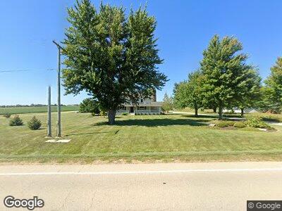
7226 N Mulford Rd Monroe Center, IL 61052
Monroe Center NeighborhoodEstimated Value: $265,000 - $428,890
--
Bed
--
Bath
1,872
Sq Ft
$187/Sq Ft
Est. Value
About This Home
This home is located at 7226 N Mulford Rd, Monroe Center, IL 61052 and is currently estimated at $349,723, approximately $186 per square foot. 7226 N Mulford Rd is a home with nearby schools including Highland Elementary School, Monroe Center Elementary School, and Meridian Junior High School.
Ownership History
Date
Name
Owned For
Owner Type
Purchase Details
Closed on
May 29, 2020
Sold by
Schock Theodore H and Schock Heidi J
Bought by
Schock Trust
Current Estimated Value
Purchase Details
Closed on
Jan 5, 2006
Sold by
Turner John I and Turner Heidi S
Bought by
Schock Theodore H and Schock Heidi J
Home Financials for this Owner
Home Financials are based on the most recent Mortgage that was taken out on this home.
Original Mortgage
$268,000
Interest Rate
6.34%
Mortgage Type
New Conventional
Create a Home Valuation Report for This Property
The Home Valuation Report is an in-depth analysis detailing your home's value as well as a comparison with similar homes in the area
Home Values in the Area
Average Home Value in this Area
Purchase History
| Date | Buyer | Sale Price | Title Company |
|---|---|---|---|
| Schock Trust | -- | None Available | |
| Schock Theodore H | $332,000 | None Available |
Source: Public Records
Mortgage History
| Date | Status | Borrower | Loan Amount |
|---|---|---|---|
| Previous Owner | Schock Theodore H | $244,000 | |
| Previous Owner | Schock Theodore H | $256,000 | |
| Previous Owner | Schock Theodore H | $262,000 | |
| Previous Owner | Turner John I | $415,564 | |
| Previous Owner | Schock Theodore H | $59,141 | |
| Previous Owner | Schock Theodore H | $268,000 | |
| Previous Owner | Turner John I | $120,000 | |
| Previous Owner | Turner John I | $450,000 |
Source: Public Records
Tax History Compared to Growth
Tax History
| Year | Tax Paid | Tax Assessment Tax Assessment Total Assessment is a certain percentage of the fair market value that is determined by local assessors to be the total taxable value of land and additions on the property. | Land | Improvement |
|---|---|---|---|---|
| 2024 | $9,822 | $133,964 | $17,005 | $116,959 |
| 2023 | $9,822 | $124,954 | $15,861 | $109,093 |
| 2022 | $8,867 | $114,333 | $14,513 | $99,820 |
| 2021 | $7,741 | $99,123 | $6,267 | $92,856 |
| 2020 | $7,499 | $95,541 | $5,978 | $89,563 |
| 2019 | $7,256 | $91,918 | $5,684 | $86,234 |
| 2018 | $7,209 | $89,294 | $5,467 | $83,827 |
| 2017 | $7,091 | $86,759 | $5,258 | $81,501 |
| 2016 | $7,012 | $85,438 | $5,239 | $80,199 |
| 2015 | $6,846 | $84,003 | $5,223 | $78,780 |
| 2014 | $6,379 | $83,992 | $5,212 | $78,780 |
| 2013 | $6,530 | $85,350 | $5,197 | $80,153 |
Source: Public Records
Map
Nearby Homes
- 000 E Mcneal Rd
- 406 Pacific St
- 8465 S Mulford Rd
- 15333 E Mcneal Rd
- 15894 E Il Route 72
- 3637 Baxter Rd
- Lot 5 Route 72 Hwy
- Lot 13 Route 72 Hwy
- 0 West St
- 4844 Cave Dr
- 124 Primrose Ln
- 6529 42nd St
- 115 Jasmine Ave
- 113 Jonquil Dr
- 1607 Wheeler Rd
- 518 Murray Dr
- 104 Dayflower Cir
- 509 Menard Dr
- 6236 Cotswold Ln
- 209 Mercer Dr
- 7226 N Mulford Rd
- 7821 N Mulford Rd
- 17972 E Crill Rd
- 18026 E Crill Rd
- 6636 N Mulford Rd
- 18136 E Crill Rd
- 6602 N Mulford Rd
- 17368 E Crill Rd
- 6502 N Mulford Rd
- 18427 E Mcneal Rd
- 18352 E Crill Rd
- 18352 E Crill Rd
- 17243 E Crill Rd
- 18508 E Crill Rd
- 7383 N Limestone Rd
- 18225 E Crill Rd
- 7410 N Limestone Rd
- 7002 N Limestone Rd