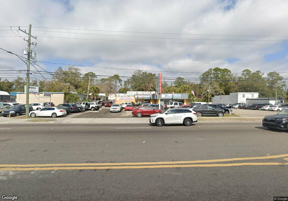
7227 Atlantic Blvd Jacksonville, FL 32211
Woodland Acres NeighborhoodEstimated Value: $532,909
--
Bed
6
Baths
500
Sq Ft
$1,066/Sq Ft
Est. Value
About This Home
This home is located at 7227 Atlantic Blvd, Jacksonville, FL 32211 and is currently estimated at $532,909, approximately $1,065 per square foot. 7227 Atlantic Blvd is a home located in Duval County with nearby schools including Woodland Acres Elementary School, Arlington Middle School, and Terry Parker High School.
Ownership History
Date
Name
Owned For
Owner Type
Purchase Details
Closed on
Apr 7, 2005
Sold by
Maszy Riley and Maszy Sharon
Bought by
Johnson David G and Johnson Derek M
Current Estimated Value
Home Financials for this Owner
Home Financials are based on the most recent Mortgage that was taken out on this home.
Original Mortgage
$208,000
Outstanding Balance
$108,033
Interest Rate
5.88%
Mortgage Type
Commercial
Estimated Equity
$424,876
Create a Home Valuation Report for This Property
The Home Valuation Report is an in-depth analysis detailing your home's value as well as a comparison with similar homes in the area
Home Values in the Area
Average Home Value in this Area
Purchase History
| Date | Buyer | Sale Price | Title Company |
|---|---|---|---|
| Johnson David G | $265,000 | All Florida Title Svcs Inc |
Source: Public Records
Mortgage History
| Date | Status | Borrower | Loan Amount |
|---|---|---|---|
| Open | Johnson David G | $208,000 |
Source: Public Records
Tax History Compared to Growth
Tax History
| Year | Tax Paid | Tax Assessment Tax Assessment Total Assessment is a certain percentage of the fair market value that is determined by local assessors to be the total taxable value of land and additions on the property. | Land | Improvement |
|---|---|---|---|---|
| 2025 | $5,769 | $305,180 | -- | -- |
| 2024 | $5,297 | $359,218 | $220,000 | $139,218 |
| 2023 | $5,297 | $326,012 | $200,000 | $126,012 |
| 2022 | $4,199 | $229,288 | $120,000 | $109,288 |
| 2021 | $4,069 | $215,722 | $120,000 | $95,722 |
| 2020 | $4,093 | $211,878 | $120,000 | $91,878 |
| 2019 | $4,142 | $211,544 | $120,000 | $91,544 |
| 2018 | $4,131 | $209,125 | $120,000 | $89,125 |
| 2017 | $4,147 | $207,584 | $120,000 | $87,584 |
| 2016 | $4,184 | $205,861 | $0 | $0 |
| 2015 | $4,272 | $206,913 | $0 | $0 |
| 2014 | $4,287 | $205,520 | $0 | $0 |
Source: Public Records
Map
Nearby Homes
- 7115 Berry Ave
- 28 Agnue Ave
- 487 Nitram St
- 246 News St
- 7140 Tynan Ave
- 232 Aralia Ln
- 245 Aralia Ln
- 0 Pecan St Unit A4529208
- 7709 Eaton Ave
- 0 Crane Ave
- 288 Aralia Ln
- 443 Holiday Hill Cir W
- 7716 Galveston Ave
- 422 Tabor Dr W
- 421 Arlington Rd N
- 7042 Mills Ave
- 6750 Oakwood Dr
- 8725 Alton Ave
- 7817 Aquarius Cir S
- 7913 Hare Ave
- 7217 Atlantic Blvd
- 7209 Atlantic Blvd
- 7226 Atlantic Blvd Unit A
- 7226 Atlantic Blvd
- 7226 Atlantic Blvd Unit B
- 59 Nitram St
- 60 Nitram Ave
- 7305 Atlantic Blvd
- 7308 Atlantic Blvd
- 7147 Alton Ave
- 7145 Alton Ave
- 7125 Atlantic Blvd
- 26 Beckwith St
- 7232 Berry Ave
- 7141 Alton Ave
- 7139 Alton Ave
- 7120 Alton Ave
- 29 Hay Ave
- 7136 Atlantic Blvd
- 30 Hay Ave
