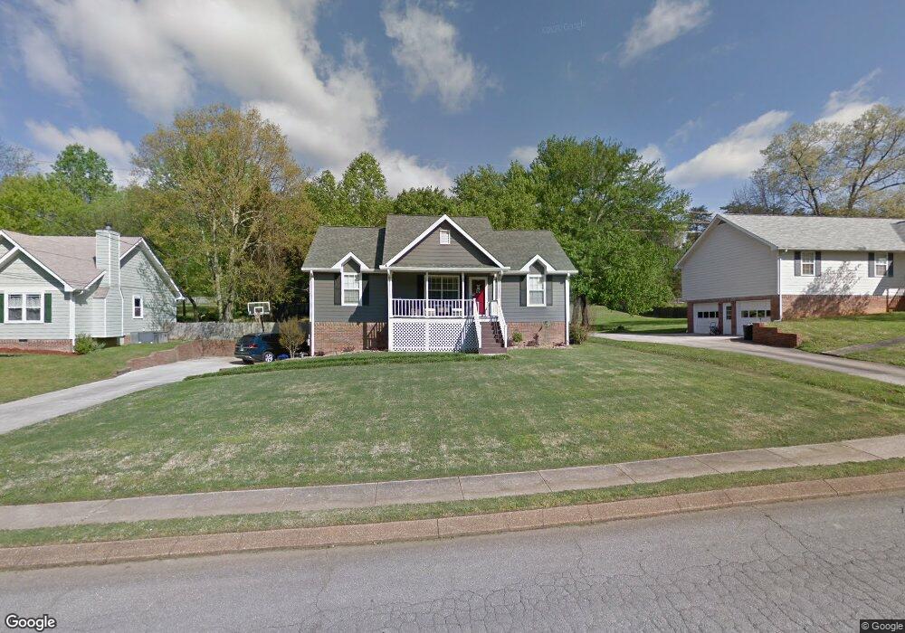
723 Ashbrook Dr Unit 47 Hixson, TN 37343
Estimated Value: $335,351 - $389,000
Studio
2
Baths
1,288
Sq Ft
$276/Sq Ft
Est. Value
About This Home
This home is located at 723 Ashbrook Dr Unit 47, Hixson, TN 37343 and is currently estimated at $355,588, approximately $276 per square foot. 723 Ashbrook Dr Unit 47 is a home located in Hamilton County with nearby schools including Ivy Academy Inc and New South Daisy Christian Academy.
Ownership History
Date
Name
Owned For
Owner Type
Purchase Details
Closed on
May 28, 2008
Sold by
Church Cristal M and Church Bradley David
Bought by
Williams Amy L and Williams Stan C
Current Estimated Value
Home Financials for this Owner
Home Financials are based on the most recent Mortgage that was taken out on this home.
Original Mortgage
$163,098
Outstanding Balance
$102,554
Interest Rate
6%
Mortgage Type
Unknown
Estimated Equity
$253,034
Purchase Details
Closed on
Mar 31, 2003
Sold by
Jordan Mark A and Jordan Teresa M
Bought by
Mcmillan Cristal A
Home Financials for this Owner
Home Financials are based on the most recent Mortgage that was taken out on this home.
Original Mortgage
$127,940
Interest Rate
5.82%
Mortgage Type
FHA
Create a Home Valuation Report for This Property
The Home Valuation Report is an in-depth analysis detailing your home's value as well as a comparison with similar homes in the area
Home Values in the Area
Average Home Value in this Area
Purchase History
| Date | Buyer | Sale Price | Title Company |
|---|---|---|---|
| Williams Amy L | $159,900 | Battlefield Title Agency Inc | |
| Mcmillan Cristal A | $129,000 | Northgate Title Escrow Inc |
Source: Public Records
Mortgage History
| Date | Status | Borrower | Loan Amount |
|---|---|---|---|
| Open | Williams Amy L | $163,098 | |
| Previous Owner | Mcmillan Cristal A | $127,940 |
Source: Public Records
Tax History
| Year | Tax Paid | Tax Assessment Tax Assessment Total Assessment is a certain percentage of the fair market value that is determined by local assessors to be the total taxable value of land and additions on the property. | Land | Improvement |
|---|---|---|---|---|
| 2025 | $1,196 | $78,925 | $0 | $0 |
| 2024 | $1,125 | $50,275 | $0 | $0 |
| 2023 | $1,695 | $50,275 | $0 | $0 |
| 2022 | $1,695 | $50,275 | $0 | $0 |
| 2021 | $1,695 | $50,275 | $0 | $0 |
| 2020 | $1,681 | $40,600 | $0 | $0 |
| 2019 | $1,681 | $40,600 | $0 | $0 |
| 2018 | $1,681 | $40,600 | $0 | $0 |
| 2017 | $1,681 | $40,600 | $0 | $0 |
| 2016 | $1,515 | $0 | $0 | $0 |
| 2015 | $1,515 | $36,575 | $0 | $0 |
| 2014 | $1,515 | $0 | $0 | $0 |
Source: Public Records
Map
Nearby Homes
- 8805 Shady Wood Ln
- 802 Northbrook Dr
- 419 Benton Ln
- 8927 Wings Way
- 8815 Gann Rd
- 8819 Gann Rd
- 8813 Gann Rd
- 8821 Gann Rd
- 914 Hickory Ave
- 8834 Gann Rd
- 9061 Daisy Dallas Rd
- 8434 W Crabtree Rd
- 8509 Fair Oaks Rd
- 8610 Daisy Dallas Rd
- 405 Classic Dr
- 9034 Wood Dale Ln
- 396 Olivia Ln
- 400 Olivia Ln
- 8725 Walnut Rd
- 9443 Williams St
- 723 Ashbrook Dr
- 719 Ashbrook Dr
- 801 Ashbrook Dr
- 0 Ashbrook Dr
- 803 Ashbrook Dr
- 724 Ashbrook Dr
- 717 Ashbrook Dr
- 717 Ashbrook Dr Unit 49
- 802 Ashbrook Dr
- 807 Ashbrook Dr
- 720 Ashbrook Dr
- 804 Ashbrook Dr
- 713 Ashbrook Dr
- 8904 Brookhill Dr
- 716 Ashbrook Dr
- 808 Ashbrook Dr
- 8934 Brookhill Dr
- 809 Ashbrook Dr
- 711 Ashbrook Dr
- 8932 Brookhill Dr
Your Personal Tour Guide
Ask me questions while you tour the home.