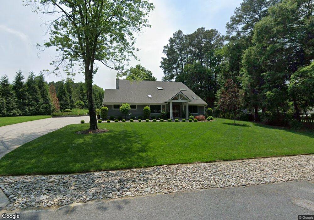
723 Burning Tree Cir Salisbury, MD 21801
South Salisbury NeighborhoodEstimated Value: $251,876 - $428,000
Studio
3
Baths
1,232
Sq Ft
$266/Sq Ft
Est. Value
About This Home
This home is located at 723 Burning Tree Cir, Salisbury, MD 21801 and is currently estimated at $328,219, approximately $266 per square foot. 723 Burning Tree Cir is a home located in Wicomico County with nearby schools including Fruitland Primary School, Fruitland Intermediate School, and Bennett Middle School.
Ownership History
Date
Name
Owned For
Owner Type
Purchase Details
Closed on
Jun 26, 1991
Sold by
Phillips Phillips J and Phillips Phyllis G
Bought by
Morgan Ronald E and Morgan Janet L
Current Estimated Value
Home Financials for this Owner
Home Financials are based on the most recent Mortgage that was taken out on this home.
Original Mortgage
$103,000
Interest Rate
9.65%
Purchase Details
Closed on
Jun 18, 1991
Sold by
Hiter Thomas Y and Hiter Mildred E
Bought by
Phillips Phillips J and Phillips Phyllis G
Home Financials for this Owner
Home Financials are based on the most recent Mortgage that was taken out on this home.
Original Mortgage
$103,000
Interest Rate
9.65%
Purchase Details
Closed on
Apr 12, 1988
Sold by
Martinez Miquel A and Martinez Elgene L
Bought by
Hiter Thomas Y and Hiter Mildred E
Home Financials for this Owner
Home Financials are based on the most recent Mortgage that was taken out on this home.
Original Mortgage
$40,000
Interest Rate
10.19%
Create a Home Valuation Report for This Property
The Home Valuation Report is an in-depth analysis detailing your home's value as well as a comparison with similar homes in the area
Home Values in the Area
Average Home Value in this Area
Purchase History
| Date | Buyer | Sale Price | Title Company |
|---|---|---|---|
| Morgan Ronald E | $105,000 | -- | |
| Phillips Phillips J | $80,000 | -- | |
| Hiter Thomas Y | $43,000 | -- |
Source: Public Records
Mortgage History
| Date | Status | Borrower | Loan Amount |
|---|---|---|---|
| Closed | Morgan Ronald E | $103,000 | |
| Previous Owner | Hiter Thomas Y | $40,000 |
Source: Public Records
Tax History
| Year | Tax Paid | Tax Assessment Tax Assessment Total Assessment is a certain percentage of the fair market value that is determined by local assessors to be the total taxable value of land and additions on the property. | Land | Improvement |
|---|---|---|---|---|
| 2025 | $1,669 | $182,700 | $0 | $0 |
| 2024 | $1,639 | $170,900 | $38,200 | $132,700 |
| 2023 | $1,643 | $164,733 | $0 | $0 |
| 2022 | $1,616 | $158,567 | $0 | $0 |
| 2021 | $1,565 | $152,400 | $38,200 | $114,200 |
| 2020 | $1,565 | $151,700 | $0 | $0 |
| 2019 | $1,580 | $151,000 | $0 | $0 |
| 2018 | $1,581 | $150,300 | $38,200 | $112,100 |
| 2017 | $1,581 | $150,300 | $0 | $0 |
| 2016 | $1,777 | $150,300 | $0 | $0 |
| 2015 | $1,777 | $185,800 | $0 | $0 |
| 2014 | $1,777 | $185,800 | $0 | $0 |
Source: Public Records
Map
Nearby Homes
- Lot 12 Holly Hill Ct
- 124 Holly Hill Ct
- 709 Grason Ln
- 820, 824 & 828 Shad Point Rd
- 5464 Cherry Hill Ln
- 28272 Riverside Dr
- 512 Sheldon Ave
- 518 Clyde Ave
- 507 W Main St
- 502 Indian Ln
- 113 Tall Timber Ln
- 625 Pine Bluff Rd
- 404 Sheldon Ave
- 104 Walden Dr
- 501 Tony Tank Ln
- 1704 Camden Ave
- 108 S Camden Ave
- 1124 Riverside Dr
- 409 Rolling Rd
- 1105 Riverside Dr
- 104 Holly Hill Ct
- 106 Holly Hill Ct
- 727 Burning Tree Cir
- 817 W Main St
- 108 Holly Hill Ct
- 716 Burning Tree Cir
- 0 Holly Hill Ct Unit 17 MDWC2011782
- 0 Holly Hill Ct Unit 16 MDWC2011780
- 0 Holly Hill Ct Unit 15 MDWC2011772
- Lot 14 Holly Hill Ct
- Lot 13 Holly Hill Ct
- Lot 11 Holly Hill Ct
- Lot 10 Holly Hill Ct
- Lot 9 Holly Hill Ct
- 0 Holly Hill Ct Unit 17 MDWC2001974
- 0 Holly Hill Ct Unit 16 MDWC2001972
- 0 Holly Hill Ct Unit 15 MDWC2001970
- 0 Holly Hill Ct
- 721 Burning Tree Cir
- 815 W Main St
Your Personal Tour Guide
Ask me questions while you tour the home.