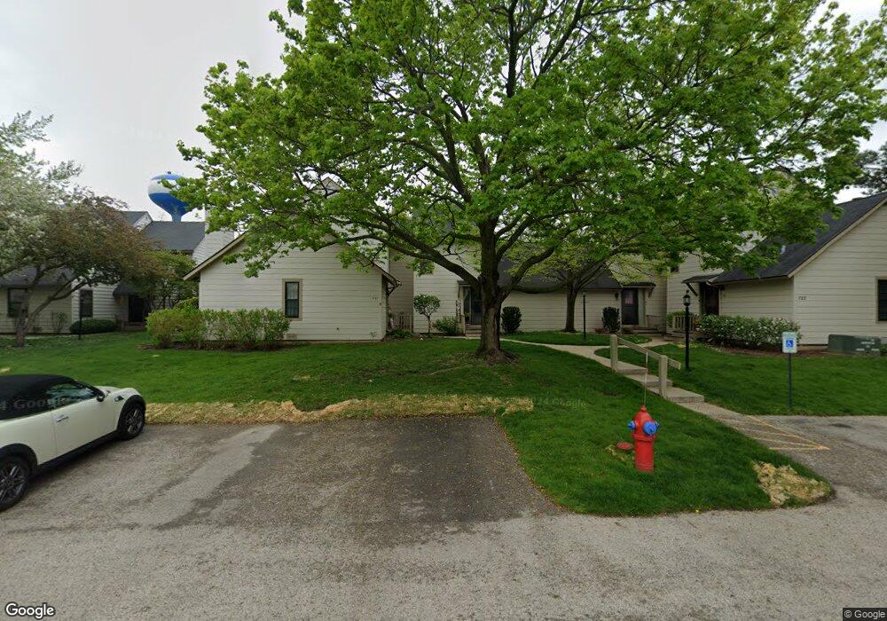
723 Colby Ct Unit U59 Gurnee, IL 60031
Estimated Value: $209,000 - $223,000
2
Beds
2
Baths
1,162
Sq Ft
$185/Sq Ft
Est. Value
About This Home
This home is located at 723 Colby Ct Unit U59, Gurnee, IL 60031 and is currently estimated at $215,199, approximately $185 per square foot. 723 Colby Ct Unit U59 is a home located in Lake County with nearby schools including Woodland Primary School, Woodland Elementary School, and Woodland Intermediate School.
Ownership History
Date
Name
Owned For
Owner Type
Purchase Details
Closed on
May 10, 2001
Sold by
Mckee Lisa A
Bought by
Mckee Ann Marie
Current Estimated Value
Home Financials for this Owner
Home Financials are based on the most recent Mortgage that was taken out on this home.
Original Mortgage
$84,800
Outstanding Balance
$31,922
Interest Rate
7.14%
Estimated Equity
$183,277
Purchase Details
Closed on
Apr 29, 1994
Sold by
Oneill Joseph and Oneill Kathleen A
Bought by
Mckee Ann Marie and Mckee Lisa A
Home Financials for this Owner
Home Financials are based on the most recent Mortgage that was taken out on this home.
Original Mortgage
$72,900
Interest Rate
7.88%
Create a Home Valuation Report for This Property
The Home Valuation Report is an in-depth analysis detailing your home's value as well as a comparison with similar homes in the area
Home Values in the Area
Average Home Value in this Area
Purchase History
| Date | Buyer | Sale Price | Title Company |
|---|---|---|---|
| Mckee Ann Marie | -- | Stewart Title Company | |
| Mckee Ann Marie | $81,000 | -- |
Source: Public Records
Mortgage History
| Date | Status | Borrower | Loan Amount |
|---|---|---|---|
| Open | Mckee Ann Marie | $84,800 | |
| Closed | Mckee Ann Marie | $72,900 |
Source: Public Records
Tax History Compared to Growth
Tax History
| Year | Tax Paid | Tax Assessment Tax Assessment Total Assessment is a certain percentage of the fair market value that is determined by local assessors to be the total taxable value of land and additions on the property. | Land | Improvement |
|---|---|---|---|---|
| 2024 | $3,627 | $56,983 | $8,185 | $48,798 |
| 2023 | $2,050 | $52,904 | $7,599 | $45,305 |
| 2022 | $2,050 | $44,333 | $5,929 | $38,404 |
| 2021 | $1,934 | $40,146 | $5,369 | $34,777 |
| 2020 | $1,922 | $39,159 | $5,237 | $33,922 |
| 2019 | $1,899 | $38,022 | $5,085 | $32,937 |
| 2018 | $1,932 | $32,973 | $2,676 | $30,297 |
| 2017 | $1,941 | $32,028 | $2,599 | $29,429 |
| 2016 | $1,884 | $30,602 | $2,483 | $28,119 |
| 2015 | $1,785 | $29,023 | $2,355 | $26,668 |
| 2014 | $1,631 | $27,502 | $2,323 | $25,179 |
| 2012 | $2,718 | $27,713 | $2,341 | $25,372 |
Source: Public Records
Map
Nearby Homes
- 651 White Ct
- 690 Chandler Rd Unit 302
- 690 Chandler Rd Unit 207
- 740 Chandler Rd Unit U85
- 650 Whitney Ct Unit 203
- 650 Whitney Ct Unit 108
- 761 Creekside Cir Unit 93
- 920 Vose Dr Unit 202
- 920 Vose Dr Unit 106
- 920 Vose Dr Unit 208
- 6296 Doral Dr
- 706 Owl Creek Ln
- 6183 Old Farm Ln Unit 3
- 6091 Washington St
- 17150 Washington St
- 4837 Middle Rd
- 34026 N White Oak Ln Unit 48C
- 34110 N White Oak Ln Unit 37B
- 17298 W Maple Ln
- 17613 W Meadowbrook Dr
- 721 Colby Ct Unit U60
- 725 Colby Ct Unit U58
- 727 Colby Ct Unit U57
- 719 Colby Ct
- 719 Colby Ct Unit 65
- 720 Drury Ct Unit U56
- 717 Colby Ct Unit U66
- 724 Drury Ct
- 722 Drury Ct Unit U55
- 729 Colby Ct
- 731 Colby Ct Unit U47
- 715 Colby Ct Unit U67
- 728 Drury Ct
- 732 Drury Ct Unit U50
- 733 Colby Ct
- 711 Colby Ct Unit 69
- 713 Colby Ct Unit U68
- 713 Colby Ct Unit 713
- 709 Colby Ct
- 735 Colby Ct Unit U45