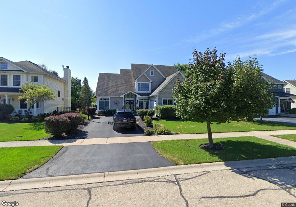
723 Independence Ave Elburn, IL 60119
Estimated Value: $466,530 - $534,000
4
Beds
3
Baths
2,322
Sq Ft
$215/Sq Ft
Est. Value
About This Home
This home is located at 723 Independence Ave, Elburn, IL 60119 and is currently estimated at $499,883, approximately $215 per square foot. 723 Independence Ave is a home located in Kane County with nearby schools including Kaneland Blackberry Creek Elementary School, Harter Middle School, and Kaneland High School.
Ownership History
Date
Name
Owned For
Owner Type
Purchase Details
Closed on
Jul 22, 2004
Sold by
Old Towne Custom Builders Inc
Bought by
West Kevin John and West Dorothy
Current Estimated Value
Home Financials for this Owner
Home Financials are based on the most recent Mortgage that was taken out on this home.
Original Mortgage
$281,000
Outstanding Balance
$133,719
Interest Rate
5.5%
Mortgage Type
Purchase Money Mortgage
Estimated Equity
$366,164
Create a Home Valuation Report for This Property
The Home Valuation Report is an in-depth analysis detailing your home's value as well as a comparison with similar homes in the area
Home Values in the Area
Average Home Value in this Area
Purchase History
| Date | Buyer | Sale Price | Title Company |
|---|---|---|---|
| West Kevin John | $352,000 | Chicago Title Insurance Comp |
Source: Public Records
Mortgage History
| Date | Status | Borrower | Loan Amount |
|---|---|---|---|
| Open | West Kevin John | $281,000 |
Source: Public Records
Tax History
| Year | Tax Paid | Tax Assessment Tax Assessment Total Assessment is a certain percentage of the fair market value that is determined by local assessors to be the total taxable value of land and additions on the property. | Land | Improvement |
|---|---|---|---|---|
| 2024 | $9,973 | $124,181 | $17,164 | $107,017 |
| 2023 | $9,602 | $112,077 | $15,491 | $96,586 |
| 2022 | $10,164 | $112,861 | $14,217 | $98,644 |
| 2021 | $9,793 | $108,021 | $13,607 | $94,414 |
| 2020 | $9,614 | $105,489 | $13,288 | $92,201 |
| 2019 | $9,619 | $103,940 | $13,093 | $90,847 |
| 2018 | $9,514 | $100,990 | $13,093 | $87,897 |
| 2017 | $9,516 | $99,842 | $12,944 | $86,898 |
| 2016 | $10,137 | $103,204 | $12,602 | $90,602 |
| 2015 | -- | $94,583 | $8,711 | $85,872 |
| 2014 | -- | $90,335 | $11,167 | $79,168 |
| 2013 | -- | $90,335 | $11,167 | $79,168 |
Source: Public Records
Map
Nearby Homes
- 765 Carolyn Ct
- 801 Citizen Ave
- 801 Carolyn Ct
- 1171 Souders Ave
- 1038 Veteran Ave
- 1074 Freedom Rd
- 1383 Dodson Ave
- 1076 Freedom Rd
- 1053 Sears Cir
- 1164 Freedom Rd
- 713 Elizabeth St
- 607 Virginia St
- 671 Virginia St
- 645 Virginia St
- LOT 7 Rowe Rd
- Lot 9 Rowe Rd
- 816 Simpson Ave
- 000 Illinois 47
- 803 Station Blvd
- 16 Derek Dr
- 701 Independence Ave
- 737 Independence Ave
- 685 Independence Ave
- 759 Independence Ave
- 1498 Seaton St
- 771 Independence Ave
- 673 Independence Ave
- 1505 Seaton St
- 692 Independence Ave
- 1486 Seaton St
- 661 Independence Ave
- 776 Independence Ave Unit 2
- 680 Avon Ct Unit 2
- 1464 Seaton St Unit 5
- 657 Independence (Bc461) Ave
- 1477 Seaton St
- 1502 Anderson Rd
- 657 Independence Ave
- 647 Independence Ave
- 1452 Seaton St Unit 5
Your Personal Tour Guide
Ask me questions while you tour the home.