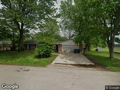
723 Po Box Tipton, MO 65081
Estimated Value: $189,000 - $274,000
--
Bed
--
Bath
2,819
Sq Ft
$82/Sq Ft
Est. Value
About This Home
This home is located at 723 Po Box, Tipton, MO 65081 and is currently estimated at $230,440, approximately $81 per square foot. 723 Po Box is a home located in Moniteau County with nearby schools including Tipton Elementary School, Tipton High School, and St. Andrew School.
Ownership History
Date
Name
Owned For
Owner Type
Purchase Details
Closed on
Sep 15, 2021
Sold by
Jack And Judy Allee Trust
Bought by
Defiance Realty Llc
Current Estimated Value
Purchase Details
Closed on
Aug 16, 2021
Sold by
Allee John B and Allee Ellen L
Bought by
John And Ellen Allee Trust
Purchase Details
Closed on
May 9, 2012
Sold by
Allee John B and Allee Ellen L
Bought by
Allee Tori L and Allee Madeline L
Purchase Details
Closed on
Sep 20, 2005
Sold by
Stieferman Jennifer and Stieferman Aaron
Bought by
Hsbc Bank Usa and Marine Midland Bank
Create a Home Valuation Report for This Property
The Home Valuation Report is an in-depth analysis detailing your home's value as well as a comparison with similar homes in the area
Home Values in the Area
Average Home Value in this Area
Purchase History
| Date | Buyer | Sale Price | Title Company |
|---|---|---|---|
| Defiance Realty Llc | -- | None Listed On Document | |
| John And Ellen Allee Trust | -- | None Available | |
| Hsbc Bank Usa | $70,000 | None Available |
Source: Public Records
Mortgage History
| Date | Status | Borrower | Loan Amount |
|---|---|---|---|
| Open | Rlga Properties Llc | $180,000 | |
| Closed | Ratcliff Bryan | $247,500 | |
| Previous Owner | Allee John B | $60,000 | |
| Previous Owner | Allee John B | $85,000 | |
| Previous Owner | Allee John B | $50,000 |
Source: Public Records
Tax History Compared to Growth
Tax History
| Year | Tax Paid | Tax Assessment Tax Assessment Total Assessment is a certain percentage of the fair market value that is determined by local assessors to be the total taxable value of land and additions on the property. | Land | Improvement |
|---|---|---|---|---|
| 2024 | $1,683 | $29,280 | $0 | $0 |
| 2023 | $1,676 | $29,280 | $0 | $0 |
| 2022 | $1,679 | $29,280 | $0 | $0 |
| 2021 | $1,679 | $29,280 | $0 | $0 |
| 2020 | $1,612 | $28,040 | $0 | $0 |
| 2019 | $1,639 | $28,650 | $0 | $0 |
| 2018 | $1,638 | $28,650 | $0 | $0 |
| 2017 | $1,557 | $24,050 | $1,420 | $22,630 |
| 2016 | $1,601 | $28,650 | $0 | $0 |
| 2011 | -- | $28,650 | $0 | $0 |
Source: Public Records
Map
Nearby Homes
- TBD Wade Blvd
- 524 U S 50
- 102 Hainen Dr
- TBD Rose Ave
- 502 S Ferguson Ave
- 245 Randolph St
- 559 U S 50
- 330 State St
- 210 W Morgan St
- 69985 U S 50
- 107 AC Knipp Rd
- 308 E State St
- Lot 5 Highway Dd
- TBD Battle Ln
- 832 Wildlife Dr
- 19606 Tuttle Rd
- 171 School St
- 13057 Fork Creek Rd
- 30133 Dan Rd
- 3278 Potters Ford Dr