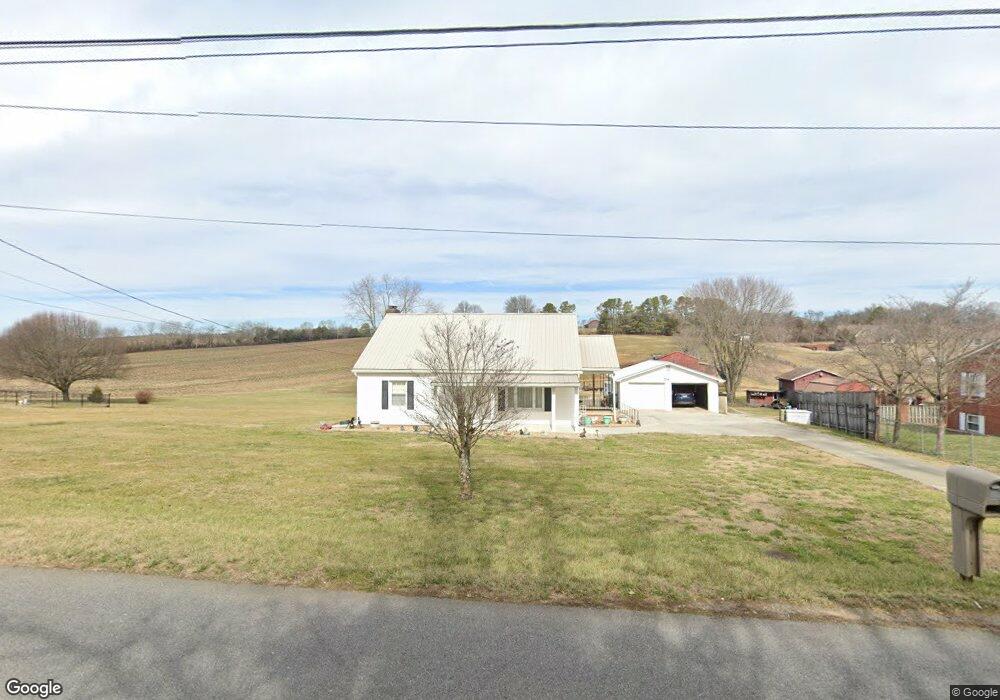
724 E Old Andrew Johnson Hwy Jefferson City, TN 37760
Estimated Value: $163,000 - $286,000
--
Bed
2
Baths
1,258
Sq Ft
$184/Sq Ft
Est. Value
About This Home
This home is located at 724 E Old Andrew Johnson Hwy, Jefferson City, TN 37760 and is currently estimated at $231,366, approximately $183 per square foot. 724 E Old Andrew Johnson Hwy is a home located in Jefferson County with nearby schools including Heritage Christian Academy.
Ownership History
Date
Name
Owned For
Owner Type
Purchase Details
Closed on
Jul 28, 2023
Sold by
Forrester Don E and Forrester Kelly E
Bought by
Stump Shirley
Current Estimated Value
Purchase Details
Closed on
May 8, 1998
Sold by
Stump Ralph H
Bought by
Billy Stump
Purchase Details
Closed on
Apr 3, 1998
Sold by
Stump Ralph H
Bought by
William Todd
Purchase Details
Closed on
Dec 11, 1962
Bought by
Stump Ralph and Stump Velma R
Purchase Details
Closed on
Jul 29, 1947
Create a Home Valuation Report for This Property
The Home Valuation Report is an in-depth analysis detailing your home's value as well as a comparison with similar homes in the area
Home Values in the Area
Average Home Value in this Area
Purchase History
| Date | Buyer | Sale Price | Title Company |
|---|---|---|---|
| Stump Shirley | -- | None Listed On Document | |
| Stump Shirley | -- | None Listed On Document | |
| Billy Stump | $35,000 | -- | |
| William Todd | $5,250 | -- | |
| Stump Ralph | -- | -- | |
| -- | -- | -- |
Source: Public Records
Tax History Compared to Growth
Tax History
| Year | Tax Paid | Tax Assessment Tax Assessment Total Assessment is a certain percentage of the fair market value that is determined by local assessors to be the total taxable value of land and additions on the property. | Land | Improvement |
|---|---|---|---|---|
| 2025 | $773 | $46,950 | $17,100 | $29,850 |
| 2023 | $773 | $33,600 | $0 | $0 |
| 2022 | $736 | $33,600 | $13,500 | $20,100 |
| 2021 | $736 | $33,600 | $13,500 | $20,100 |
| 2020 | $736 | $33,600 | $13,500 | $20,100 |
| 2019 | $736 | $33,600 | $13,500 | $20,100 |
| 2018 | $778 | $33,125 | $13,500 | $19,625 |
| 2017 | $778 | $33,125 | $13,500 | $19,625 |
| 2016 | $778 | $33,125 | $13,500 | $19,625 |
| 2015 | $778 | $33,125 | $13,500 | $19,625 |
| 2014 | $778 | $33,125 | $13,500 | $19,625 |
Source: Public Records
Map
Nearby Homes
- 8020 W Pointe Dr
- 8070 W Pointe Dr
- 248 Belle Ct
- 120 Waverly Path
- 509 Alpine Cir
- 1171 W E Hwy 11e E
- 104 Settlers Ln
- 1004 Battle Ridge
- Cabral Plan at Battle Ridge
- Macon Plan at Battle Ridge
- Aria Plan at Battle Ridge
- Sullivan Plan at Battle Ridge
- Freeport Plan at Battle Ridge
- Glendale Plan at Battle Ridge
- Cali Plan at Battle Ridge
- Belhaven Plan at Battle Ridge
- 1003 Battle Ridge
- Parcel 086 N Chucky Pike
- 1015 Battle Ridge
- 634 Heather Brook Cir
- 730 E Old Andrew Johnson Hwy
- 718 E Old Andrew Johnson Hwy
- 2370 Tarr Rd
- 812 E Old Andrew Johnson Hwy
- 2378 Tarr Rd
- 868 E Highway 11 E
- 847 E Old Andrew Johnson Hwy
- 272 Rocktown Rd
- 609 E Old Andrew Johnson Hwy
- 864 E Highway 11 E
- 911 E Broadway Blvd
- 0 E Highway 11 E
- 2215 Moser Rd
- 597 E Old Andrew Johnson Hwy
- 2237 Moser Rd
- 2239 Moser Rd
- 875 E Highway 11 E
- 867 E Highway 11 E
- 859 E Highway 11 E
- 2422 Tarr Rd