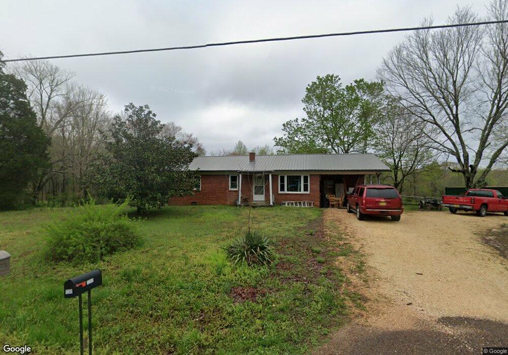
7240 Highway 69a Big Sandy, TN 38221
Estimated Value: $346,000 - $355,000
--
Bed
1
Bath
1,189
Sq Ft
$295/Sq Ft
Est. Value
About This Home
This home is located at 7240 Highway 69a, Big Sandy, TN 38221 and is currently estimated at $350,500, approximately $294 per square foot. 7240 Highway 69a is a home located in Benton County with nearby schools including Big Sandy School.
Ownership History
Date
Name
Owned For
Owner Type
Purchase Details
Closed on
Sep 29, 2022
Sold by
Wayne Markham
Bought by
Markham Patricia
Current Estimated Value
Purchase Details
Closed on
Jul 6, 2018
Sold by
Terry Krystal Markham
Bought by
Markham Wayne
Purchase Details
Closed on
Feb 29, 2016
Sold by
Mccardell Amanda
Bought by
Markham Wayne
Purchase Details
Closed on
Oct 8, 1985
Bought by
Wilson Ethelene Markham
Purchase Details
Closed on
Mar 10, 1983
Create a Home Valuation Report for This Property
The Home Valuation Report is an in-depth analysis detailing your home's value as well as a comparison with similar homes in the area
Home Values in the Area
Average Home Value in this Area
Purchase History
| Date | Buyer | Sale Price | Title Company |
|---|---|---|---|
| Markham Patricia | -- | -- | |
| Markham Wayne | $30,000 | -- | |
| Markham Wayne | $33,000 | -- | |
| Wilson Ethelene Markham | -- | -- | |
| -- | -- | -- |
Source: Public Records
Tax History Compared to Growth
Tax History
| Year | Tax Paid | Tax Assessment Tax Assessment Total Assessment is a certain percentage of the fair market value that is determined by local assessors to be the total taxable value of land and additions on the property. | Land | Improvement |
|---|---|---|---|---|
| 2024 | $826 | $30,300 | $17,400 | $12,900 |
| 2023 | $826 | $30,300 | $17,400 | $12,900 |
| 2022 | $826 | $30,300 | $17,400 | $12,900 |
| 2021 | $826 | $30,300 | $17,400 | $12,900 |
| 2020 | $827 | $30,300 | $17,400 | $12,900 |
| 2019 | $816 | $27,650 | $14,800 | $12,850 |
| 2018 | $841 | $27,650 | $14,800 | $12,850 |
| 2017 | $841 | $28,525 | $14,800 | $13,725 |
| 2016 | $841 | $28,525 | $14,800 | $13,725 |
| 2015 | $853 | $28,525 | $14,800 | $13,725 |
| 2014 | $727 | $28,525 | $14,800 | $13,725 |
| 2013 | $727 | $24,717 | $0 | $0 |
Source: Public Records
Map
Nearby Homes
- 175 Rolling Oak Dr
- 3636 Reynoldsburg Rd
- 1530 Prince Rd
- 540 Rolling Oak Dr
- 9825 Highway 69a
- 4820 Highway 641 N
- 0 Hwy 641 N Unit 134811
- 0 Hwy 641 N Unit RTC2699308
- 0 Hwy 641 N Unit 131394
- 0 Hwy 641 N Unit 124817
- 179 French Ln
- 000 Williams Grove Rd
- 674 Cantrell Rd
- 309 Asbury Rd
- 0 Asbury Rd
- 000 Cedar Dr
- 0 Cedar Dr
- 0 Mount Zion Rd
- 1105 Ballard Rd
- 1779 Mount Zion Rd
- 7150 Highway 69a
- 7150 Tennessee 69a
- 7150 Hwy 69
- 7390 Highway 69a
- 7237 Highway 69a
- 7012 Highway 69a
- 296 Prince Rd
- 6885 Highway 69a
- 441 Prince Rd
- 505 Prince Rd
- 6680 Highway 69a
- 547 Prince Rd
- 7735 Highway 69a
- 6675 Highway 69a
- 7770 Highway 69a
- 820 Prince Rd
- 7840 Highway 69a
- 7840 Tennessee 69a
- 7875 Highway 69a