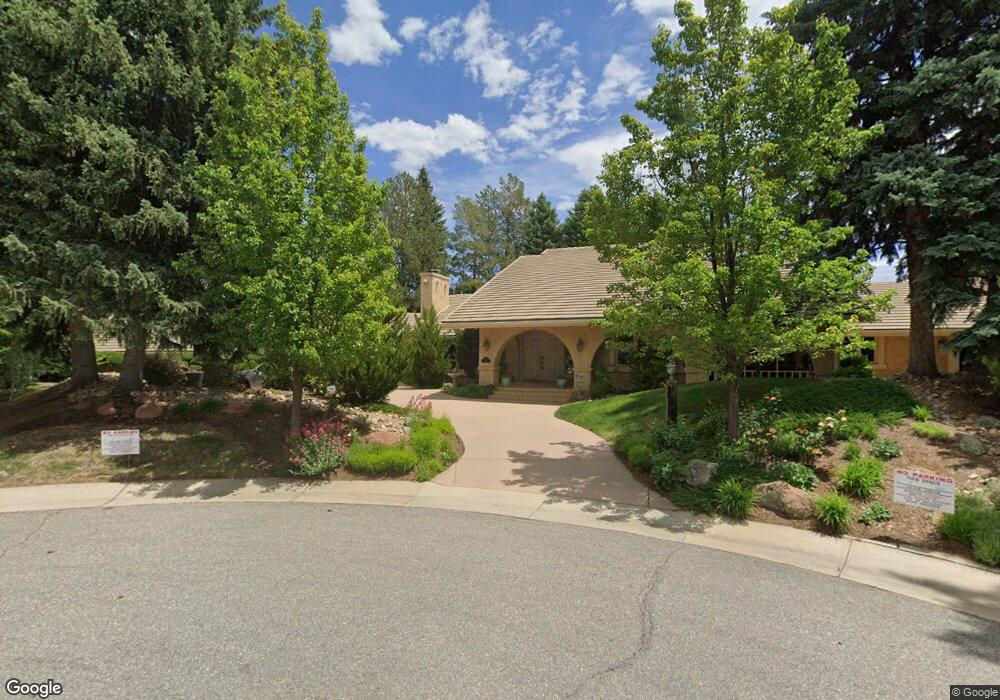
7242 Old Post Rd Boulder, CO 80301
Gunbarrel NeighborhoodEstimated Value: $1,938,000 - $2,365,462
5
Beds
4
Baths
3,719
Sq Ft
$579/Sq Ft
Est. Value
About This Home
This home is located at 7242 Old Post Rd, Boulder, CO 80301 and is currently estimated at $2,154,366, approximately $579 per square foot. 7242 Old Post Rd is a home located in Boulder County with nearby schools including Heatherwood Elementary School, Nevin Platt Middle School, and Boulder High School.
Ownership History
Date
Name
Owned For
Owner Type
Purchase Details
Closed on
Oct 19, 2005
Sold by
Stevenson Mark J
Bought by
Mark J Stevenson Living Trust
Current Estimated Value
Purchase Details
Closed on
Jun 16, 1999
Sold by
Stevenson Mark J
Bought by
Mark J Stevenson Living Trust
Purchase Details
Closed on
Nov 15, 1979
Bought by
Stevenson Maureen M Living Trust
Purchase Details
Closed on
Nov 5, 1975
Bought by
Stevenson Maureen M Living Trust
Create a Home Valuation Report for This Property
The Home Valuation Report is an in-depth analysis detailing your home's value as well as a comparison with similar homes in the area
Home Values in the Area
Average Home Value in this Area
Purchase History
| Date | Buyer | Sale Price | Title Company |
|---|---|---|---|
| Mark J Stevenson Living Trust | -- | -- | |
| Stevenson Mark J | -- | -- | |
| Mark J Stevenson Living Trust | -- | -- | |
| Maureen M Stevenson Living Trust | -- | -- | |
| Stevenson Mark J | -- | -- | |
| Stevenson Maureen M Living Trust | $339,500 | -- | |
| Stevenson Maureen M Living Trust | -- | -- |
Source: Public Records
Tax History
| Year | Tax Paid | Tax Assessment Tax Assessment Total Assessment is a certain percentage of the fair market value that is determined by local assessors to be the total taxable value of land and additions on the property. | Land | Improvement |
|---|---|---|---|---|
| 2025 | $12,754 | $141,938 | $57,763 | $84,175 |
| 2024 | $12,754 | $141,938 | $57,763 | $84,175 |
| 2023 | $12,543 | $144,995 | $62,176 | $86,504 |
| 2022 | $10,218 | $111,992 | $45,738 | $66,254 |
| 2021 | $9,742 | $115,215 | $47,054 | $68,161 |
| 2020 | $8,721 | $102,824 | $40,326 | $62,498 |
| 2019 | $8,591 | $102,824 | $40,326 | $62,498 |
| 2018 | $7,846 | $93,600 | $34,416 | $59,184 |
| 2017 | $7,612 | $113,558 | $38,049 | $75,509 |
| 2016 | $7,636 | $92,153 | $31,203 | $60,950 |
| 2015 | $7,250 | $75,620 | $31,840 | $43,780 |
| 2014 | $6,119 | $75,620 | $31,840 | $43,780 |
Source: Public Records
Map
Nearby Homes
- 7205 Rustic Trail
- 7312 Island Cir
- 7302 Island Cir
- 4500 S Meadow Dr
- 4803 Briar Ridge Ct
- 4788 Briar Ridge Trail
- 4422 Pali Way
- 4667 Ashfield Dr
- 4953 Clubhouse Ct
- 4936 Clubhouse Cir
- 4862 Silver Sage Ct
- 4935 Sundance Square
- 7088 Indian Peaks Trail
- 4423 Alberta Ct
- 4872 Country Club Way
- 7134 Cedarwood Cir
- 5020 Buckingham Rd Unit B2
- 7186 Petursdale Ct
- 5174 Buckingham Rd Unit L1
- 7309 Windsor Dr
- 0 Old Post Rd
- 7232 Old Post Rd
- 7252 Old Post Rd
- 0 Island Cir
- 4606 Field Ct
- 7222 Old Post Rd
- 7310 Island Cir
- 7262 Old Post Rd
- 7223 Old Post Rd
- 4605 Field Ct
- 7212 Old Post Rd
- 7253 Old Post Rd
- 7213 Old Post Rd
- 4571 S Meadow Dr
- 4609 Field Ct
- 7319 Yucca Ct
- 4569 S Meadow Dr
- 7337 Yucca Ct
- 7272 Old Post Rd
- 4619 Field Ct
Your Personal Tour Guide
Ask me questions while you tour the home.