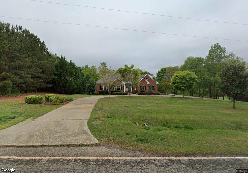
725 Austin Reynolds Rd Bethlehem, GA 30620
Estimated Value: $376,000 - $710,000
4
Beds
3
Baths
2,643
Sq Ft
$197/Sq Ft
Est. Value
About This Home
This home is located at 725 Austin Reynolds Rd, Bethlehem, GA 30620 and is currently estimated at $520,175, approximately $196 per square foot. 725 Austin Reynolds Rd is a home located in Barrow County with nearby schools including Yargo Elementary School, Haymon-Morris Middle School, and Apalachee High School.
Ownership History
Date
Name
Owned For
Owner Type
Purchase Details
Closed on
Mar 16, 2011
Sold by
Hanna Jennifer S
Bought by
Gunter Richard W and Gunter Sharya E
Current Estimated Value
Purchase Details
Closed on
Mar 2, 2006
Sold by
Hanna Donald B
Bought by
Hanna Jennifer S
Purchase Details
Closed on
Aug 2, 2005
Sold by
Wages Jody L
Bought by
Hanna Donald B
Home Financials for this Owner
Home Financials are based on the most recent Mortgage that was taken out on this home.
Original Mortgage
$220,000
Interest Rate
5.51%
Create a Home Valuation Report for This Property
The Home Valuation Report is an in-depth analysis detailing your home's value as well as a comparison with similar homes in the area
Home Values in the Area
Average Home Value in this Area
Purchase History
| Date | Buyer | Sale Price | Title Company |
|---|---|---|---|
| Gunter Richard W | $226,000 | -- | |
| Hanna Jennifer S | -- | -- | |
| Hanna Donald B | $65,000 | -- |
Source: Public Records
Mortgage History
| Date | Status | Borrower | Loan Amount |
|---|---|---|---|
| Previous Owner | Hanna Donald B | $220,000 |
Source: Public Records
Tax History Compared to Growth
Tax History
| Year | Tax Paid | Tax Assessment Tax Assessment Total Assessment is a certain percentage of the fair market value that is determined by local assessors to be the total taxable value of land and additions on the property. | Land | Improvement |
|---|---|---|---|---|
| 2024 | $2,737 | $166,963 | $20,118 | $146,845 |
| 2023 | $3,139 | $166,963 | $20,118 | $146,845 |
| 2022 | $1,652 | $113,391 | $20,118 | $93,273 |
| 2021 | $1,425 | $101,778 | $16,094 | $85,684 |
| 2020 | $1,267 | $96,653 | $18,559 | $78,094 |
| 2019 | $1,313 | $96,653 | $18,559 | $78,094 |
| 2018 | $1,278 | $96,653 | $18,559 | $78,094 |
| 2017 | $2,533 | $87,007 | $18,559 | $68,448 |
| 2016 | $895 | $84,386 | $18,559 | $65,827 |
| 2015 | $2,460 | $85,078 | $18,559 | $66,519 |
| 2014 | $1,778 | $76,304 | $9,094 | $67,210 |
| 2013 | -- | $72,096 | $9,094 | $63,002 |
Source: Public Records
Map
Nearby Homes
- 720 Westbury Ct
- 738 Worth Ct
- 724 Westbury Dr
- 1111 Otis Dr
- 1024 Lyndhurst Ln
- 713 Carl Bethlehem Rd
- 1164 Otis Dr
- 209 Angie Way
- 1129 Loganville Hwy
- 303 Ron Dr
- 704 Newnham Walk
- 784 Morris Ln
- 933 Kendall Park Dr
- 834 Kendall Park Dr Unit 1
- 758 Clarence Edwards Rd
- Cosmos Plan at Rivington Walk
- 903 Kendall Park Dr
- 297 Rydal Way
- 29 Padley Dr
- 59 Thetford Way
- 704 Worth Ct
- 706 Worth Ct
- 719 Austin Reynolds Rd
- 702 Worth Ct
- 734 Austin Reynolds Rd
- 708 Worth Ct
- 579 Hoyt King Rd
- 587 Hoyt King Rd
- 1101 Worth Dr
- 700 Worth Ct
- 709 Worth Ct Unit RES
- 709 Worth Ct
- 701 Worth Ct
- 713 Worth Ct
- 563 Hoyt King Rd
- 1100 Worth Dr
- 911 Downing Dr
- 909 Downing Dr
- 708 Westbury Ln
- 913 Downing Dr