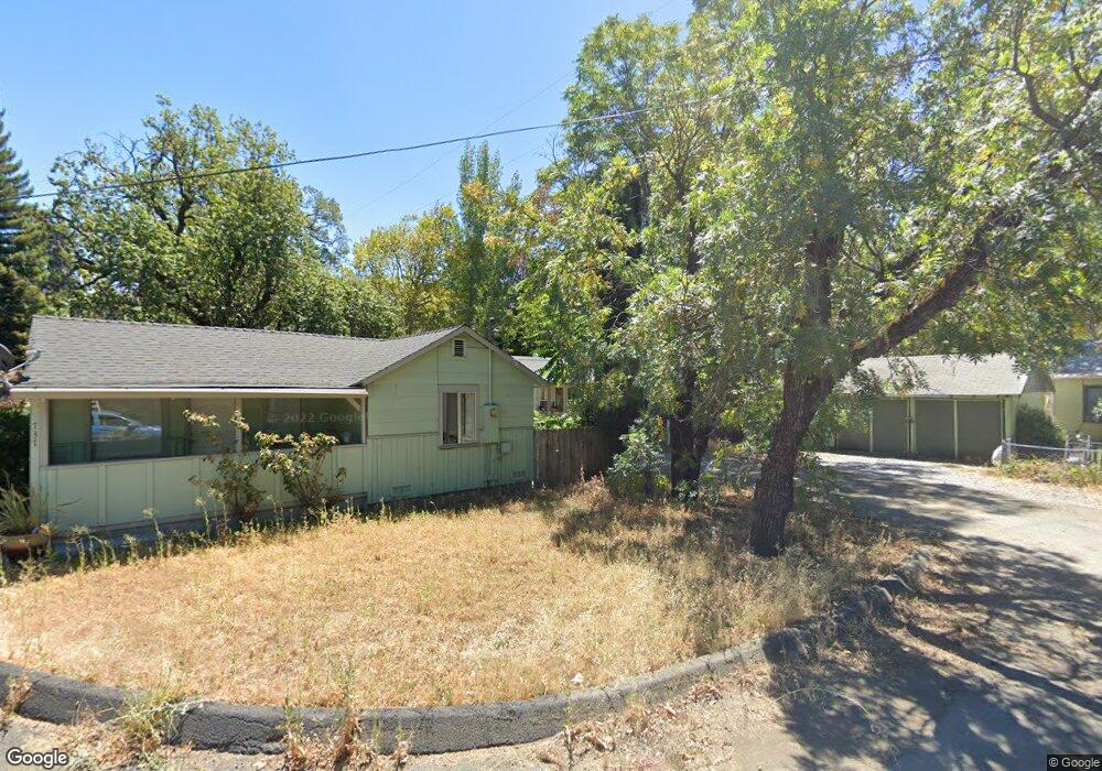
725 Leland Ct Unit 1 Redding, CA 96001
Parkview NeighborhoodEstimated Value: $270,000 - $299,000
3
Beds
2
Baths
1,230
Sq Ft
$231/Sq Ft
Est. Value
About This Home
This home is located at 725 Leland Ct Unit 1, Redding, CA 96001 and is currently estimated at $284,718, approximately $231 per square foot. 725 Leland Ct Unit 1 is a home located in Shasta County with nearby schools including Juniper, Sequoia Middle School, and Shasta High School.
Ownership History
Date
Name
Owned For
Owner Type
Purchase Details
Closed on
Mar 29, 1999
Sold by
Emerson Richard L and Emerson Pamela
Bought by
Solorzano Jose and Jaenke Brenda
Current Estimated Value
Home Financials for this Owner
Home Financials are based on the most recent Mortgage that was taken out on this home.
Original Mortgage
$67,114
Outstanding Balance
$16,811
Interest Rate
6.91%
Mortgage Type
FHA
Estimated Equity
$267,907
Create a Home Valuation Report for This Property
The Home Valuation Report is an in-depth analysis detailing your home's value as well as a comparison with similar homes in the area
Home Values in the Area
Average Home Value in this Area
Purchase History
| Date | Buyer | Sale Price | Title Company |
|---|---|---|---|
| Solorzano Jose | $68,000 | Placer Title Company |
Source: Public Records
Mortgage History
| Date | Status | Borrower | Loan Amount |
|---|---|---|---|
| Open | Solorzano Jose | $67,114 | |
| Closed | Solorzano Jose | $3,355 |
Source: Public Records
Tax History
| Year | Tax Paid | Tax Assessment Tax Assessment Total Assessment is a certain percentage of the fair market value that is determined by local assessors to be the total taxable value of land and additions on the property. | Land | Improvement |
|---|---|---|---|---|
| 2025 | $1,058 | $106,579 | $26,637 | $79,942 |
| 2024 | $1,040 | $104,490 | $26,115 | $78,375 |
| 2023 | $1,040 | $102,442 | $25,603 | $76,839 |
| 2022 | $1,020 | $100,434 | $25,101 | $75,333 |
| 2021 | $1,013 | $98,465 | $24,609 | $73,856 |
| 2020 | $1,025 | $97,456 | $24,357 | $73,099 |
| 2019 | $972 | $95,546 | $23,880 | $71,666 |
| 2018 | $979 | $93,673 | $23,412 | $70,261 |
| 2017 | $972 | $91,837 | $22,953 | $68,884 |
| 2016 | $940 | $90,037 | $22,503 | $67,534 |
| 2015 | $927 | $88,685 | $22,165 | $66,520 |
| 2014 | $919 | $86,948 | $21,731 | $65,217 |
Source: Public Records
Map
Nearby Homes
- 745 Parkview Ave
- 864 Kite Ln
- 351 Weldon St
- 1012 State St
- 2514 California St
- 2590 Henderson Rd
- 3244 Veda St
- 2405 Cliff Dr
- 815 Locust St
- 3443 West St
- 2239 Garden Ave
- 350 Park Marina Cir
- 2845 River Mist Walk
- 2857 River Mist Walk
- 2630 Wyndham Ln
- 2865 River Mist Walk
- 2123 Waldon St
- 1005 Gold St
- 2056 Canal Dr
- 2935 Shotwick Trail
- 725 Leland Ct
- 733 Leland Ct
- 2807 Leland Ave
- 2805 Leland Ave
- 703 Leland Ct
- 737 Leland Ct
- 2809 Leland Ave
- 710 Severtson Dr
- 740 Severtson Dr
- 736 Leland Ct
- 0 Leland Ct
- 750 Severtson Dr
- 709 Leland Ct
- 2642 Sharon Ave
- 2644 Sharon Ave
- 752 Leland Ct
- 2801 Leland Ave
- 2638 Sharon Ave
- 2803 Leland Ave
- 2636 Sharon Ave
Your Personal Tour Guide
Ask me questions while you tour the home.