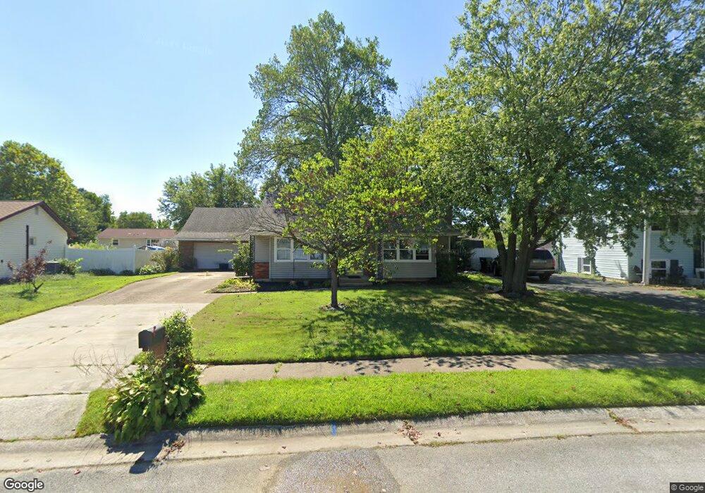
725 Manfield Rd Newark, DE 19713
Estimated Value: $339,000 - $360,000
3
Beds
1
Bath
816
Sq Ft
$429/Sq Ft
Est. Value
About This Home
This home is located at 725 Manfield Rd, Newark, DE 19713 and is currently estimated at $350,419, approximately $429 per square foot. 725 Manfield Rd is a home located in New Castle County with nearby schools including Smith (Jennie E.) Elementary School, Gauger-Cobbs Middle School, and Newark High School.
Ownership History
Date
Name
Owned For
Owner Type
Purchase Details
Closed on
May 9, 2008
Sold by
Teague John A
Bought by
Teague John V
Current Estimated Value
Home Financials for this Owner
Home Financials are based on the most recent Mortgage that was taken out on this home.
Original Mortgage
$150,500
Outstanding Balance
$95,610
Interest Rate
5.94%
Mortgage Type
Purchase Money Mortgage
Estimated Equity
$254,809
Purchase Details
Closed on
May 8, 2008
Sold by
Teague John V and Teague Carol D
Bought by
Teague John A
Home Financials for this Owner
Home Financials are based on the most recent Mortgage that was taken out on this home.
Original Mortgage
$150,500
Outstanding Balance
$95,610
Interest Rate
5.94%
Mortgage Type
Purchase Money Mortgage
Estimated Equity
$254,809
Purchase Details
Closed on
Oct 26, 2006
Sold by
Teague John V and Teague Carol D
Bought by
Teague John V and Teague Carol D
Create a Home Valuation Report for This Property
The Home Valuation Report is an in-depth analysis detailing your home's value as well as a comparison with similar homes in the area
Home Values in the Area
Average Home Value in this Area
Purchase History
| Date | Buyer | Sale Price | Title Company |
|---|---|---|---|
| Teague John V | -- | None Available | |
| Teague John A | -- | None Available | |
| Teague John V | -- | None Available |
Source: Public Records
Mortgage History
| Date | Status | Borrower | Loan Amount |
|---|---|---|---|
| Open | Teague John V | $150,500 |
Source: Public Records
Tax History Compared to Growth
Tax History
| Year | Tax Paid | Tax Assessment Tax Assessment Total Assessment is a certain percentage of the fair market value that is determined by local assessors to be the total taxable value of land and additions on the property. | Land | Improvement |
|---|---|---|---|---|
| 2024 | $2,408 | $54,800 | $11,800 | $43,000 |
| 2023 | $2,345 | $54,800 | $11,800 | $43,000 |
| 2022 | $2,329 | $54,800 | $11,800 | $43,000 |
| 2021 | $2,279 | $54,800 | $11,800 | $43,000 |
| 2020 | $2,216 | $54,800 | $11,800 | $43,000 |
| 2019 | $2,094 | $54,800 | $11,800 | $43,000 |
| 2018 | $1,922 | $54,800 | $11,800 | $43,000 |
| 2017 | $1,856 | $54,800 | $11,800 | $43,000 |
| 2016 | $1,841 | $54,800 | $11,800 | $43,000 |
| 2015 | $1,684 | $54,800 | $11,800 | $43,000 |
| 2014 | $1,685 | $54,800 | $11,800 | $43,000 |
Source: Public Records
Map
Nearby Homes
- 871 Broadfield Dr
- 886 Broadfield Dr
- 170 Scottfield Dr
- 11 Kensington Ln
- 3 Matthews Rd
- 148 Brookside Blvd
- 183 Brookside Blvd
- 42 Lynch Farm Dr
- 13 Erskine Ct
- 1000 Fountainview Cir Unit 311
- 3000 Fountainview Cir Unit 3411
- 25 Glyn Dr
- 1401 Chelmsford Cir Unit 1401
- 511 Lisbeth Rd
- 103 Anglin Dr
- 1200 Chelmsford Cir
- 620 Ilse Dr
- 18 Mapleshade Rd
- 716 S College Ave
- 47 Carole Rd
- 723 Manfield Rd
- 727 Manfield Rd
- 826 Broadfield Dr
- 824 Broadfield Dr
- 828 Broadfield Dr
- 721 Manfield Rd
- 729 Manfield Rd
- 720 Manfield Rd
- 822 Broadfield Dr
- 722 Manfield Rd
- 830 Broadfield Dr
- 820 Broadfield Dr
- 719 Manfield Rd
- 718 Manfield Rd
- 832 Broadfield Dr
- 621 Postfield Rd
- 731 Manfield Rd
- 818 Broadfield Dr
- 619 Postfield Rd
- 834 Broadfield Dr